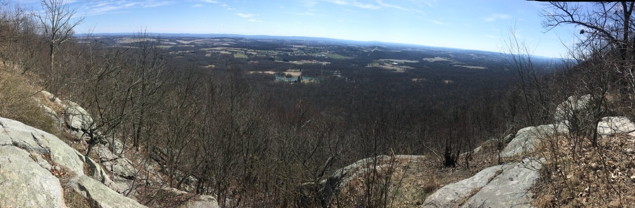
 T+3 Beside having to fix the blog this AM because apparently I screwed something up last night (thanks Twitter friends for notifying me!) I took today relatively easy. I hiked from the Leroy Smith shelter to an unapproved, but well traveled, campsite 9.2 miles down the trail. Got started around 10 AM even though I was up before 7 AM. Had a good chat with the couple who stayed in the shelter with me (@thesunfishduo on Instagram) and found it hard to set out. They later passed me after I made camp. They set off from Delaware Water Gap too, just the day before me. Since I’m generally hiking at a faster pace than them, I'm sure I'll see them again. The trail today was much less rocky, plus the rocks are far less treacherous when dry (dare I say an “easy" day?) so it was't full speed ahead. I was only slowed by the fact that I'm currently in a bit of a water desert. So, I was forced to hike to hike 0.4 miles down off the plateau / ridge the AT runs along to go get a resupply of water. While at the spring I ate lunch and drank the remainder of my water (~1.5 L). This gave me plenty of time to take in the scenery, which was beautiful! 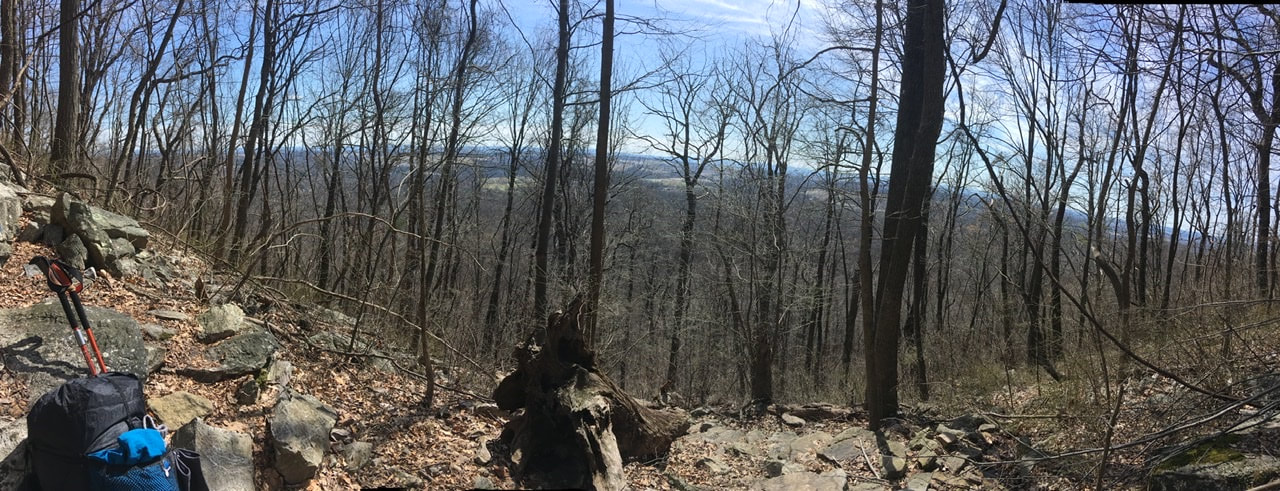 After that it was only 3.3 miles to the place I decided to camp. It was early - between 3:30 and 4-but I decided to call it a day. Certainly, I could have gone further, but it's only 6.5 miles to Palmerton and I needed to air out the tent. I packed it wet yesterday and the whole day was wet, so didn't bother attempting to air it out after getting to the shelter. Plus, what a location to make camp! 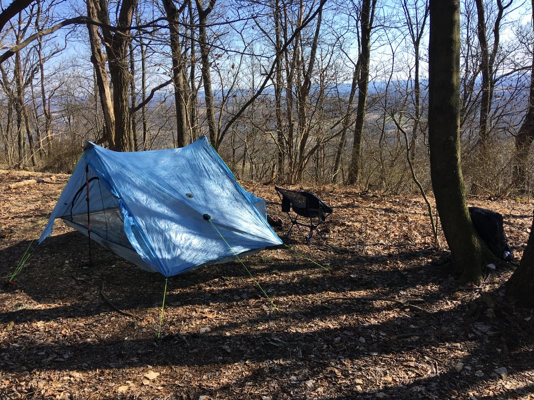 An added attraction is that the tent site I'm staying at is a 20-ish minute walk from Blue Mountain Resort. I took advantage of this by getting dinner from there (take-out of course). Was a tad pricey - $13 for a wild boar sausage flatbread...yum - but worth getting a "real meal" in my belly. I say this because it is forecasted to be 26°F tonight (in the valley), and its less daunting facing that kinda temperature on a full stomach!  All around, today was a bit of a pick-me-up after the first two days of fog and drizzle, which left me feeling like the protagonist in some post-apocalyptic movie. But, I'll delve into my thoughts in another entry.
2 Comments
For whatever reason, I managed to break the blog and it’s been down overnight. Working to get it back up...
 T+1 (Mar. 20, 2020) Got a surprisingly decent night of sleep last night. Usually while hiking I toss and turn most of the night and feel completely un-rested. Last night however I managed to only wake up a few times. Hoping for more of that tonight...we'll see! Woke up for good around 6:30 and spent around 1 1/2 hours uploading the post to my blog. Took another ~2 hours to eat and break camp. Because of the time involved I decided to make camp early today, which should allow me to post this tonight. So, for today's hike I departed my camp near Wolf Rocks spring (mile 1286.8) without a clearly defined destination for the day. I just let my body and the weather decide my fate. In the end, I stopped at Leroy A. Smith shelter (mile 1275.9) for the night. That makes today's mileage 10.9. Again, not bad for an old fart having a hard time with the rocks! 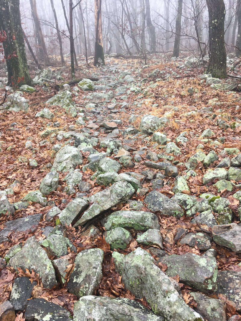 Speaking of the rocks, wow do they ever suck - big time! Especially when wet, which it has been the entire hike so far. I've never really hiked on terrain like this. The rocks are all either completely smooth and super slippery in wet weather, or poke up at random angles, and as you can see they essentially make up the trail. There’s almost no smooth ground to step on! I can't count the number of times I have twisted my ankle(s), stubbed my toe, nearly fallen on my keister, gotten the hiking poles stuck and nearly bent them, or some combination thereof - in rapid succession. It's no wonder that this state is referred to as "Rocksylvania" in the hiker community!
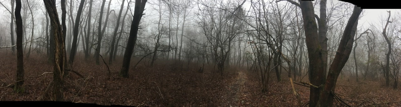
Long story short, all of the extreme jostling of my pack is definitely slowing me up (not that I’m in a big hurry) and causing significant soreness in my shoulders and hips. I was expecting some physical discomfort due to lack of training, but this has been a bit of a surprise. On the bright side, the trail is rather flat. This has allowed me to keep the pace I've been able to maintain. As the Monty Python song goes: "Always look on the bright side of life". In spite of my inherently negative nature, I really am trying to do this! 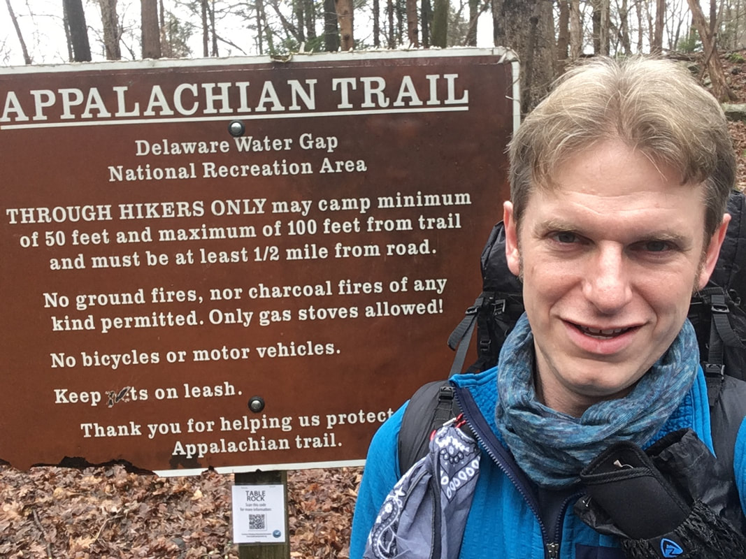 T+1 (March 19, 2020) So, there's been a MAJOR change of plans. Due to the COVID-19 pandemic the ATC strongly recommended against thru-hikers starting trips and further recommended thru-hikers already on the trail get off of it and return home. For those people who do decide to start their thru-hike, they recommended initiating at some point other than the North or South termini - so as to avoid other hikers along the trail. I have ignored their recommendation and have initiated my thru-hike. That said, I did heed their advice and canceled my travel down to Georgia. Instead, I have begun my trip from Pennsylvania - Delaware Water Gap (mile 1296) to be precise...I’m now heading south to Springer Mountain and should I make it there I will return to Delaware Water Gap and head north to Katahdin. Considering all that is happening in the "real world" I would be VERY surprised if I make it to Springer - nonetheless Katahdin. Hell, I'm not even sure if I'll be able to resupply in the next town, or the town after that. Oh well, I've stressed out over the decision to get on the trail enough over the last few weeks, I should leave resupply anxieties for another day! Anyway, I've got enough food for 4+ days, so I will be able to get a decent section hike in at the very least. The current plan is to stop in Palmerton, PA (mile 1260) for a resupply. I should be able to make it there by Sun. the 22nd. We'll see! Ok, so enough about the plans - time for the juicy stuff...the hike itself! As I said above, I started the day off at Delaware Water Gap. My wife drove me there and doo ed me off at about 1PM. Once we said off goodbyes I headed up Mountain Road on the AT. The “trail” heads up to a parking lot, then runs along I-80 for quite a way. It didn't take long for the trail to turn into an actual green tunnel through a stand of rhododendrons! 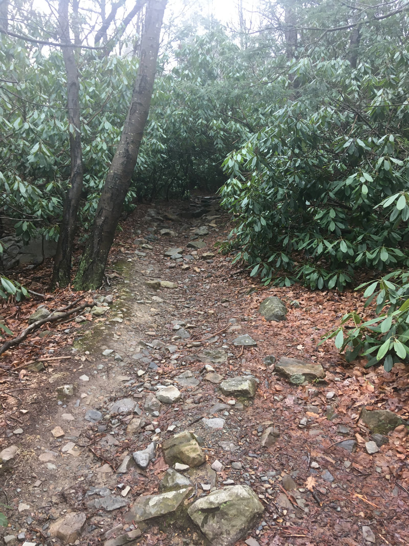 Not too many views today - it was overcast, foggy, and lightly drizzling at times. Managed to make it to the southern end of the Wolf Rocks cut off (mile 1268.8). That means I hiked 9.2 miles in a bit over 4 hours. Not bad considering my lack of training and the annoyingly rocky
terrain! Also didn't have too many problems setting up camp. The biggest issue was getting the tent stakes to stay in the ground with all of the rocks around. Well, that and dealing with the iPad, which didn't want to pair with the pencil...working now after a half hour of futzing about with them. It's an hour past hiker midnight, so I'll leave things there and perhaps make a feeble attempt at posting this, but the cell signal is shit where I set up camp. Fingers crossed for a good connection! UPDATE: The connection sucked, so I went to sleep. Rainy and cold (high 30s) overnight, but I was nice and toasty, YAY!! |
About Me
Archives
July 2020
Categories |
 RSS Feed