|
Welp, it’s come to that point. My hike is no longer feasible, so I will be getting off the trail for the time being.
There’s no immediate problems preventing me from continuing, but fewer and fewer resupply options are available and, more importantly, everything on the trail has been shut down. Now, it’s possible to soldier on in spite of orders, but that wouldn’t be prudent given all that is going on. I still have a couple days of material to post, but that won’t happen for a couple of days. Sorry!
2 Comments
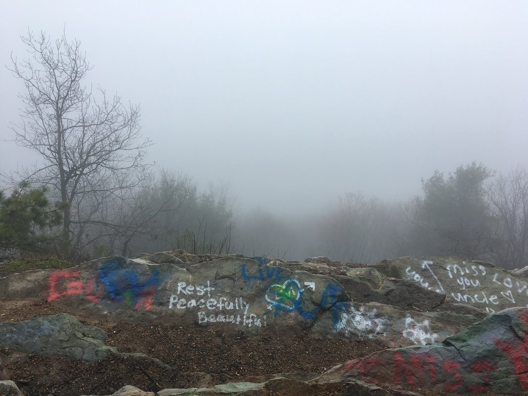
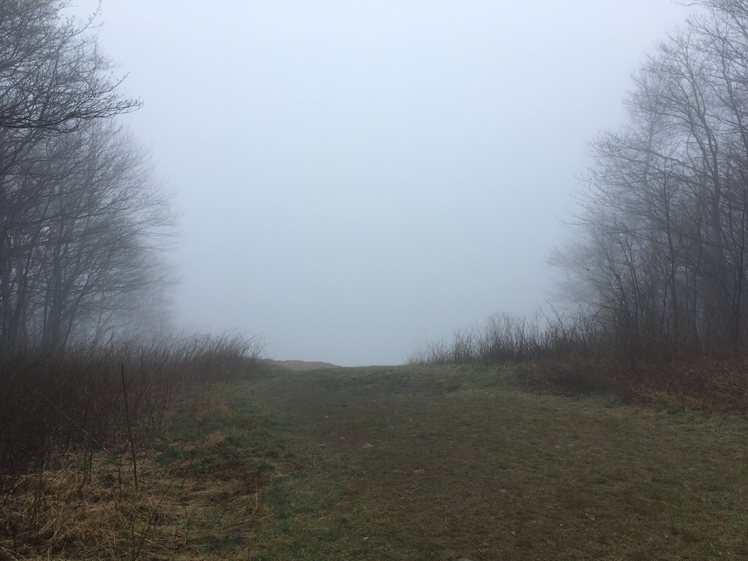
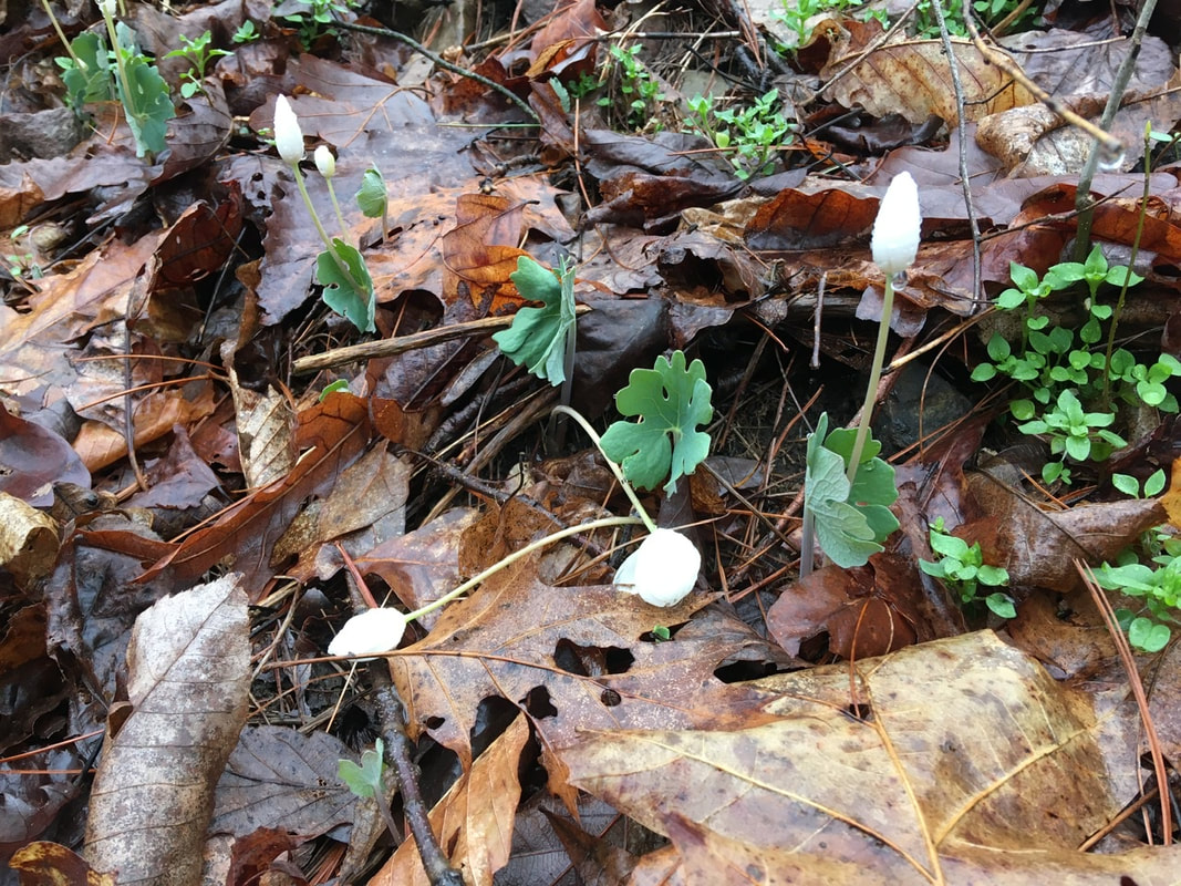
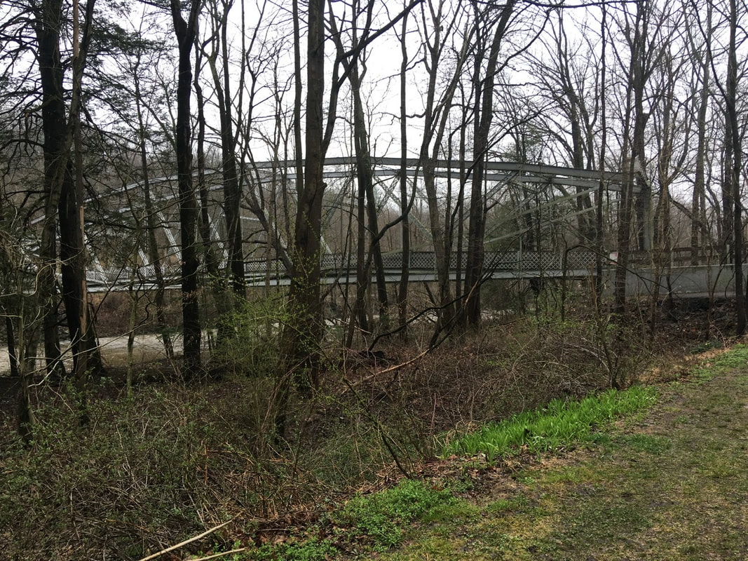
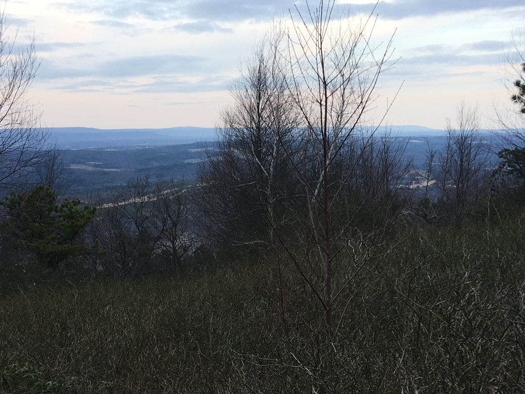
T+11 (Mar. 29, 2020) Navigation Report: Starting Point: 501 Shelter (mile 1196.1) Destination: resupply in Lickdale. Hotel in town, campsite 0.7 miles after I-81, and a campsite 2.5 miles after I-81 are all sleeping options Travel Log: Depart camp (mile 1196.1) - 10:15 Cross PA-645 (mile 1194.1) - 11:30 William Penn Shelter (mile 1192) - 12:30 Lick dale KOA (mile 1184.7) - 5:00 Campsite 0.7 miles after I-81 - 6:45 Daily mileage: 12.1 Total mileage: 112.0 Commander's Report: I awoke this morning around 6 AM. Worked on posting the previous day's blog and generally dallied around in bed, so as to not disturb the other hikers who got to bed later than I did. Around 8:30 I got out of bed and started getting ready for the day. The two other hikers, Richie and Brian, got out of bed around 9 and we had a nice conversation about each others' plans and braving the dreadful weather the day before. Until they mentioned it I hadn't given any thought to the fact that they were out in the elements for the worst of things: the thunderstorm. I was comfortably protected while they were slogging around looking for the shelter-they passed it twice in the darkness. Also from this conversation I discovered that the outfitter in Duncannon was open a couple days ago. Apparently they're considered a grocery store for the purposes of the essential / non-essential businesses. That means I may be able to procure a gas tank or two in Duncannon! Again this morning I did everything possible in order to avoid putting on my wet socks, gloves, and boots. While I know after a few minutes of wearing them things aren't so bad, those first few minutes suck big time! After much delay (made easier by conversation with Richie & Brian) I made it on trail by 10:15. The weather was equal parts amazing and dreadful. The fog was so thick it was like walking through a cloud all day. Unfortunately, it was also reining a slow soaking drizzle for most of the day. Weather that is great for the creepy ambiance, but sucks to be out in for the whole day. I think days like this are going to be when I miss having rain pants once I switch to the skirt. My legs will definitely be getting wet on future days like this. That being said, I will take it over these useless rain pants. Every time I wear them I do more and more damage to them. Today, less than a mile into the day's hike, I wasn't careful in a boulder scramble and sliced the front of the shin open. I had to stop and repair that 4" gash with duct tape before proceeding. These damned pants are going to look like an old timey hockey mask by the time I get the rain skirt! Shortly after leaving the shelter is an overlook. Not much view today. As with many things that are road-adjacent on the AT, this overlook was well tagged by the local kids. Not that much further down is an old cot in the forest for power lines (now absent) that should have a good view on a clear day, but without the graffiti. Came across other overlooks (or lookout like in the accompanying photo), but didn't really bother to stick around to admire the views for terribly long. I wonder why... Sorry to flog a dead horse about the rocks here, but I've gotta give it another thumping. There are some rocks here that stick straight up out of the ground, like miniature headstones. I manage to figure out a way to trip over EVERY. SINGLE. ONE. OF. THEM! The thing is that when you're walking along they usually look like any other random loose stone on the trail. It's not until you're right on top of them that their true nature is revealed. In an effort to "name and shame" those bastards, I've taken to calling them Toey Tombstones. I feel this name has a nice '30's gangster feel to it. Let's see if the name takes off (it won't). I've seen a lot of evidence for frequent deer trafficking along the trail. Random stretches with tons of loose hairs on the ground and hoof prints. Today, I first spotted this old deer scat. Then a couple miles down the trail I crested a small hill to discover a mommy deer and her yearling grazing about 10 yards away from me, I stopped and fumbled for my camera, but I was too slow. They turned tail and bounded out of sight. I'd forgotten how cute the backsides are of white-tailed deer, but that reminded me. More signs of spring today. Saw my first wild flowers emerging. I'm not sure what they are yet, but they're getting ready to bloom. On the two mile walk into town I saw that the daffodils are also starting to pop. Speaking of the walk into town. The trail crosses under I-81 outside of town. Hikers go under the highway bridge over Swatara Creek and cross the river on an old '30's style metal arch bridge. They have turned this into foot-traffic only and incorporated it into a walkway / bikeway park. It even seemed to be getting plenty of use today.
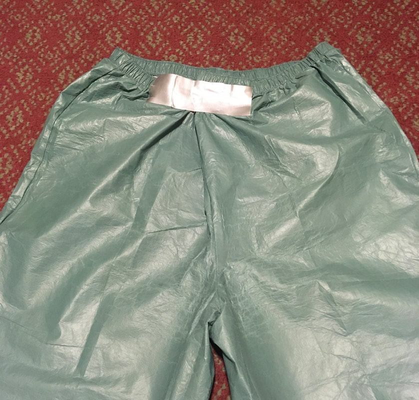
Finally, when I got into town, I stopped at the first place (the KOA) to resupply. It's a campground convenience store, so I wasn't expecting much. It exceeded expectations though. Filled the food bag up with more granola bars, pop tarts, snack foods, and Mac and cheese, little nutritional value, but will get me through to Duncannon. Also, I've felt quite low on energy the last couple days. So I took the opportunity to calorie load. I bought a pint of ice cream and ate that tub in less time than it took to walk off of KOA property. So gluttonous, but so good. Also in town I said 'goodbye' to the rain pants. I was stepping up on a rock earlier in the day and the ass split open a good 6". I probably could have repaired them, but with a replacement arriving in a couple days and no rain in the forecast I decided today was the day to rid myself of them. RIP shitty assed pants! After town came a brisk walk to the trail and then to the first campsite. It was late and I wanted to set up camp in the daylight if possible. I managed to make it happen, with a few minutes to spare. Just to completely bury the lede, I passed 100 miles on the trail today. 1/22nd of the way to my goal! T+10 (Mar. 28, 2020)
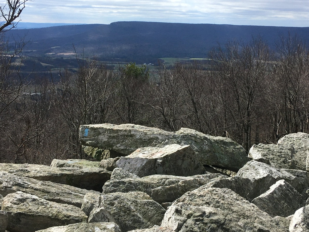
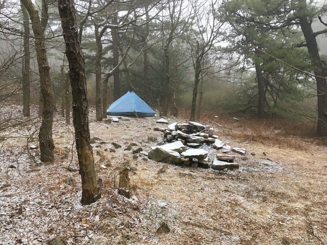
Navigation Report: Starting Point: Camp at Black Swatara Creek (mile 1206.7) Destination: Either 501 Shelter (mile 1196.1) or William Penn Shelter (mile 1192) Travel Log: Depart camp (mile 1206.7) 8:45 Cross PA-183 (mile 1205.4) 10:15 Hartline Creek & Campsite (mile 1201.7) 12:45 501 Shelter (mile 1196.1) 3:30 Daily Mileage 10.6 Total mileage 99.9 Commander’s Report: Today is the tenth day on the trail for me. YAY double digits!! (Also, sorry for the title Millennials, I fear you haven’t had the experience of watching a car’s odometer roll over from 99,999 to 00,000. It used to be a thing us olds got excited about.) The forecast was mostly correct, it indeed did start raining before sunrise. About 4:30AM to be exact - 3 hours before the forecast suggested it would roll in. The rain woke me up, so I decided to make the most of the time by posting the T+8 blog post and write up the T+9 blog post. One of those things got accomplished. The cell service was so spotty I couldn't even log in to start the process of posting. Then I made my breakfast oatmeal, but instead of using hot water I just soaked the oats in cold water and sadness. I'm running low on gas, so am rationing for dinners only. Oatmeal can be eaten dry or uncooked, so there's no point in wasting fuel preparing it. The next possibility for resupplying the fuel is after Duncannon, so at Lickdale I'll be buying food stuffs that don't require any heating. Gotta stretch the fuel until then though. Hell, it may not be possible to resupply fuel even after Duncannon. The resupply options remaining in Pennsylvania consist of a few shuttle drivers and two rural General stores. After that it's the Walmart in Waynesboro, PA - on the Pennsylvania / Maryland border. Will be calling around tomorrow to see if any of the options for fuel resupply are actually viable. After the breakfast I slowly packed everything into my bag while waiting for a lull in the rain to disassemble and pack my tent. That opportunity came around 8:30, so I took it! Then it was back on the trail. Sorry, no pics from today, the rain was so bad the phone got stored in the heart of my bag to keep it safe and dry. Hiking was slow going today! The trail being more like a river than something a person would walk on. Plus, it's Pennsylvania so there's still the annoying rock problem. Only now some of them are obscured by the water - all the better to twist an ankle! All that is to say that I'm taking it easy today. I set myself up well yesterday: two shelters are within a day's hoke even at a much reduced pace. Around 10:15 I crossed PA-183. Where the AT intersects with it, the road is 4 lanes and the AT crosses it on a hill and a curve, so the ability to see vehicles is only about 200 yards. I waited for traffic to clear and started across. I only got one lane in before an 18-wheeler appeared traveling in the furthest lane. So I made a dash for the other side. I'd say sprint, but its impossible to sprint with 30 pounds on your back! As I'm writing this it's clear that the truck didn't get me. Beside the whole trail as a river, the next couple of miles were fairly easy going. A little bit of an incline, but the ground was fairly free of rocks. This was followed by a drop down to Hotline Creek. The Creek at this time was quite expansive due to all the rain, so I took a minute to have lunch before rock-hopping across it. In the process of crossing the creek I slipped and tweaked something in my foot. After that, every time I stepped on a rock in such a way that the outside of my foot rotated up I experienced significant pain. At this point I had pretty much made up my mind that I'd call it a day at 501 shelter. After the creek the trail goes back up to the top of the plateau / ridge and continues at elevation until reaching 501 shelter. There's also a series of lookout points between the Creek and the shelter - including Kessel View - but the only views to be had were of cloud. Considering my lethargic pace today, one could say that I made the Slowest Kessel Run in history! The trail after the creek becomes quite rocky and this had me cursing the stones again. Again, this slowed progress but I just needed to reach the shelter, which was never in doubt. The slow progress did sap all enthusiasm for hiking though. The constant soaking rain, 40°F weather, sore foot, and slow progress was really getting to me! But this too shell pass. And pass it did once I arrived at the shelter - even though the weather outside turned even nastier, with thunder and heavier rains. The shelter is gigantic and fully enclosed. More like a cabin than a shelter, really. Inside is 6 bunk beds, for a capacity of 12-but with plenty of space on the floor for additional bodies. The shelter even has a solar shower, running water, and a caretaker. MTV Cribs could almost get away with doing an episode on this place. (Again, sorry Boomers and Millennials, you'll have to look that reference up.) Once in the shelter, everything got unpacked from the bag and splayed out to dry. Set up my bedding and went about preparing dinner. In Palmerton (before the fuel worries) I purchased a Zatarains rice dish for a dinner. Figured I would splurge as that pack is supposed to serve 4 (as a side). The downside is that the rice it contains isn't instant rice, so requires substantial boil time (25 min per the package). I anticipated this, so cold soaked the rice during the day in an attempt to semi-rehydrate them. Then I only boiled the rice for 5 minutes before transferring to the insulating coozy for 20 minutes or so. As not all would fit in my pot, this was repeated twice. I felt like a piggy, but I put it all in my belly! I layed down to get under the covers and warm up while eating and decided to leave cleanup until morning and call it an early night. Just as I was nodding off (~8:30) I heard footsteps and saw lights. At first I thought it was the caretaker checking in. In actuality it was two other hikers getting in from the rain. They said they'd done 17 miles in that weather. No thanks!! T+9 (Mar. 27, 2020) Section Itinerary: Start @ Hamburg (mile 1219.7) End @ Duncannon (mile 1150.9) Total Distance 68.8 miles Stop in Lickdale for resupply @ Love's Truck Stop (mile 1185.1) Navigation Report: Destination: Unknown. At minimum Eagle's Nest Shelter (mile 1211.2. Approx. 8.5 mile hike). Numerous tenting options further along. Real goal is to stay in a shelter tomorrow night (T+10), as it will rain all day tomorrow. Those options are: 501 Shelter (mile 1196.1) William Penn Shelter (mile 1192) Travel Log: Departed Hamburg, PA around 10AM. Arrive at AT trailhead around 11:15AM Lunch at 2 PM Pass Eagle's Nest Shelter (mile 1211.2) at 3:15PM Make Camp at Black Swatara Creek (mile 1206.7) at 6:15PM Commander's Report: I wanted to extract every ounce of value from the access to WiFi, so I stayed up late last night getting things onto the blog. In the end, I turned off the lights and went to bed at 2:30AM. My alarm was set for 8AM, but I awoke at 7.45. I left the iPad charging overnight, so switched to charging the phone while preparing for departure. Showered, packed, and ran to Wendy's for breakfast. Upon my return phone was at 98%, so unplugged that and gave the battery pack a final top up before departure. I got checked out around 10 and started the 3 mile walk to the trail heed. As I made additions to my gear it took a few stops along the way to adjust things for maximal comfort. Made it to the trailhead around 11:15 and everything switched from a nice walk in the park" to "scale a wall" very abruptly. The first several hundred yards I would describe as "nearly vertical" and this was followed by a half mile or so of "just" a steep incline. All told > 1000' of elevation is gained in just 0.5 miles. Unfortunately, perspective of elevation change is largely lost when viewing a picture, but I took one anyway. Bonus points if you can spot the second white blaze. After the steep climb to elevation, the rest of the day was more or less a flat hike alternating between rocky terrain and packed duff of a hardwood forest floor. Decently easy going for much of the day, with frequent rocky reminders that I'm still in Pennsylvania. Something different today: I crossed multiple what are described as dirt roads in the guide book. They ranged from more of a forest clearing to "real" dirt roads. The first one is at mile 1218 and definitely fits the former category. Met a day hiker here headed in the other direction. Stayed there a while here so that I could call the IT help desk at my former employer and have them reset my password. While I was on the phone, another day hiker passed me in the opposite direction. The call took 15 minutes, plus a few more to actually change the password to something permanent. (Or as permanent as can be when they demand you change it more frequently than most people change their underwear!) Shortly after getting back on the trail, I met a third day hiker coming in the opposite direction. While I didn't speak to any of them, the day hikers must all have been returning from Auburn Lookout. It's only 0.4 miles from the dirt road and provided the only views of the day. I left the overlook at 12:30 and had an uneventful afternoon hike. Didn't see any other hikers and made it to the Blue-blazed trail to Eagle's Nest Shelter around 3:15. 6.4 miles in -3 hours isn't gonna win me any speed competitions, but this is is a marathon not a sprint anyway. I stood at the trail intersection for a minute pondering and in the end I decided to push on. At this point, I am low on water so I need to either stop and filter some along the way, or stop at a campsite with water. The first campsite is 2.6 miles down, but has no water access. 0.9 miles after that campsite is a stream, but no campsite. 4.5 miles down however is a campsite with water access: Bleck Swatara Creek. I'm making for there. Made quick time to the first campsite and then the stream. When I got to the stream, I came upon a guy who had just started a fire about 50 yards from the trail. Immediately, I got bad vibes from the dude. Too many things seemed out of place. He had a giant German Shepard, which explained the huge doggy foot prints I had been seeing for the last several miles. But it was 5:30 and I didn't see any tenting equipment...on a night where the forecast calls for 100% chance of rain before sunrise. Plus he had on what seemed to be a regular cotton sweat shirt and some sporty khaki pants the exact nature of which I couldn't really discern at that distance. Either way, not great hiking / camping clothes when rain is involved. And the dog. The dog seemed quite aggressive: growling and barking, and straining the guy pulling on the leash. (At least he was leashed!) Definitely not a cuddly doggo, more in the vein of a Cujo. Too many things seemed wrong, so I quickly passed the stream by, even though I had thought of getting water here to save from the extra 0.5 mile round trip trek for water at the campsite. Made it to the campsite at 6:15, and set up the tent, made bed, etc. Then I went for water and following that heated water for dinner. After dinner it was straight to bed. I was exhausted from the late night yesterday! [Spoiler: In spite of the bad vibes, I didn’t have any problems with the dude and his dog.] A positive sign for the near future is that there are definite indications that Spring is springing! I have seen some of the first leaves of the new year. As I’m sure you’ve noticed by now if you’ve been following along, these daily logs are more or less stream of consciousness creations. Sorry everyone, I’m doing them for me - so I can look back in a decade and *remember the time when* - so that aspect won’t be changing.
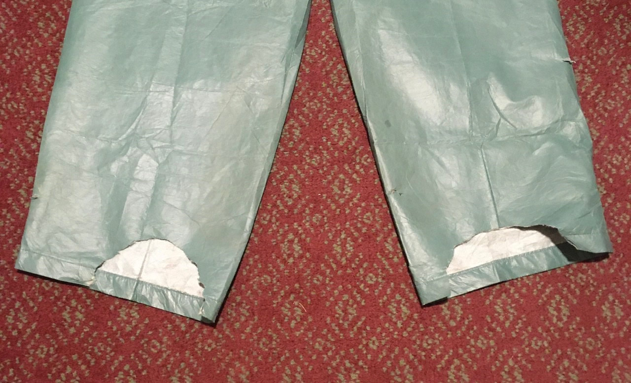
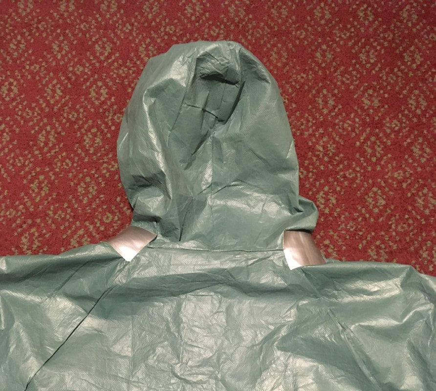
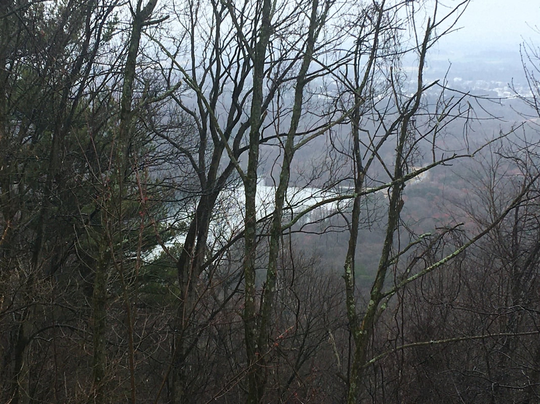
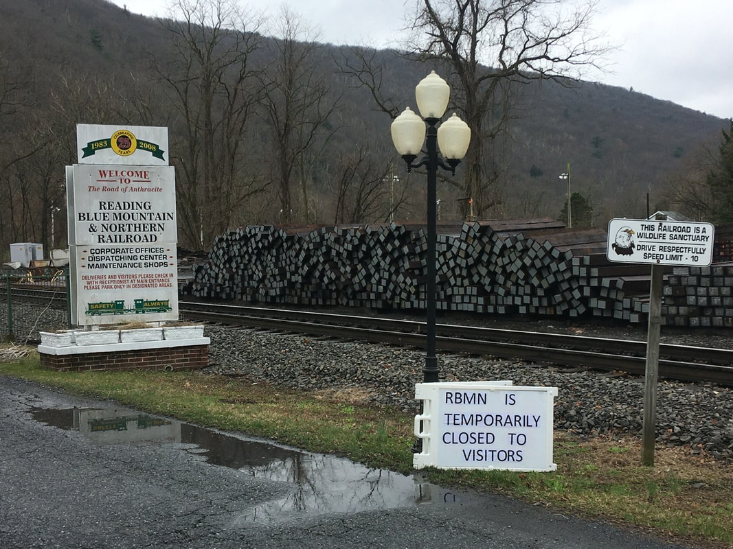
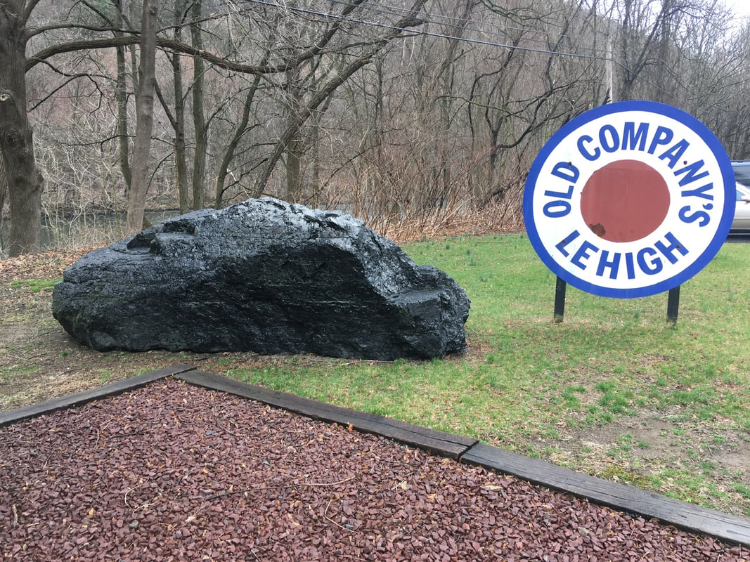
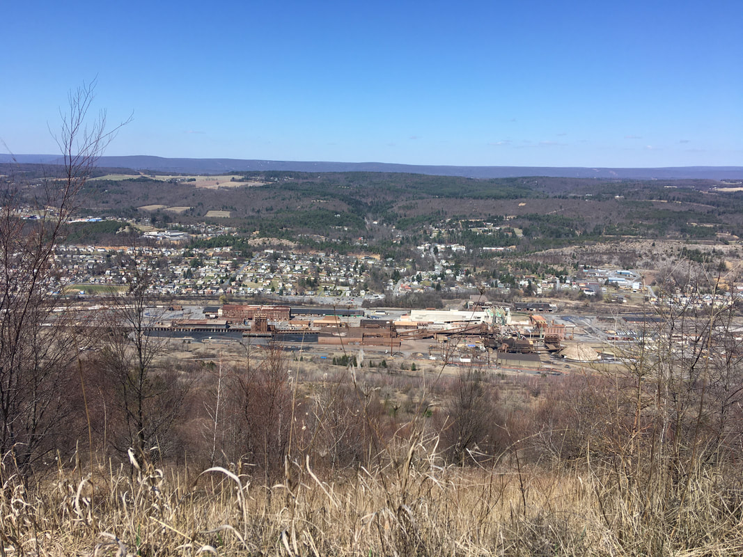
What will be changing is the formatting of the posts. In each post there’s really two parts: 1) Discussion of the navigational aspects of the trip 2) Recollections as to what I saw or things that happened or people I talked to The thing is that I’ve been remembering to put #1 up top sometimes and forgetting and sliding it in at the end other times. I want to try to remember to get the navigational discussion in at the top. To help me do this I think what I’m going to do is to make a Navigation Report section to discuss that and follow hat up with a Commander’s Log section where I discuss the events of the day. I’m going to try this out on the T+9 entry I will be writing tonight. Also, I want to thank everyone for the comments and emails you all have sent. I haven’t been responding to them for lack of time and data, but please be assured that I see every one of them and appreciate the feedback! It lets me know that people are investing heir time and energy following along, which means a lot. These blog entries are an extension to a journal I’m keeping, but each one takes between 30 minutes and 2 hours to get online (depending on upload speeds). It keeps me motivated to continue posting knowing that I’m not just doing it for me, myself, and I. T+8 (Mar. 26, 2020) So what does a 0 day actually entail? Lounging around in bed relaxing? Hardly! Lots of chores, actually. Banking and finances I did last night. Also, planning for resupply was completed last night. Planning for what? Gear alterations, mainly. 1) Hip irritation. I think the irritation I'm experiencing is partly due to the rocks and extreme jostling. The worst pain and numbness was experienced after traversing the roughest terrain. But I still experience a bit of discomfort on more gentle terrain. I believe the underlying problem is the belt being too short on my pack. Thus the buckles ride directly on my hip bone. While there's padding underneath, I think it's just too much weight being transferred to the hip bones. 2) I've already mentioned my loathing of the rain pants. Well, I made some modifications to get me far enough along to pick up new gear. I used a safety pin and duct tape to slim the pants down. Plus I chopped bits out of the heels, so I would stop stepping on them. (I also added duct tape to seams of the jacket where I saw the seam starting to split.) After that I had to decide on a replacement. I find the floppy nature of rain pants annoying. It causes me to wander the forest like I dropped a load in my pants so as to avoid the legs rubbing together. Thus, I will be getting a rain skirt as a replacement. The problem with this change is that it leaves the openings to my socks and boots exposed for water to run down into. So, I'll be getting gaiters as well. 3) Decide what to add to my kit while at Walmart. - Underwear and T-shirt, so I have clean / dry clothes for bed time - Sunscreen. This pale ass white boy got a Sunburn on his face in PA...in March. - Bug spray. They're not bad now, but I can see the trees starting to pop and the insects won't follow too far behind. - Camp shoes. I avoided these for weight space considerations, but it was a serious pain to go potty during the night with soaking wet boots and dry sleeping socks. - Wet wipes. Again, I avoided these for weight / space considerations. I think I'd prefer to schlep them around than rinsing off my face and arms (only) off in streams. - Food stuffs. I generally just note the number of granola bars or dinner entrees, see what's available and attempt to buy only the number required. As planning was done last night, I was able to get out around 8:30 to get breakfast and head to Walmart. Was able to get most everything at Walmart. Unfortunately, they were sold out of fuel canisters. Tried Cabela's, but single canisters aren't available online and nobody was answering the phone-though I did see people utilizing the curbside pickup option. Oh well, worse case scenario I move to cold soaking until I can resupply that. There's probably 3 days worth left. Though I tend to underestimate such things out of an abundance of caution. Once back at the hotel, all of the purchased items come out of their packaging and I have to find homes for them in appropriate stuff sacks or in the backpack. Next up? Call Verizon about data plans. Clearly the 4GB my wife and I share wasn't going to cut it. Unlimited for me, but metered for her would be ideal to save money: Unlimited is $70 per line and that's quite steep! Unfortunately after talking with the agent, it's clear Verizon wants all the monies. They will not allow an account to split between unlimited and metered. It's all or nothing. In the end, I decided to double the date and revisit. I will pull the trigger if need be, but an extra $120/mo is currently too rich for my blood! After that comes work on blog posts. Writing and attempting to upload them while I have access to WiFi. Unfortunately, the WiFi is borderline worthless - especially in the evening. Thus, posting to the blog is an exercise in finding my inner happy place. I started posting of the The post, but while waiting the 20 minutes for a picture to upload I fell asleep. So add a nap to the "To-Do" list I guess. Next up is the repacking of my bag - including divvying up food into the zip lock bags I use to ration my food by day. Can't finish this one because the batteries for all my devices need to be charged before storage. Halfway there with the rest all ready to go will have to do. After that more writing and successfully posting T+6's post. This was intermixed with a phone calls with Dad and Mrs. Tedward. And the day is finished off with dinner and more writing / blogging. Currently, its 1:45 AM and it's WAY past bedtime! But, I’m nearly all caught up!! T+7 (Mar. 25, 2020) Another night of good sleep in a shelter. I'm starting to see why people stay in them. Well designed to protect from the wind and much less work to set up and break down each day...I still worry about running into other people though. I have a relatively easy day of hiking planned for my trip into town. From the shelter (mile 1225.9) to the junction with Schuylkill River Trail (mile 1219. 7) is only 6.2 miles. That said, it's a more intense day in terms of elevation change than yesterday. Still, it’s nothing like the the mountains I typically hike, so should be a breeze. Since I have nothing pressing in town I'll relax and take it slow. Plus, the forecast is for 100% chance of rain and its still chilly. I'm planning on bundling up under the rain gear and using the slow pace to avoid over heating. First off, a 500 foot climb followed by a 200 foot descent, then 200 feet back up before the roughly 1000 foot descent down to town. The rain started about half way up the first ascent, which I was taking very slowly as I was a bit overdressed at the time. But with the rain came wind, which helped to keep me cool enough. Both climbs were quite simple and both "summits" overlook Hamburg, but with obscured views. Hamburg is where PA-61 intersects with I-78 and the side of town nearest to the AT is the one with all of the shops that crop up around such an intersection. You can kind of make this out from the picture captured from the second "summit". Also visible from the second "summit" was the lake in Kaercher Creek Park. Sorry for the poor picture, this was the best view I could get. For a 1000' descent, which appears steep in the guide, this wasn't as bad as anticipated. At the bottom the trail turns sharply south to cross PA-61 underneath its bridge over the Schuylkill River. There I met a man who appears to have made this underpass his home. I gave him the remaining ~1 day's worth of food - as I was already planning on resupplying anyway. After crossing under PA-61, the trail heads back north to Port Chester. There, the trail passes over Schuylkill River on the Broad St. bridge, and finally heads south again - through Reading Railroad yard. No, I didn't get to take a ride on the Reading and I didn't get to warp to the rail yard. From what I was able to glean von the signs out for public display, this rail line was known for the quantities of coal it carried out of the hills of the region. They even have giant chunks of anthracite on display. The rail yard was previously destroyed, but was recently rebuilt as a working museum. I really liked the look of the place and would like to come back some time to see the museum. Perhaps that's because I think we had some of the train cars as model trains growing up. Specifically, I recall the green engine quite vividly. It may still be somewhere in my Dad’s attic. After the rail yard I separated from the AT and headed south on Schuylkill River Trail towards Hamburg. It's a 3 mile walk to town this way, though where the trail meets town is quite close to the hotel I booked a room in.
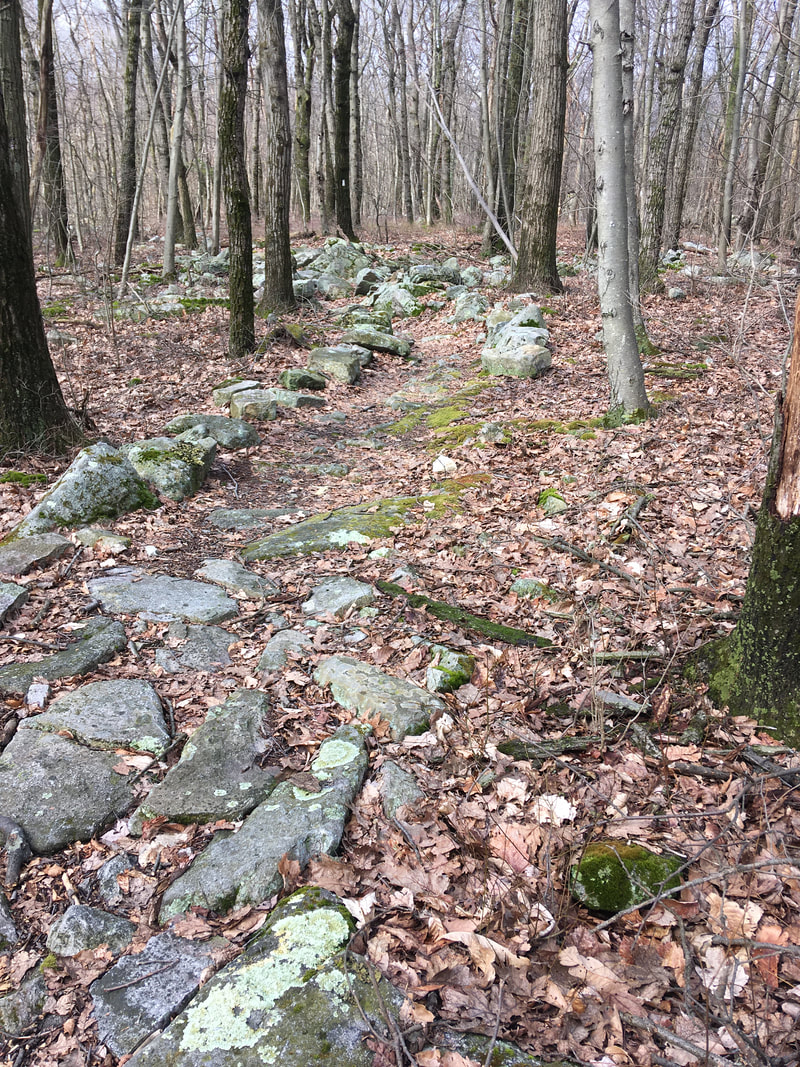
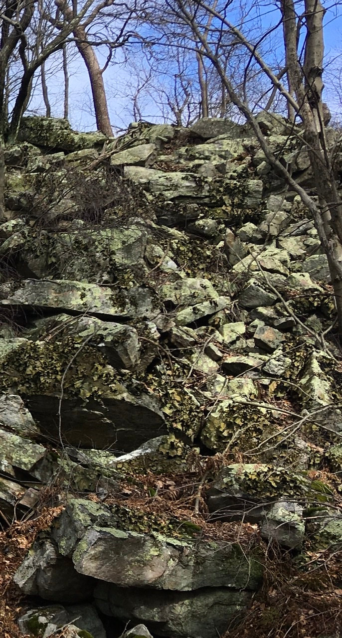
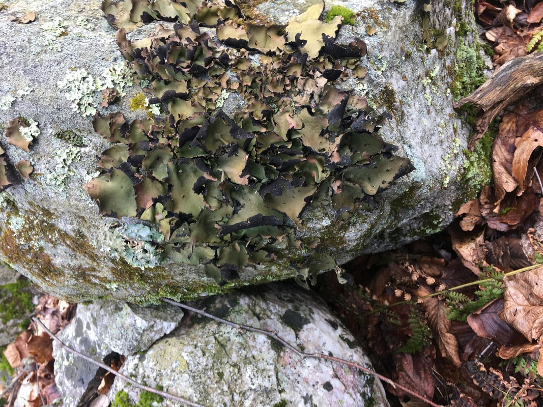
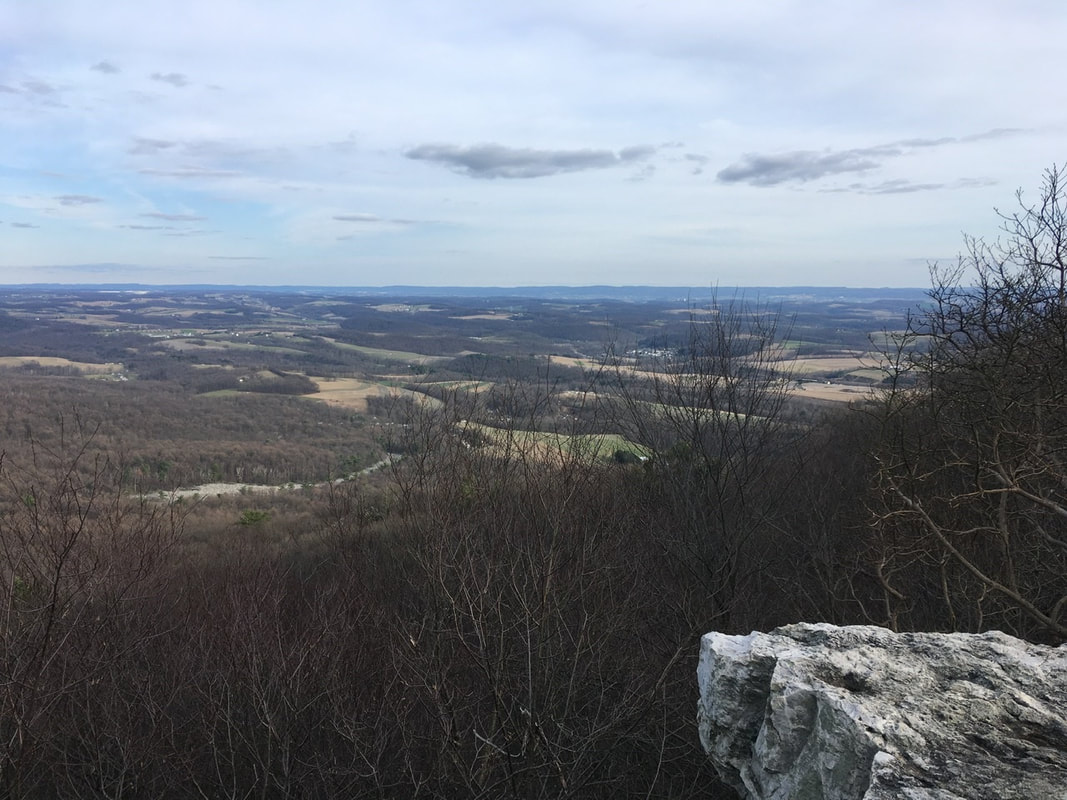
Once checked in it was a race to get clean! First I had to get the laundry going. Sorry to go into details here, but I find it humorous. Empty bag and pile up clothes for washing, strip naked and add those clothes to the pile. Put pile of extra "juicy" clothes on to Patagonia jacket and tie up the jacket around clothes pile. At this point, you must be wondering "Wait, you're naked, how are you going to get the clothes to the laundry?" For that, the rain gear is the answer. Boy did I ever look haggard walking to the laundry area! Luckily I didn’t meet anybody in the hallway! During laundry, it was shower time and then I unpacked the bag and layed everything out to dry and air out. After laundry, dinner and planning my 0 day tomorrow. I'll leave that for tomorrow's post. T+6 (Mar, 24,2020) Got a surprisingly good night of sleep last night. The rain subsided around dusk and after the sky cleared out so I could see some stars. Luckily my last minute worrying paid off in spades yesterday. The bag I purchased for the hike is made from DCF (Dyneema Composite Fabric) and is supposed to be the most water resistant pack material available. Initially I had it in my mind that I would skip on buying a pack liner, but about a week before hitting the trail I had a change of heart. My thinking was: they're light and quite cheap, so why not - just in case. Well, I'm here to tell you that DCF is indeed water RESISTANT, not water PROOF. If it's out in the rain for 8+ hours water will get in! I was glad I didn't have to suffer through the ~30°F night with a wet sleeping bag and clothes! That being said, I REALLY didn't want to put on my wet hiking clothes & boots in the AM! I did everything to avoid this, so got on the trail late again: 11 AM. The goal heading into the day was Windsor Furnace Shelter 16.4 miles down the trail. My late start certainly put that in jeopardy. In the end, hiking along old Jeep trails for the most part in the afternoon saved the day and I was indeed able to make the mileage and camp for the night at another shelter. I'm always anxious of meeting a large group of people at the shelter, but apart from the first stay in one I've had the places to myself. Staying in them does save time and energy of erecting the tent, which part of me feels guilty about “cutting corners” but the trail weary part can easily overrule that part of me. On to the hiking for the day! Just south of the shelter is one of the most wonderfully attended sections of trail I've ever hiked. Some group of people has taken the time to rearrange the PA rocks into almost an Avenue. It was quite a thing to see and ponder when some archeologist 10,000 years from now would think of the avenue. If they're anything like modern archeologists they'll probably chalk it up to an ill defined "ritual". I guess in a way one could consider the-hiking the AT a ritual, so they may not be too far from the truth! Right after that section of trail was a rocky outcropping completely covered in what looked from afar to be Ivy. That is until one realizes that in truth it is all some sort of lichen. I found the extensive growth of this stuff quite remarkable. If anyone knows what it actually is, please leave let me know in the comments. Whatever the name, its remarkable that they've been able to nearly completely cover the rocks. I wonder how many centuries it took for them to do this! About 3.5 miles into the hike I came upon Dan's Pulpit overlook. Actually, I nearly passed it up. There was a couple of women snacking there and I didn't want to bug them. That is until I got a glimpse of the view. Most of the views I've experienced so far have been pretty obscured (or obscured by cloud / fog), so when I got a glimpse at the last minute I just had to turn around and take it in proper. While there I had a nice chat with the two ladies. Both were locals out enjoying time "away from their adult children". Apparently, they go on day hikes frequently and are quite familiar with the section of trail I've traversed thus far. They informed me that the most rocky bits of PA are indeed now behind me. They were also surprised that I went over knife's Edge yesterday in the freezing rain. Well, to be honest, I'm not sure that surprised is the right word. Stunned? Horrified? (Maybe too strong of a word that one.) All in all a nice chat while adjusting my equipment and snacking. After Dan's Pulpit its downhill to Hawk Mountain Road. On this downhill I met another local and we had a chat. A recently retired, former physical therapist. He seemed genuinely worried about the situation and his choice to retire early. He never said anything outright but if I were a belting man I'd wager that he has a good chunk of his savings in the market...which has really pooped the bed. I try not to think about it! In spite of everything, he offered to help me in any way he could. A ride, food, a shower. I politely declined and we eventually went our separate ways. I hit Hawk Mountain Road around 2. Meaning 7.4 miles down, ~9 to go to make it to Windsor Furnace Shelter. After Hawk Mountain Road the trail runs along a series of old jeep roads, so I got to make up some time, The ladies I had spoken to earlier in the day informed me I could look forward to this (and I did look forward to it!). So, the plus of traversing such "trail" is that you can make quick work of it. The negative is that others out looking for an easy day hike will be attracted to it. I probably passed 20+ people, mainly kids in their teens and 20's, out day hiking. Not great for social distancing. Though we do pass quickly and I try to take a big breath and hold it for as long as possible after I'm passed them. Made it to Pulpit Rock around 5:45. Beautiful views and only one other person there. That's in contrast to the Pinnacle, which is where all of the kids were headed. So I skipped that one. Glad I did! The view was essentially the same from Pulpit Rock and I avoided people, success! After that it was another 1.8 miles downhill to the shelter. On the way down ran into a rock outcropping that appeared as if it had been photocopied from one in the White Mountains. I managed to successfully make my target destination, make camp (including sweep the floor of the shelter), filter water, and start cooking dinner before sunset. Still don't know how I managed to do it with the late start, but it happened!
For those keeping up at home T+6 adds an additional 16.4 miles for a total so far of 69.9 miles. T+5 (Mar. 23, 2020)
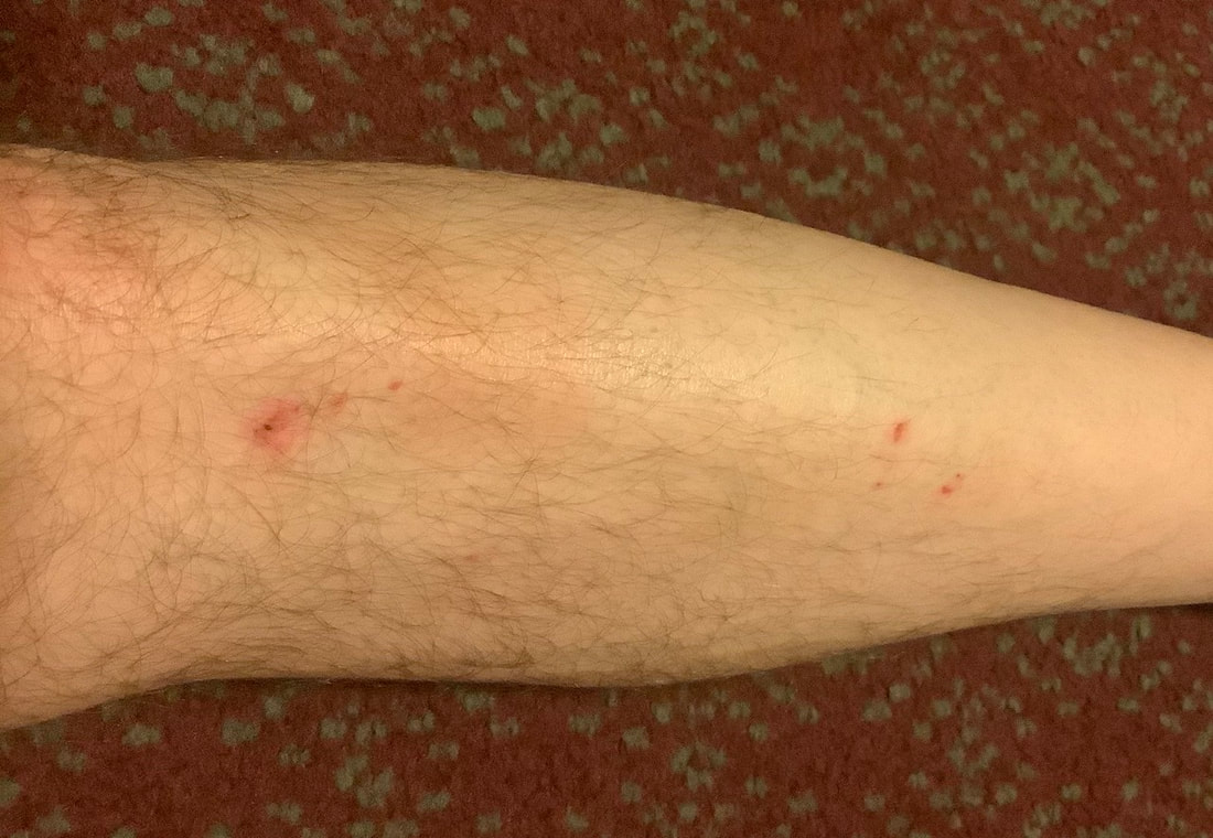
Woke up around 4AM to the unmistakable sounds of ice pellets hitting my tent. It wasn't coming down hard, but not a good sign considering it wasn't supposed to start until 9-ish. I forced myself back to sleep until about 6AM, then went about making myself breakfast in bed. Once completed, I packed what I could while still in bed and only got out of bed when it was time to pack the sleeping gear itself. Doing things this way definitely took longer, but it was much more appealing than braving the sub-0 temps and ice pellets! Got everything packed and onto the trail around 8:45AM. By that time the precipitation had subsided. The destination of this section is either Port Clinton or Hamburg. My preference is for Port Clinton. There is a hotel there that is hiker friendly and has all the necessary amenities on-site: restaurant, laundry, plus the requisite warm, dry bed, and shower. I'm planning on doing my first 0 (day I don't hike any miles on the trail) there. I need a more extensive resupply and there's some equipment that I'm not satisfied with, so I'm planning on seeing if I can upgrade at the World's Largest Cabela's in Hamburg. Will be calling Tues. to see if either the hotel or Cabela’s are open. Anyway, from Palmerton (mile 1260.2) to Port Clinton (mile 1220.0) is 40.2 miles. I knocked out 3.3 miles getting to camp yesterday, but that's still a shade under 37 miles to go and I'd like to arrive on Wednesday evening. Doable, but much higher mileage than previously. I say doable because much of the trip I'll be on the top of a ridge and there isn't too many ups and downs to deal with. Only the weather... To start today's hike the trail was moderately rocky with some small ups and downs, but I was making good time. About 2 miles in everything changed: I ran into a shit storm...literally. Wintry mix! First came more ice pellets, then rain, some freezing rain, and even larger raindrop sized hail. To make matters worse, I hadn't achieved my goal of passing the technically challenging portions of the day's hike. The first being Bake Oven knob, a 120' climb up a boulder field to the top. A mile and a half after that is Bear Rocks a really annoying - but flat - rock scramble. Then a half mile further is knife's Edge where, as the name implies, you hike along the rocky peak of the ridge. Given the weather and terrain I took things as slowly as possible, but several points were quite exposed which prompted haste. It was at one of those points where I made a misstep sending my foot into the Abyss. I landed on my shin and did a bit of minor damage to it (bruise and abrasion - picture at end of post). Nothing serious, just annoying. While traversing Bear Rocks I actually ate it and landed on an unforgiving rock splayed out like road-kill. Luckily the rock was quite flat (which is why I slipped), so there was no physical damage - just that to my ego. The scariest was losing my footing on knife's Edge! I didn't fall, just twisted my ankle (not bad) and shredded the right leg of my rain pants. Speaking of rain pants, let's take an aside to talk about them. I have the Frogg Fogg's rain gear. They come as a combo with standard S/M/L/XL sizing, I got the M, and the jacket fits nicely. The pants however...don't even come close to fitting! I tried them on in my apartment over my jeans and they seemed fine, but I never took them for a spin in the wild. Boy do I regret that! When I don't have the added bulk of jeans and a leather belt those bad boys are 3 1/2" too big around the waist. To make matters worse they seem to be proportioned for your average NBA player as the legs are 4+" too long. So, I have to play Urkel (sorry for the dated reference Millennials, you'll have to use the Google) and hike the damned things up to my armpits in order to not step on the legs. Of course while hiking they slide down, so constant adjustment is required. I'll be firing those things into the sun ASAP! After knife's Edge there's one more climb up a relatively easy boulder field to the top of an unnamed summit, just shy of PA-309. Not bad hiking up, but on the way down I witnessed some of the worst vandalism I've ever seen on any trail. A group of kids (come on, we all KNOW it was kids) spray painted everything in sight: rocks, trees, signs...everything. Plus they used axes to cut down 3 or 4 good sized trees - all healthy, living trees - one of which fell right across the trail. This destruction went on for over a half mile, probably closer to a full mile. I can't imagine how much spray paint those asshats had to lug into the woods to make that mess! What I can imagine is taking my anger out on their hides! After PA-309, the jackasses’ destruction ended and for the rest of the way to camp the AT largely follows a series of vehicle (logging? jeep?) paths. So it was rather quick going from there on out. Due to the weather, I wanted to stay at a shelter and the next one up is Allentown Hiking Club Shelter (mile 1242.4). Just as I was nearing that destination I got excited to be out of the rain...and got hasty. I didn't notice my pants falling down, so when I stepped on a rock I got no traction - only pant leg. Totally wiped out again! Again, only bruised my ego, so no harm no foul. Once at the campsite I hastily unpacked everything an dumped / squeezed the water out of my pack. Then I got out of the rain jacket and wet base layer and T-shirt and into my light jacket and puffy coat. Next, I used my tent to cover up most of the shelter opening and hung what I could to "dry". I haven't checked yet, but I wouldn't be surprised if I have frozen socks and gloves to look forward to this morning! All in all it was a really eventful day, with a few casualties: RIP rain pants, RIP skin on my left shin, RIP my dignity. Ok, who am I kidding? I never had that last one! Total mileage for the day: 14.5 (started at mile 1256.9, ended at 1242.4). I realized after my last entry that I haven't, to date, been giving total miles traveled. Since I started at mile 1296 and am at 1242.4, the total mileage is 53.8 thus far. T+4 (Mar. 22,2020) Brutally cold night going into T+4! The forecast called for 26°F in the valley, but I'm sure it was colder up at elevation. But, while the views from the campsite were wonderful and it was conveniently situated near food the exposed nature of the location was particularly cold on that windy night! Note to self: check weather before deciding on camping location! This, despite waking early I dithered in the tent before breakfasting and breaking camp. That did give me plenty of time to post T+3's blog. (As an aside, I'm amazed at how different attempting to upload in the AM us. PM is! It has been virtually impossible to upload in the PM, and while it is slow it’s doable in the AM...people: get off the internet at night just for me!) In spite of the lethargic start to the AM I still managed to get back on trail around 10:30. Not too bad all things considered. After getting on trail it was off to the races! I needed to hike the 6.4 miles to the trailhead in Palmerton then 1.5 miles to town, resupply, walk 1.5 miles back to the trail and make it to a campsite. I didn't know how long the resupply would take, so I was moving briskly! Just after Blue Mountain Rd. I met a group of 3 guys and 1 teenager as I was stopping to remove my top layer before a long incline. They asked my plans and we chatted for a few minutes before going our separate ways. Seemed like good people and they appeared to be genuinely interested in the blog. After that incline it was pretty much hiking on or near the top of a ridge line. But this isn't just any ridge line, no this is an active Super Fund site. You see, Palmerton is an zinc mining town and, as with most other mining operations in the US, as soon as the one is depleted or economically unsustainable the company declares bankruptcy, and the public gets to sort out the environmental damage. Yay corporate welfare! They've done a good job of remediating most of the area, but several patches of boulder fill remain exposed Most notably, the 900' decent from the ridge down to the road into town is a giant boulder field most reminiscent of something in the White Mountains. And I saw people attempting it with young 4 year old children and dogs - including a giant English bull dog. I suggested that family turn back and take the easier way up, but they didn't heed the advice. (They also hadn't made it to the rock scrambling portion either...) I made it down to the road into town at 2PM and proceeded into town. First stop country Harvest grocery store. Got dinners for 2 days, granola bars, oatmeal, a real toothbrush (I found the micro hiking toothbrush I brought with me unusable), and a mini bag of Starburst jelly beans. Plus, for hikers they give you an option of a free apple or orange - I chose orange. Spent a few minutes packing the resupply and headed out. On the way in I had noticed a sub shop, Joe's Place, So on a whim I decided to get a sub for lunch / dinner, and 1L of Gatorade to wash it down. The initial plan was to eat 42 on the way back to the trail and the other 1/2 for dinner after making camp. Well yeah, that didn't happen! This oinker who didn't think he was very hungry decided that the damned sub was so good I had to put all 14" in my belly on the walk back to the trail. Mission Accomplished! And finished the Gatorade to boot!
Got back on trail a bit before 4. So made good time, but boy did I ever feel like I had swallowed a bowling ball! From where I rejoined the trail it goes down PA-248 turns left on PA-873 across the bridge over the Lehigh River to the next trail head. As I was walking down 248 a car passed with the occupants shouting encouragement for Tedward - must've been the crew I stopped to talk to earlier in the day! It is back up to the ridge line from the road. On my way up I met a lady with her ~10 year old daughter. They stopped to let me pass way sooner than most people would, so I had to comment that it made me feel pressured to hurry up and get past them. The mother said "take your time" and the daughter chimed in with "are you section hiking?". The look on her face when I told her I was doing the whole thing was absolute 1 priceless! Eyes as wide as frisbees! Thinking of it is bringing a smile to my face... Pretty uneventful after that. the ridge line is pretty smooth, so I made good time to the campsite I wanted to make it to right after I-476, which goes through the ridge in a tunnel. So for those keeping tabs at home: I started at mile 1266.6 and hiked to 1260.2 where I went into town and then continued on to 1256.9 to the campsite, for a total (trail) mileage of 9.7. Didn't do any blogging as I wanted to tuck in early as I was expecting nasty weather to roll in early. And in fact, it came earlier than forecasted! |
About Me
Archives
July 2020
Categories |
Site powered by Weebly. Managed by Hostgator














 RSS Feed