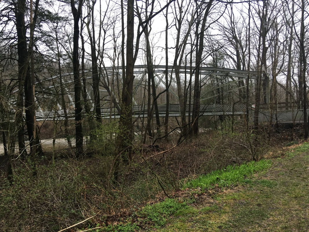
 A random section of the trail today T+11 (Mar. 29, 2020) Navigation Report: Starting Point: 501 Shelter (mile 1196.1) Destination: resupply in Lickdale. Hotel in town, campsite 0.7 miles after I-81, and a campsite 2.5 miles after I-81 are all sleeping options Travel Log: Depart camp (mile 1196.1) - 10:15 Cross PA-645 (mile 1194.1) - 11:30 William Penn Shelter (mile 1192) - 12:30 Lick dale KOA (mile 1184.7) - 5:00 Campsite 0.7 miles after I-81 - 6:45 Daily mileage: 12.1 Total mileage: 112.0 Commander's Report: I awoke this morning around 6 AM. Worked on posting the previous day's blog and generally dallied around in bed, so as to not disturb the other hikers who got to bed later than I did. Around 8:30 I got out of bed and started getting ready for the day. The two other hikers, Richie and Brian, got out of bed around 9 and we had a nice conversation about each others' plans and braving the dreadful weather the day before. Until they mentioned it I hadn't given any thought to the fact that they were out in the elements for the worst of things: the thunderstorm. I was comfortably protected while they were slogging around looking for the shelter-they passed it twice in the darkness. Also from this conversation I discovered that the outfitter in Duncannon was open a couple days ago. Apparently they're considered a grocery store for the purposes of the essential / non-essential businesses. That means I may be able to procure a gas tank or two in Duncannon! Again this morning I did everything possible in order to avoid putting on my wet socks, gloves, and boots. While I know after a few minutes of wearing them things aren't so bad, those first few minutes suck big time! After much delay (made easier by conversation with Richie & Brian) I made it on trail by 10:15. The weather was equal parts amazing and dreadful. The fog was so thick it was like walking through a cloud all day. Unfortunately, it was also reining a slow soaking drizzle for most of the day. Weather that is great for the creepy ambiance, but sucks to be out in for the whole day. I think days like this are going to be when I miss having rain pants once I switch to the skirt. My legs will definitely be getting wet on future days like this. That being said, I will take it over these useless rain pants. Every time I wear them I do more and more damage to them. Today, less than a mile into the day's hike, I wasn't careful in a boulder scramble and sliced the front of the shin open. I had to stop and repair that 4" gash with duct tape before proceeding. These damned pants are going to look like an old timey hockey mask by the time I get the rain skirt!  Poor, beat up rain pants Shortly after leaving the shelter is an overlook. Not much view today. As with many things that are road-adjacent on the AT, this overlook was well tagged by the local kids. 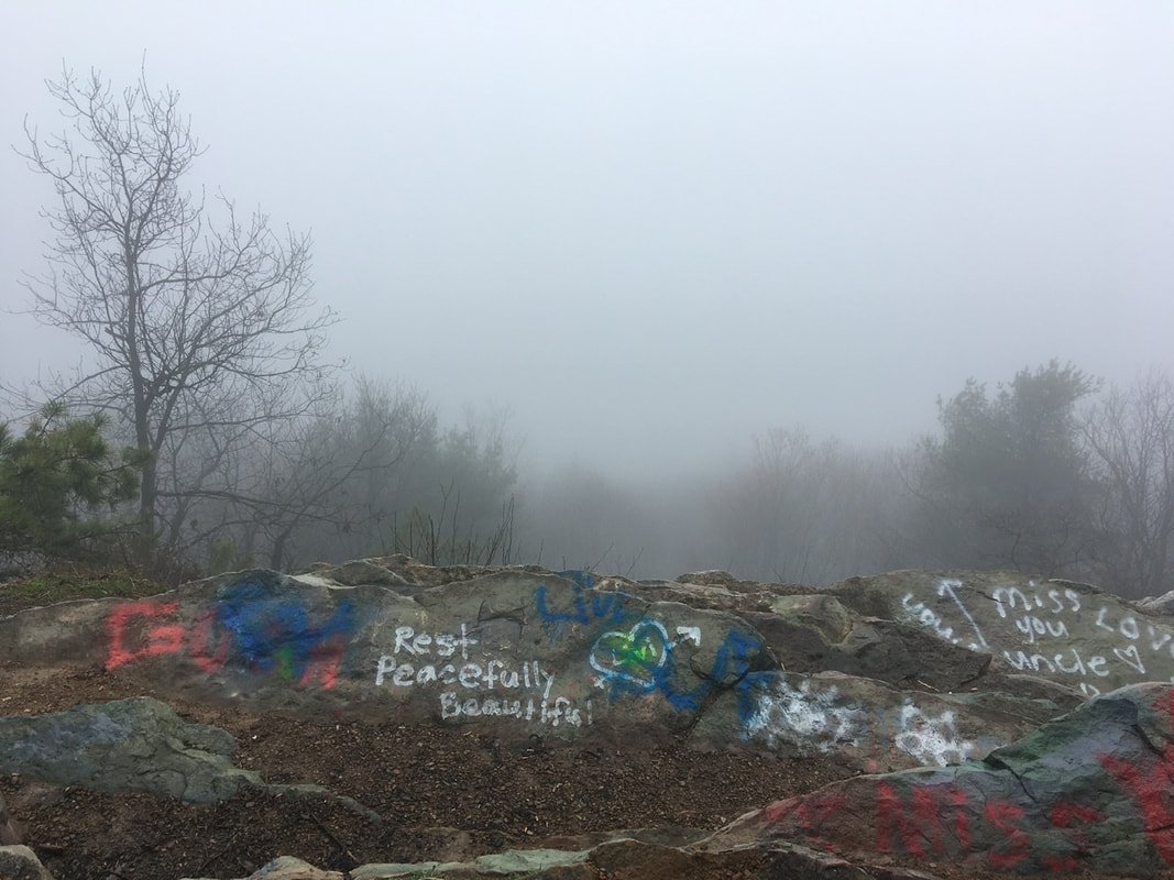 The only view today is of the graffiti :-( Not that much further down is an old cot in the forest for power lines (now absent) that should have a good view on a clear day, but without the graffiti. 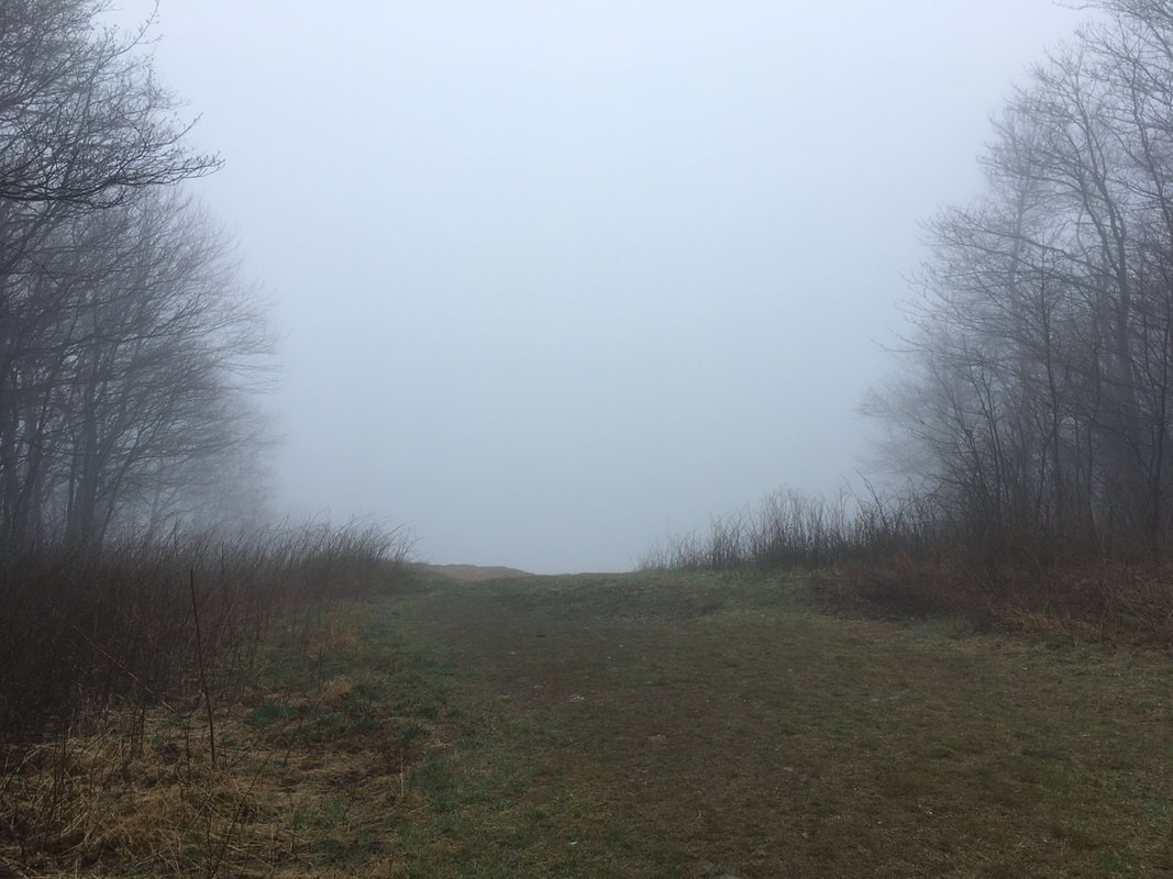 A better view, because there’s no graffiti Came across other overlooks (or lookout like in the accompanying photo), but didn't really bother to stick around to admire the views for terribly long. I wonder why...  Lookout at mile 1189.3 Sorry to flog a dead horse about the rocks here, but I've gotta give it another thumping. There are some rocks here that stick straight up out of the ground, like miniature headstones. I manage to figure out a way to trip over EVERY. SINGLE. ONE. OF. THEM! The thing is that when you're walking along they usually look like any other random loose stone on the trail. It's not until you're right on top of them that their true nature is revealed. In an effort to "name and shame" those bastards, I've taken to calling them Toey Tombstones. I feel this name has a nice '30's gangster feel to it. Let's see if the name takes off (it won't).  Tory Tombstone when you sink down to his level  Tory Tombstone as seen from a hiker’s vantage point I've seen a lot of evidence for frequent deer trafficking along the trail. Random stretches with tons of loose hairs on the ground and hoof prints. Today, I first spotted this old deer scat.  Fooled you! This is ancient dog crap. Seriously people, pick up your animal’s crap, People shouldn’t have to avoid it for fears in the future!! Then a couple miles down the trail I crested a small hill to discover a mommy deer and her yearling grazing about 10 yards away from me, I stopped and fumbled for my camera, but I was too slow. They turned tail and bounded out of sight. I'd forgotten how cute the backsides are of white-tailed deer, but that reminded me. More signs of spring today. Saw my first wild flowers emerging. I'm not sure what they are yet, but they're getting ready to bloom. 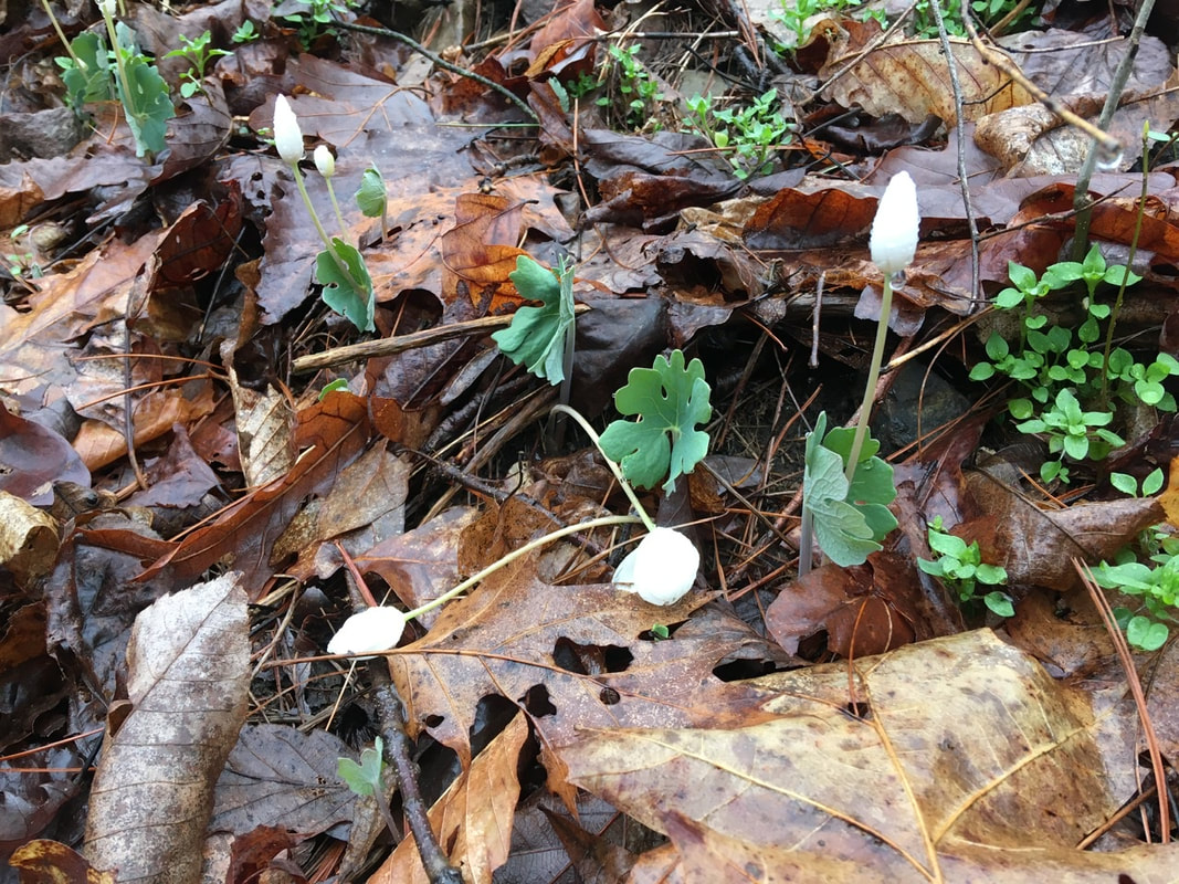 On the two mile walk into town I saw that the daffodils are also starting to pop.  Daffodils!  Pond with daffodils on far shore. Speaking of the walk into town. The trail crosses under I-81 outside of town. Hikers go under the highway bridge over Swatara Creek and cross the river on an old '30's style metal arch bridge. They have turned this into foot-traffic only and incorporated it into a walkway / bikeway park. It even seemed to be getting plenty of use today.
 Finally, when I got into town, I stopped at the first place (the KOA) to resupply. It's a campground convenience store, so I wasn't expecting much. It exceeded expectations though. Filled the food bag up with more granola bars, pop tarts, snack foods, and Mac and cheese, little nutritional value, but will get me through to Duncannon. Also, I've felt quite low on energy the last couple days. So I took the opportunity to calorie load. I bought a pint of ice cream and ate that tub in less time than it took to walk off of KOA property. So gluttonous, but so good. Also in town I said 'goodbye' to the rain pants. I was stepping up on a rock earlier in the day and the ass split open a good 6". I probably could have repaired them, but with a replacement arriving in a couple days and no rain in the forecast I decided today was the day to rid myself of them. RIP shitty assed pants!  Well ventilated rain gear. Not terribly water proof anymore! After town came a brisk walk to the trail and then to the first campsite. It was late and I wanted to set up camp in the daylight if possible. I managed to make it happen, with a few minutes to spare. Just to completely bury the lede, I passed 100 miles on the trail today. 1/22nd of the way to my goal!
0 Comments
Leave a Reply. |
About Me
Archives
July 2020
Categories |

 RSS Feed