|
T+4 (Mar. 22,2020) Brutally cold night going into T+4! The forecast called for 26°F in the valley, but I'm sure it was colder up at elevation. But, while the views from the campsite were wonderful and it was conveniently situated near food the exposed nature of the location was particularly cold on that windy night! Note to self: check weather before deciding on camping location! This, despite waking early I dithered in the tent before breakfasting and breaking camp. That did give me plenty of time to post T+3's blog. (As an aside, I'm amazed at how different attempting to upload in the AM us. PM is! It has been virtually impossible to upload in the PM, and while it is slow it’s doable in the AM...people: get off the internet at night just for me!) In spite of the lethargic start to the AM I still managed to get back on trail around 10:30. Not too bad all things considered. After getting on trail it was off to the races! I needed to hike the 6.4 miles to the trailhead in Palmerton then 1.5 miles to town, resupply, walk 1.5 miles back to the trail and make it to a campsite. I didn't know how long the resupply would take, so I was moving briskly! Just after Blue Mountain Rd. I met a group of 3 guys and 1 teenager as I was stopping to remove my top layer before a long incline. They asked my plans and we chatted for a few minutes before going our separate ways. Seemed like good people and they appeared to be genuinely interested in the blog. After that incline it was pretty much hiking on or near the top of a ridge line. But this isn't just any ridge line, no this is an active Super Fund site. You see, Palmerton is an zinc mining town and, as with most other mining operations in the US, as soon as the one is depleted or economically unsustainable the company declares bankruptcy, and the public gets to sort out the environmental damage. Yay corporate welfare! They've done a good job of remediating most of the area, but several patches of boulder fill remain exposed Most notably, the 900' decent from the ridge down to the road into town is a giant boulder field most reminiscent of something in the White Mountains. And I saw people attempting it with young 4 year old children and dogs - including a giant English bull dog. I suggested that family turn back and take the easier way up, but they didn't heed the advice. (They also hadn't made it to the rock scrambling portion either...) 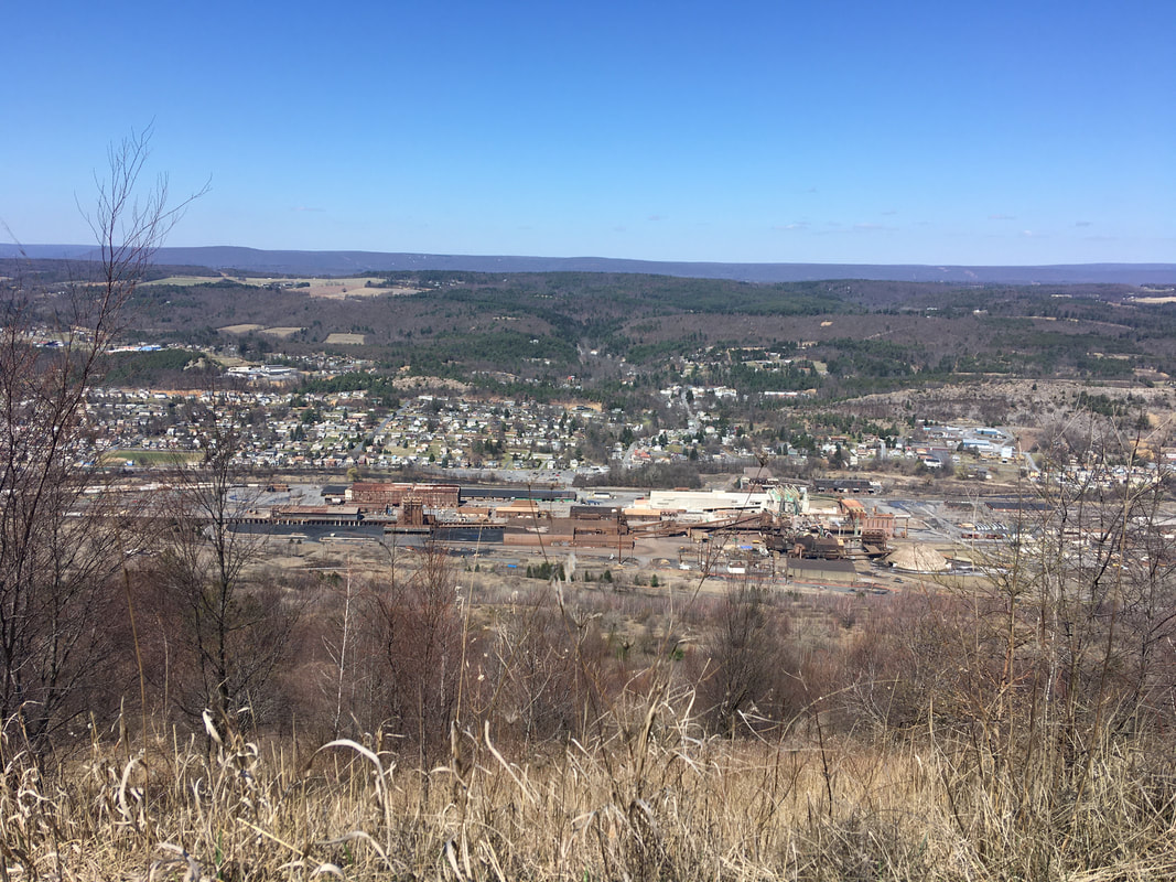 The zinc mining plant in Palmerton  At least our tax money bought us this nice trail... I made it down to the road into town at 2PM and proceeded into town. First stop country Harvest grocery store. Got dinners for 2 days, granola bars, oatmeal, a real toothbrush (I found the micro hiking toothbrush I brought with me unusable), and a mini bag of Starburst jelly beans. Plus, for hikers they give you an option of a free apple or orange - I chose orange. Spent a few minutes packing the resupply and headed out. On the way in I had noticed a sub shop, Joe's Place, So on a whim I decided to get a sub for lunch / dinner, and 1L of Gatorade to wash it down. The initial plan was to eat 42 on the way back to the trail and the other 1/2 for dinner after making camp. Well yeah, that didn't happen! This oinker who didn't think he was very hungry decided that the damned sub was so good I had to put all 14" in my belly on the walk back to the trail. Mission Accomplished! And finished the Gatorade to boot! Got back on trail a bit before 4. So made good time, but boy did I ever feel like I had swallowed a bowling ball! From where I rejoined the trail it goes down PA-248 turns left on PA-873 across the bridge over the Lehigh River to the next trail head. As I was walking down 248 a car passed with the occupants shouting encouragement for Tedward - must've been the crew I stopped to talk to earlier in the day! It is back up to the ridge line from the road. On my way up I met a lady with her ~10 year old daughter. They stopped to let me pass way sooner than most people would, so I had to comment that it made me feel pressured to hurry up and get past them. The mother said "take your time" and the daughter chimed in with "are you section hiking?". The look on her face when I told her I was doing the whole thing was absolute 1 priceless! Eyes as wide as frisbees! Thinking of it is bringing a smile to my face... Pretty uneventful after that. the ridge line is pretty smooth, so I made good time to the campsite I wanted to make it to right after I-476, which goes through the ridge in a tunnel. So for those keeping tabs at home: I started at mile 1266.6 and hiked to 1260.2 where I went into town and then continued on to 1256.9 to the campsite, for a total (trail) mileage of 9.7. Didn't do any blogging as I wanted to tuck in early as I was expecting nasty weather to roll in early. And in fact, it came earlier than forecasted! 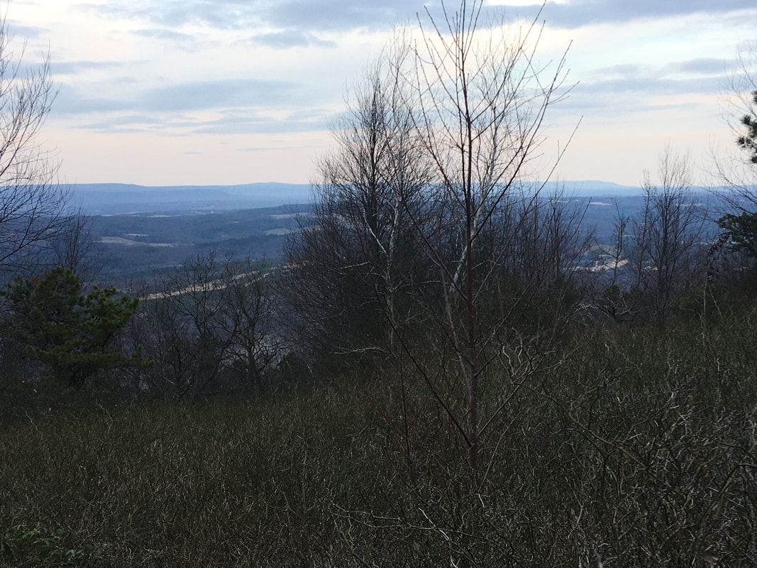 The view from my campsite
1 Comment
Joe Cikowski
3/24/2020 05:58:31 am
Thanks for the shout out on your blog, our crew enjoyed our limited chat. Will be sure to follow you, hope one day to give it a try ourselves. As a biologist myself, I was wondering your thoughts re: Zinc Superfund. Keep trucking and looking forward to additional updates. Stay safe! Leave a Reply. |
About Me
Archives
July 2020
Categories |
 RSS Feed