|
T+4 (Mar. 22,2020) Brutally cold night going into T+4! The forecast called for 26°F in the valley, but I'm sure it was colder up at elevation. But, while the views from the campsite were wonderful and it was conveniently situated near food the exposed nature of the location was particularly cold on that windy night! Note to self: check weather before deciding on camping location! This, despite waking early I dithered in the tent before breakfasting and breaking camp. That did give me plenty of time to post T+3's blog. (As an aside, I'm amazed at how different attempting to upload in the AM us. PM is! It has been virtually impossible to upload in the PM, and while it is slow it’s doable in the AM...people: get off the internet at night just for me!) In spite of the lethargic start to the AM I still managed to get back on trail around 10:30. Not too bad all things considered. After getting on trail it was off to the races! I needed to hike the 6.4 miles to the trailhead in Palmerton then 1.5 miles to town, resupply, walk 1.5 miles back to the trail and make it to a campsite. I didn't know how long the resupply would take, so I was moving briskly! Just after Blue Mountain Rd. I met a group of 3 guys and 1 teenager as I was stopping to remove my top layer before a long incline. They asked my plans and we chatted for a few minutes before going our separate ways. Seemed like good people and they appeared to be genuinely interested in the blog. After that incline it was pretty much hiking on or near the top of a ridge line. But this isn't just any ridge line, no this is an active Super Fund site. You see, Palmerton is an zinc mining town and, as with most other mining operations in the US, as soon as the one is depleted or economically unsustainable the company declares bankruptcy, and the public gets to sort out the environmental damage. Yay corporate welfare! They've done a good job of remediating most of the area, but several patches of boulder fill remain exposed Most notably, the 900' decent from the ridge down to the road into town is a giant boulder field most reminiscent of something in the White Mountains. And I saw people attempting it with young 4 year old children and dogs - including a giant English bull dog. I suggested that family turn back and take the easier way up, but they didn't heed the advice. (They also hadn't made it to the rock scrambling portion either...) 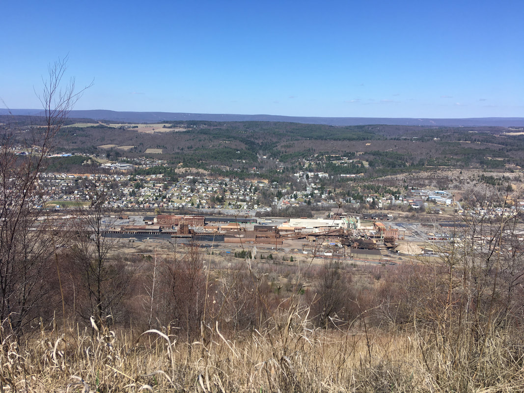 The zinc mining plant in Palmerton  At least our tax money bought us this nice trail... I made it down to the road into town at 2PM and proceeded into town. First stop country Harvest grocery store. Got dinners for 2 days, granola bars, oatmeal, a real toothbrush (I found the micro hiking toothbrush I brought with me unusable), and a mini bag of Starburst jelly beans. Plus, for hikers they give you an option of a free apple or orange - I chose orange. Spent a few minutes packing the resupply and headed out. On the way in I had noticed a sub shop, Joe's Place, So on a whim I decided to get a sub for lunch / dinner, and 1L of Gatorade to wash it down. The initial plan was to eat 42 on the way back to the trail and the other 1/2 for dinner after making camp. Well yeah, that didn't happen! This oinker who didn't think he was very hungry decided that the damned sub was so good I had to put all 14" in my belly on the walk back to the trail. Mission Accomplished! And finished the Gatorade to boot! Got back on trail a bit before 4. So made good time, but boy did I ever feel like I had swallowed a bowling ball! From where I rejoined the trail it goes down PA-248 turns left on PA-873 across the bridge over the Lehigh River to the next trail head. As I was walking down 248 a car passed with the occupants shouting encouragement for Tedward - must've been the crew I stopped to talk to earlier in the day! It is back up to the ridge line from the road. On my way up I met a lady with her ~10 year old daughter. They stopped to let me pass way sooner than most people would, so I had to comment that it made me feel pressured to hurry up and get past them. The mother said "take your time" and the daughter chimed in with "are you section hiking?". The look on her face when I told her I was doing the whole thing was absolute 1 priceless! Eyes as wide as frisbees! Thinking of it is bringing a smile to my face... Pretty uneventful after that. the ridge line is pretty smooth, so I made good time to the campsite I wanted to make it to right after I-476, which goes through the ridge in a tunnel. So for those keeping tabs at home: I started at mile 1266.6 and hiked to 1260.2 where I went into town and then continued on to 1256.9 to the campsite, for a total (trail) mileage of 9.7. Didn't do any blogging as I wanted to tuck in early as I was expecting nasty weather to roll in early. And in fact, it came earlier than forecasted! 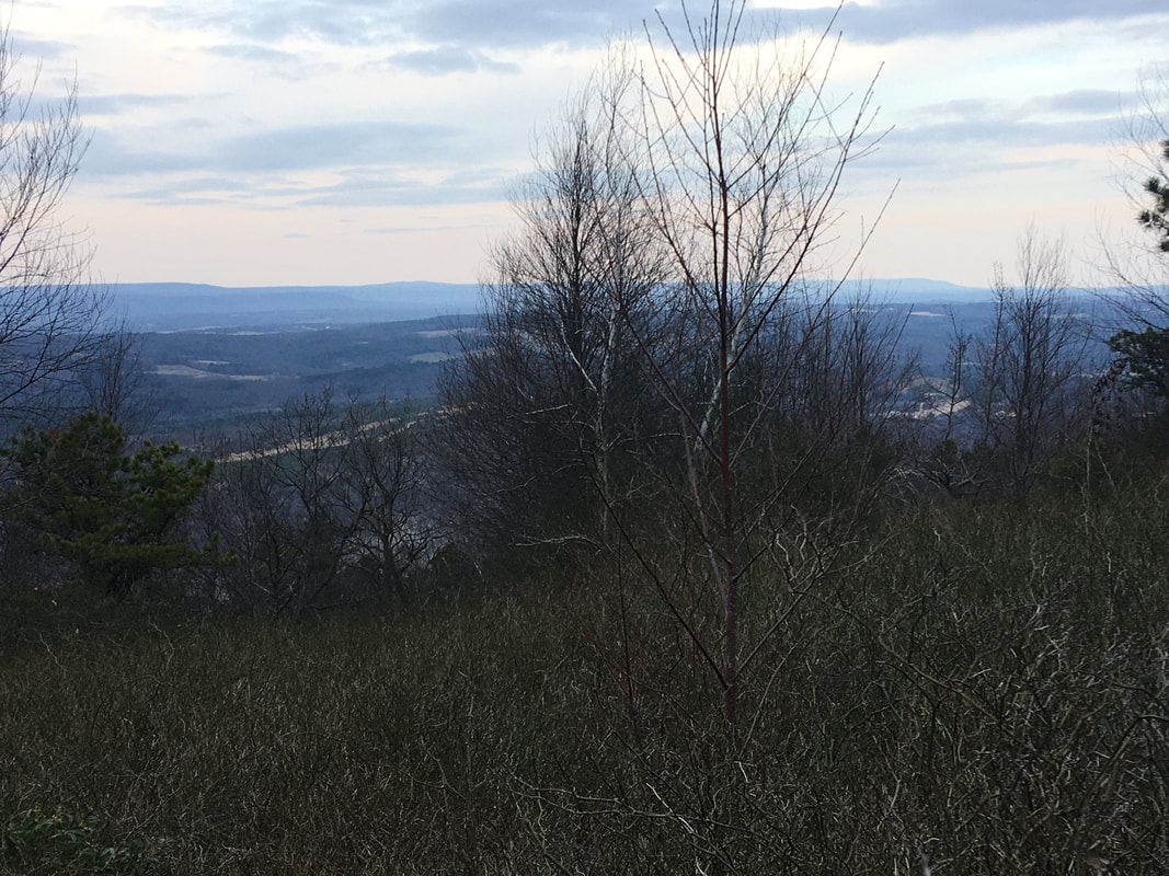 The view from my campsite
1 Comment
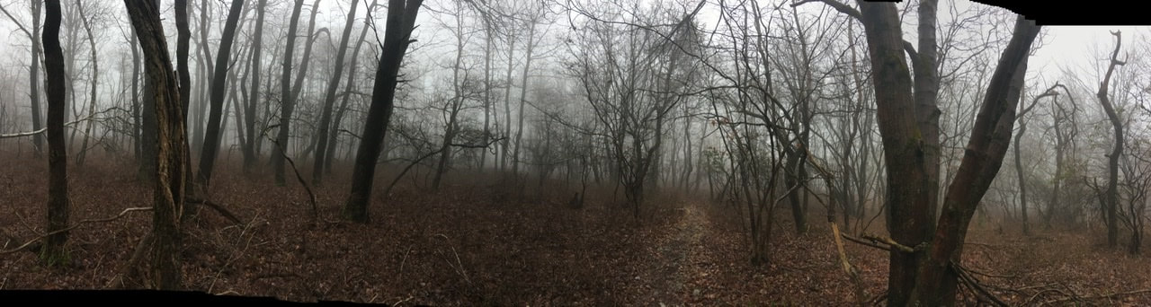
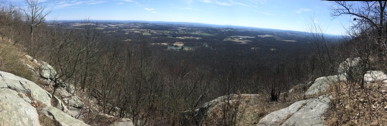 T+3 Beside having to fix the blog this AM because apparently I screwed something up last night (thanks Twitter friends for notifying me!) I took today relatively easy. I hiked from the Leroy Smith shelter to an unapproved, but well traveled, campsite 9.2 miles down the trail. Got started around 10 AM even though I was up before 7 AM. Had a good chat with the couple who stayed in the shelter with me (@thesunfishduo on Instagram) and found it hard to set out. They later passed me after I made camp. They set off from Delaware Water Gap too, just the day before me. Since I’m generally hiking at a faster pace than them, I'm sure I'll see them again. The trail today was much less rocky, plus the rocks are far less treacherous when dry (dare I say an “easy" day?) so it was't full speed ahead. I was only slowed by the fact that I'm currently in a bit of a water desert. So, I was forced to hike to hike 0.4 miles down off the plateau / ridge the AT runs along to go get a resupply of water. While at the spring I ate lunch and drank the remainder of my water (~1.5 L). This gave me plenty of time to take in the scenery, which was beautiful! 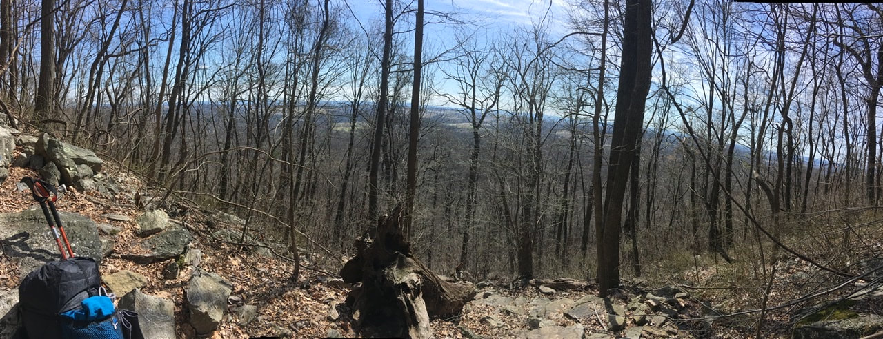 After that it was only 3.3 miles to the place I decided to camp. It was early - between 3:30 and 4-but I decided to call it a day. Certainly, I could have gone further, but it's only 6.5 miles to Palmerton and I needed to air out the tent. I packed it wet yesterday and the whole day was wet, so didn't bother attempting to air it out after getting to the shelter. Plus, what a location to make camp! 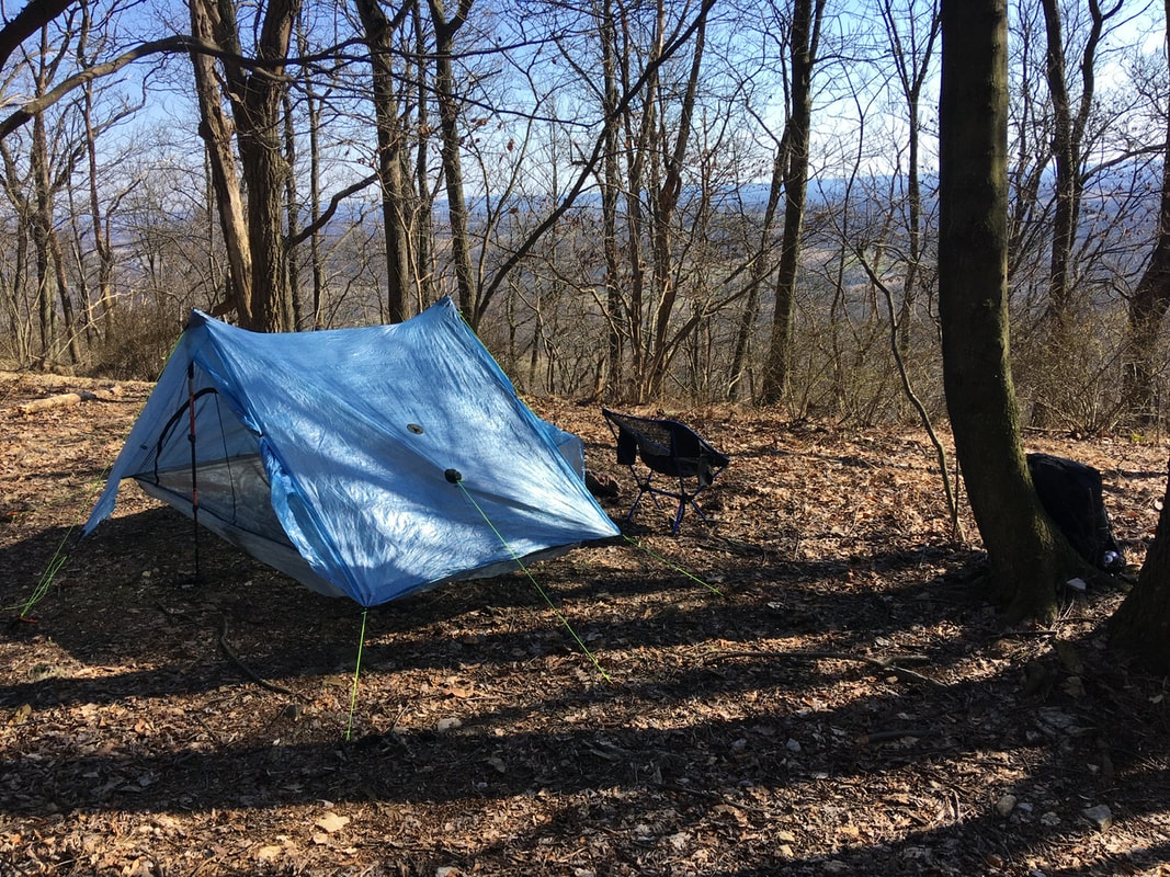 An added attraction is that the tent site I'm staying at is a 20-ish minute walk from Blue Mountain Resort. I took advantage of this by getting dinner from there (take-out of course). Was a tad pricey - $13 for a wild boar sausage flatbread...yum - but worth getting a "real meal" in my belly. I say this because it is forecasted to be 26°F tonight (in the valley), and its less daunting facing that kinda temperature on a full stomach!  All around, today was a bit of a pick-me-up after the first two days of fog and drizzle, which left me feeling like the protagonist in some post-apocalyptic movie. But, I'll delve into my thoughts in another entry.
For whatever reason, I managed to break the blog and it’s been down overnight. Working to get it back up...
 T+1 (Mar. 20, 2020) Got a surprisingly decent night of sleep last night. Usually while hiking I toss and turn most of the night and feel completely un-rested. Last night however I managed to only wake up a few times. Hoping for more of that tonight...we'll see! Woke up for good around 6:30 and spent around 1 1/2 hours uploading the post to my blog. Took another ~2 hours to eat and break camp. Because of the time involved I decided to make camp early today, which should allow me to post this tonight. So, for today's hike I departed my camp near Wolf Rocks spring (mile 1286.8) without a clearly defined destination for the day. I just let my body and the weather decide my fate. In the end, I stopped at Leroy A. Smith shelter (mile 1275.9) for the night. That makes today's mileage 10.9. Again, not bad for an old fart having a hard time with the rocks! 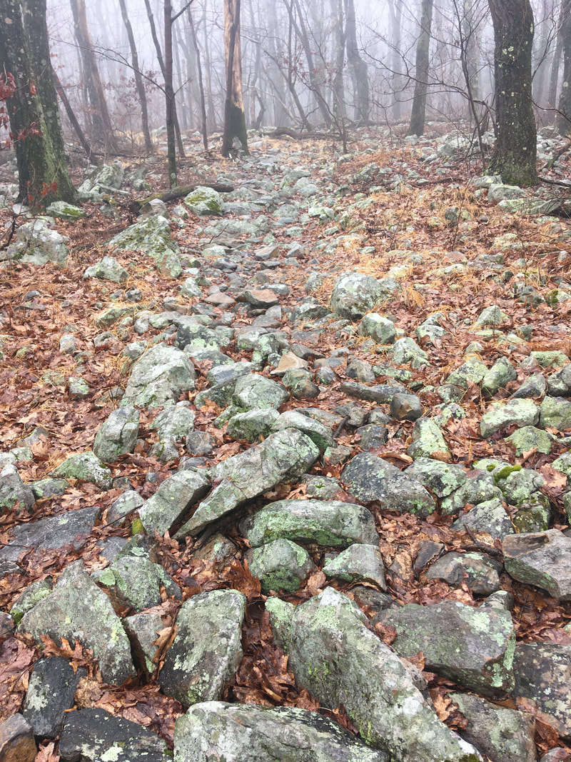 Speaking of the rocks, wow do they ever suck - big time! Especially when wet, which it has been the entire hike so far. I've never really hiked on terrain like this. The rocks are all either completely smooth and super slippery in wet weather, or poke up at random angles, and as you can see they essentially make up the trail. There’s almost no smooth ground to step on! I can't count the number of times I have twisted my ankle(s), stubbed my toe, nearly fallen on my keister, gotten the hiking poles stuck and nearly bent them, or some combination thereof - in rapid succession. It's no wonder that this state is referred to as "Rocksylvania" in the hiker community!
Long story short, all of the extreme jostling of my pack is definitely slowing me up (not that I’m in a big hurry) and causing significant soreness in my shoulders and hips. I was expecting some physical discomfort due to lack of training, but this has been a bit of a surprise. On the bright side, the trail is rather flat. This has allowed me to keep the pace I've been able to maintain. As the Monty Python song goes: "Always look on the bright side of life". In spite of my inherently negative nature, I really am trying to do this!  T+1 (March 19, 2020) So, there's been a MAJOR change of plans. Due to the COVID-19 pandemic the ATC strongly recommended against thru-hikers starting trips and further recommended thru-hikers already on the trail get off of it and return home. For those people who do decide to start their thru-hike, they recommended initiating at some point other than the North or South termini - so as to avoid other hikers along the trail. I have ignored their recommendation and have initiated my thru-hike. That said, I did heed their advice and canceled my travel down to Georgia. Instead, I have begun my trip from Pennsylvania - Delaware Water Gap (mile 1296) to be precise...I’m now heading south to Springer Mountain and should I make it there I will return to Delaware Water Gap and head north to Katahdin. Considering all that is happening in the "real world" I would be VERY surprised if I make it to Springer - nonetheless Katahdin. Hell, I'm not even sure if I'll be able to resupply in the next town, or the town after that. Oh well, I've stressed out over the decision to get on the trail enough over the last few weeks, I should leave resupply anxieties for another day! Anyway, I've got enough food for 4+ days, so I will be able to get a decent section hike in at the very least. The current plan is to stop in Palmerton, PA (mile 1260) for a resupply. I should be able to make it there by Sun. the 22nd. We'll see! Ok, so enough about the plans - time for the juicy stuff...the hike itself! As I said above, I started the day off at Delaware Water Gap. My wife drove me there and doo ed me off at about 1PM. Once we said off goodbyes I headed up Mountain Road on the AT. The “trail” heads up to a parking lot, then runs along I-80 for quite a way. It didn't take long for the trail to turn into an actual green tunnel through a stand of rhododendrons! 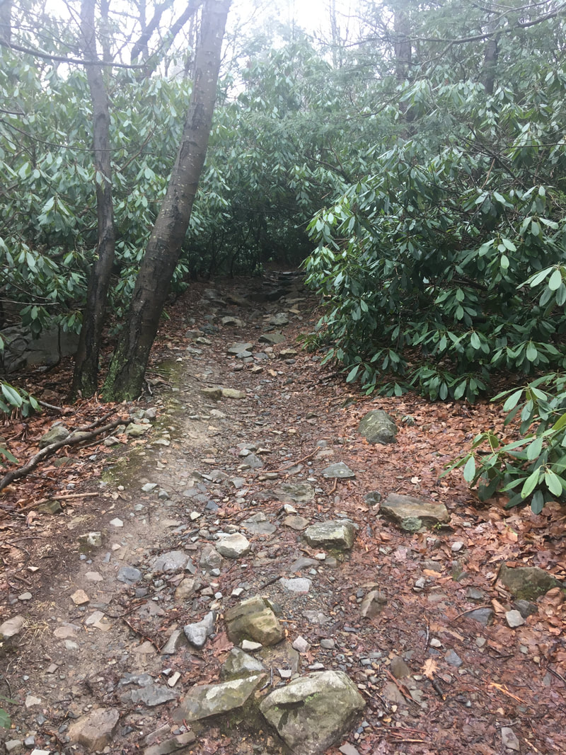 Not too many views today - it was overcast, foggy, and lightly drizzling at times. Managed to make it to the southern end of the Wolf Rocks cut off (mile 1268.8). That means I hiked 9.2 miles in a bit over 4 hours. Not bad considering my lack of training and the annoyingly rocky
terrain! Also didn't have too many problems setting up camp. The biggest issue was getting the tent stakes to stay in the ground with all of the rocks around. Well, that and dealing with the iPad, which didn't want to pair with the pencil...working now after a half hour of futzing about with them. It's an hour past hiker midnight, so I'll leave things there and perhaps make a feeble attempt at posting this, but the cell signal is shit where I set up camp. Fingers crossed for a good connection! UPDATE: The connection sucked, so I went to sleep. Rainy and cold (high 30s) overnight, but I was nice and toasty, YAY!! T-minus 24 days.
It’s been quite the last few weeks! I’ve been a bit overwhelmed trying (and failing) to get everything wrapped up before setting off for the trail. Anyways I wanted to both get a post up, but more importantly do so from a device I’ll be taking with me - instead of the laptop, which will definitely be staying home! For many reasons, the mobile interface for site editing is really clunky and nearly impossible to use with my phone, so I’ve spur of the moment decided to get a tablet for use on the trip. Not sure I’m in love it yet, but I’m hoping it’ll grow on me. This post is being made from the tablet, so at the very least I am indeed able to edit the site from the thing. I’ll putz around with alternate portals for site editing in the future, cause I’m sure doing it this way is going to grate on my nerves. Anyway for a status update: much of the packing and moving has been accomplished. Ive also managed to make much of the arrangements. Still have about a dozen things to check off, but I’m moving in the right direction. Going to try and get those wrapped up by the end of next week. In my last post I mentioned I was using Craigslist to get rid of my old stuff. Turns out it just reminded me of how much people suck! Arranged to sell 4 items and here’s what happened: Desk (listed at $25) - guy showed up liked it and only had $20. Close enough, sold. Bottles for home brewing ($10) - guy shows up 30 minutes late and “doesn’t have his wallet”. Fuck it, take the damned things. You wasted more than $10 worth of my time already. Chair ($15) - lady postpones at last minute, then wants it for $10 when she does show up. Fine whatever. Old UK/US power converter ($10) - guy again shows up with “no wallet”. Again I give the damned thing away because it ain’t worth my time arranging another deal. The lesson learned? I’m going to just give all my other re-sellable stuff away to the secondhand store down the street. Let them deal with the Masshats! 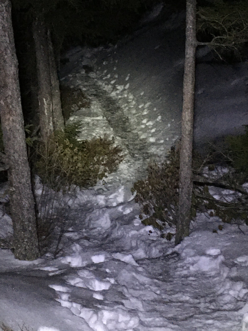 T-minus 49 days. Yes, I've decided to go with the T-minus system for counting down until I embark in the AT. I'm planning on switching to AT-# for tracking the days when on the trail. We'll see if I come up with something better or not. So, yesterday I was in a MOOD. The day started with me making a trip to the post office and I had a bizarre encounter with another driver. When I was in the shared turn lane to the shopping plaza this dude popped into the turn lane immediately in front of me. This annoyed me to no end, but hey it's Massachusetts I'm kinda used to asshat drivers. The thing that set me off was this: as he popped into the turn lane he proceeds to make eye contact with me, takes both hands off the wheel to do jazz hands or something, and pursed his lips up and stuck out his tongue. In that instant I had the urge to gun the gas and have a head-on collision with him – all in hopes of having him bite his tongue off. Anywho, that bizarreness left me really annoyed until after noon, and in that time I decided that I would do a night hike to stomp some of the aggression out of my body. It worked! Went with the old standby of hiking up Pumpelly trail on Mt. Monadnock. It's about a 9 mile round-trip hike that I've done numerous times in a variety of weather conditions – including at night.  All that said, this was my first winter night hike, so I decided to just go with the flow and turn around if things got too spicy. The trail conditions weren't as treacherous as anticipated, so I was able to nearly summit. I made it to the second most prominent point of this trail – about 3/4 mile from the actual summit – before calling the hike because of a dense fog at the top of the mountain. (As an aside, should it be called fog if I think it was actually the clouds that were blowing in?) 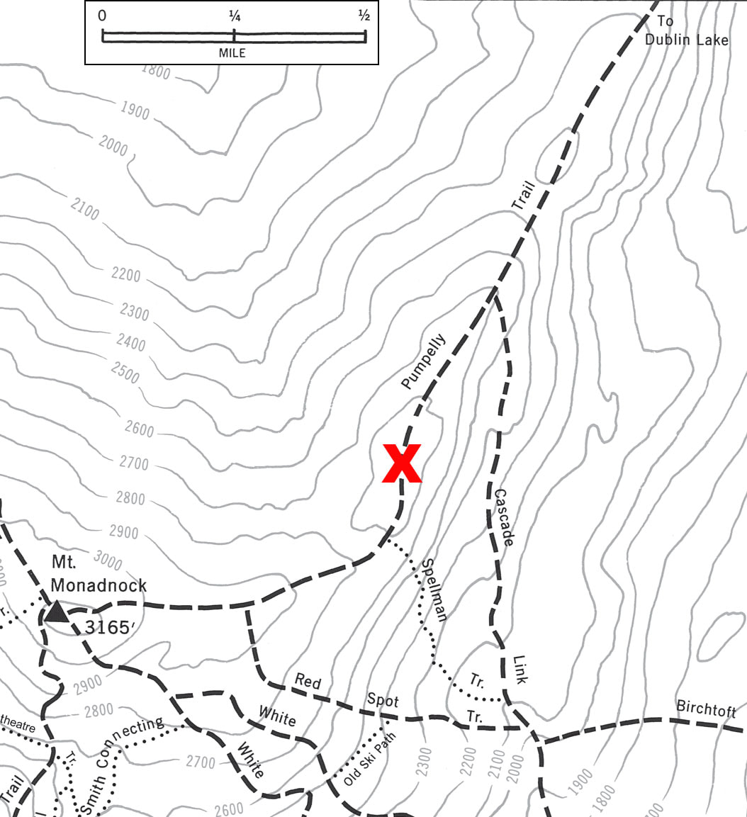 I'm pleased to report that the hike went very smoothly! It was easy to get in the hiking rhythm and just let the stress and anxiety wash away. The only problem I really had was with a particular section of the trail, which for all intents and purposes is a staircase that gets incredibly icy during the winter. No problems making it up, but I went ass over teakettle twice on the way down – once at the beginning of that section, and once just before the end. No harm done beyond a bruised elbow though, so no worries. 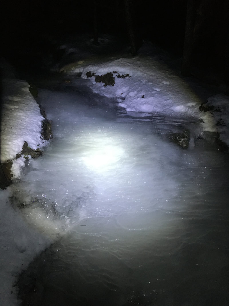 The "trail" at the staircase section. I made it home safely a bit after 2 AM and am dragging a bit this morning, but it was definitely worth the trip! I'm feeling much better this AM.
I'm hoping that continues today, but I'm meeting a guy today from Craigslist to sell some furniture. I'm anxious about meeting some rando from the internet, and really hope there's no dumbass-ery in the transaction! Been packing up and divesting myself of much of the crap I've accumulated over the last several years.
The goal has always been to consolidate our stuff again since the wifey and I moved into separate living situations way, way, WAY back in 2011. The time has now come to jettison the furniture and whatnot I've surrounded myself with. In order to trick my brain into accepting my living scenario I kept the apartment quite spartan. Doing so allowed for the separated living arrangements to feel temporary. Now, I reap the side benefit – only having a handful of things to resell or give away. In this move I'm also trying to downsize. I have a tendency to keep anything I could ever possibly desire to use again or anything with even a hint of sentimentality, so this is particularly hard! Going to be strong and toss the things I haven't looked at in 5+ years, I swear! No really, I have the catapult all ready to go. T-minus 55 days until arrival at Amicalola Falls and I embark on the trail.
I feel like I should do something to mark days on the trail, kinda like the 'Stardate' from Star Trek or 'Sol" from The Martian. Unfortunately, I'm not clever at naming things like those drosophila geneticists. All I can think of is going with R (for rotation), just to make really niche R0 joke. Though, with the novel coronavirus outbreak ongoing, perhaps more people will appreciate the joke... Anyway, much of the planning for the trip has been accomplished. Equipment has been purchased and tested. Travel to Amicalola Falls has been arranged. Assembling drop box resupplies is in process. So, now my attention is turning to cleaning my research plate off and downsizing my possessions. March seems so far away at the moment, tricking my mind into procrastinating at the any appearance of the depression demon. In spite of this, in the last week I managed to get this blog online. Given that much of the content has been very tough to assemble, I'll consider that a win. Here's to hoping that the extra push of writing about my preparations will help drive me onward and upward. |
About Me
Archives
July 2020
Categories |
 RSS Feed