|
T+13 (Mar. 31, 2020) Navigation Report: Starting point: Yellow Springs Camp (mile 1174) Destination: Clark's ferry Shelter (mile 1153.9) [Fallback option: Peters Mountain Shelter (mile 1160.6)] Travel Log: Depart camp (mile 1174) 9:00 Rattling Run Creek; filter water (mile 1171.3) 10:15-10:30 Cross PA-325 (mile 1167.3) 12:30 10 miles from Clark's Ferry shelter (mile 1164) 2:30 Whitetail Trail (mile 1162.1) 3:00 Peters Mountain Shelter (mile 1160.6) 3:30 Arrive at Clark's Ferry Shelter (mile 1153.9) 7:10 Daily mileage = 20.1 Total mileage = 142.1 Commander’s Report: I got a very early start this morning: I awoke at 4:45, but I didn't want to accept that I had to get up until 5:30. Spent a bit too long working on writing up yesterday's report, so I didn't start packing things up until a bit before 8:00. I had everything set around 8:45, said “bye" to @thesunfishduo, signed the Yellow Springs log book and was off. I've noticed that a typical morning on the trail for me is generally slow going as I adjust my pack, shoes, pants, etc. So it was today, with the added complication of weather that was chilly, but too warm for my light outer layer when the sun emerged. So that outer layer came off, went back on, came off... It really slows things down to have to go in your bag every half hour. On the plus side, the military was doing some training flights over the area. So, I got to watch what looked to be A-10 Warthogs flying really low in circles around me. A couple of times they flew almost overhead. Moments like that turn me into a little kid. Even though I'm not a huge fan of the military industrial complex that produces them, one has to admire the engineering and impressiveness of the machine as an object in and of itself - rather than an instrument of death. Around 10:15 I stopped at Rattling Run Creek to filter some water for the day. Perhaps a mile and a half after that I came upon a junction with the Horse-Shoe Trail, which is not in my guidebook. So, I decided to check out the trail register for a minute. Seems to be getting some use, but the entries are spaced days apart - kinda like the shelter log books. 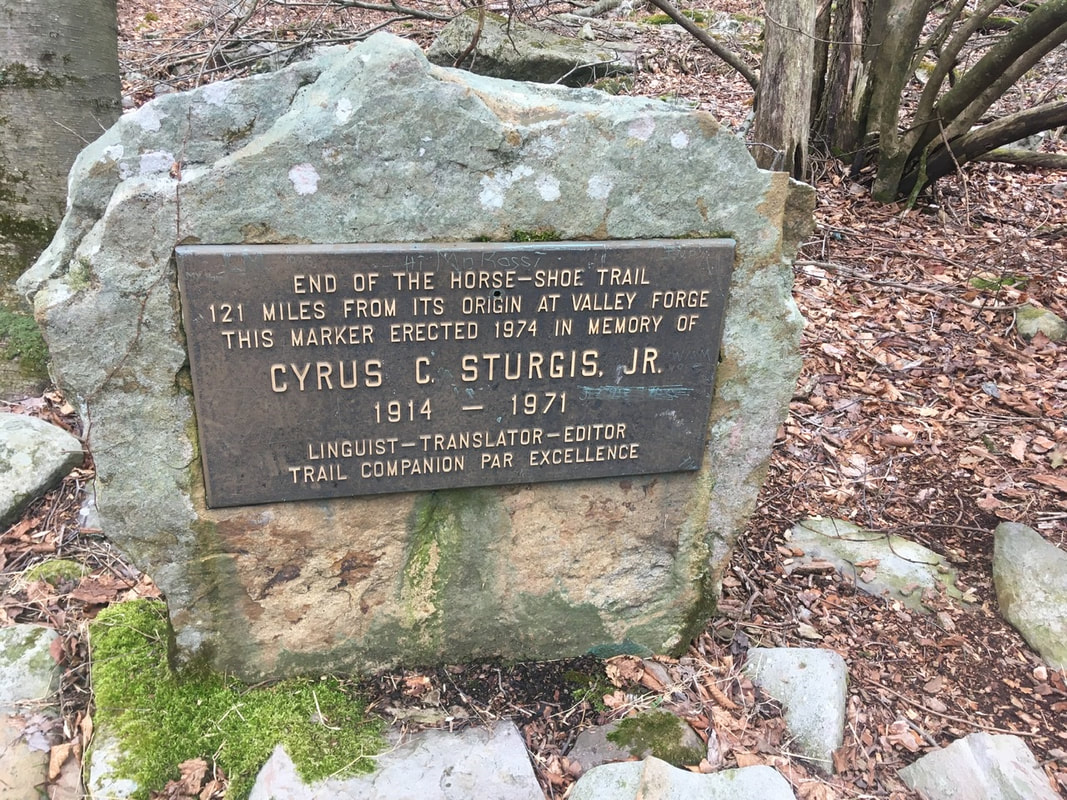 Marker at terminus of the Horse-Shoe Trail. In memory of Cyrus Sturgis, Jr. While I was checking that out, another hiker came up the trail northbound. Said his trail name is Yeti. Given his giant white beard, I'd say the name fits. He started last year in GA, but had to get off trail at Harper's Ferry. He's giving the remainder a go this year. Good on him, hope he’s able to make it to Maine! A ways down the trail I came across a spring running out of the mountain whose water was so loaded with iron that it costs everything it contacts with rust! I wonder if the mining operations I saw yesterday were going after iron. Coal seems likely too though. I'll have to look that up sometime. [Editing note: The Rausch Gap mines we’re going after coal, not iron.] 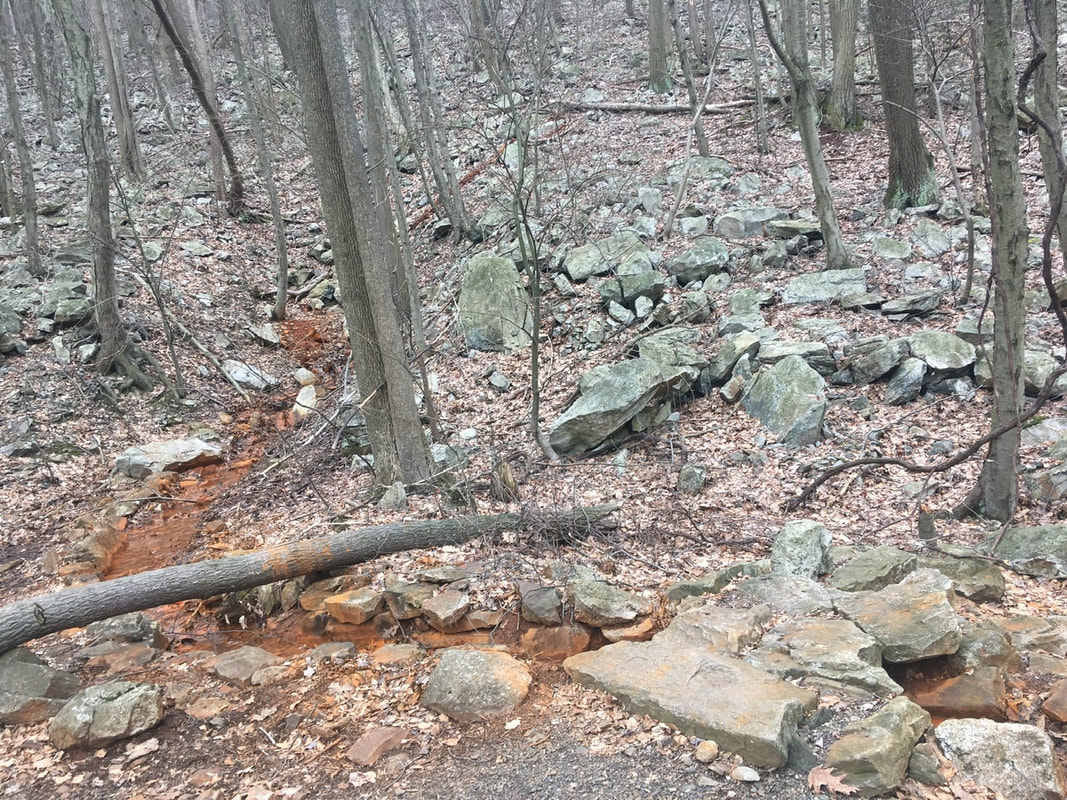 Iron spring Just a bit after PA-325 there's a stretch of land where all of the rocks are covered thick with moss. I've always enjoyed that aesthetic, and have been looking forward to the Smokies because much of the forest there is moss covered. The Smokies are a long way down the trail though! 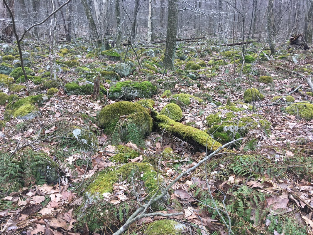 None of these are Rolling Stones, that’s for sure! Immediately after the short moss covered region of the trail is a nice little stream. I stopped here for a minute to take lunch. 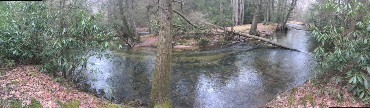 Wonderful little stream. If it were warmer I’d have probably bathed in it! Once back on the trail, I decided to make some phone calls to plan my resupply in Duncannon. First up: Kind of Outdoorsy. I heard from Ricky and Brian that this outfitter was still open and selling fuel canisters. Over the phone though the proprietor said that they were indeed closed, but provided options for procuring fuel canisters in the area. A couple calls later and I had arranged to meet someone in Boiling Springs to obtain two fuel canisters. Next up: lodging. I would like to spend the night in town to shower, dry equipment, and recharge batteries. For the fourth day in row, I was unable to reach the small hotel in town. I suppose they must be closed. I did get in touch with the Red Roof Inn (3.7 miles outside of town) and they're open. Unfortunately, they are not currently providing shuttle service to / from town. So, I guess that means I will be spending the night in Carlisle (18 miles further down) as the lodging options are much closer to the trail. That means I have to figure out a way to recharge batteries if I will be on trail an additional 2 days before I can get those fully charged. Supposedly Mutzabaugh's Market in Duncannon is hiker friendly and may allow me to charge my battery bank while I shop. It charges fully in 3.5 hours, so 30 minutes of charging will probably be enough to at least get my phone through until Carlisle. Around 2:30PM I checked Guthook (my GPS-based navigation App) to see my progress and discovered that I was only half way to Clark's Ferry Shelter. 10 miles down to miles to go. Back of the envelope calculation indicates an arrival at the shelter around 7PM. The old legs and feet are definitely getting tired though, which will definitely affect this calculation! At 3PM I passed the intersection with White Tail Trail, and around that time the weather rolled in. It wasn't forecast to rain today, so at first I believed it would just sprinkle for a bit and then pass me by. Unfortunately, that wasn't my luck. It sprinkled on and off for the next couple of hours. Nothing hard, just enough to soak everything through and be generally annoying. After the rain though, the cloud cover was lower than the elevation of the plateau / ridge - meaning another night sleeping in the clouds. It was also after the rain had set in that I got to the best view spots of the day. Unfortunately, it was quite overcast and drizzly when I captured the pictures. I guess it could have been worse: the ceiling could have dropped by then so all I could see is cloud!   At 3:30 PM, I FINALLY passed Peters Mountain Shelter, 6.7 miles left to Clark's Ferry Shelter. I lingered a while at the intersection leading to this shelter for a few minutes, both regretting my decision to go to the further shelter tonight and knowing that it’s the correct long-term decision. My feet are so sore, especially the right one. The injury sustained crossing the swollen Creek on T+10 has become a nagging source of pain. Every time I step on a rock or root such that the pressure is concentrated on the outside of my arch sends a shock of electricity through my leg and I have to stop and let the pain pass before continuing. I crossed Peters Mountain Road (mile 1157.7) around 5PM. It would have been a pretty dangerous crossing. in the past, but the local trail club installed a pedestrian bridge over the road. Much appreciated in my current exhausted state! For the rest of the 4.2 mile trip to the shelter my legs felt like they were made of overcooked spaghetti. I relied heavily on my hiking poles to keep me moving forward at any kind of reasonable pace. Also, my feet felt as if they had gotten caught under a steam roller (think Tom & Jerry style). Whenever I stopped for a breather it was really difficult to push past the pain to get back into a rhythm. The last mile or so felt as long as the first 19 combined! I was really cursing my decision to push this hard after less than two weeks on the trail! I was also cursing everything else, but it all stemmed from my decision to go 20 miles to the second shelter. Given the changes in resupply and sleeping plans I think it was the best option - in spite of the short-term pain. Just after 7PM I arrived at Clark's Ferry Shelter. It's an older one, definitely showing its age. It has a bunk bed set up on either side of the shelter and a ~10' square open area in the middle. First thing after arriving at the shelter: get my shoes off and give my tootsies a bit of a massage. In doing so, I discovered that the pain I was feeling on my pinky toe was the cause of a relatively large blister. I'll take care of that in the morning. Tonight’s for stuffing food in my tummy and getting some sleep!!  The big baby has another owie!
0 Comments
Leave a Reply. |
About Me
Archives
July 2020
Categories |
 RSS Feed