|
T+16 (June 14, 2020) Navigation Report: starting Point: Campsite @ 1305.9 Destination: Campsite @ 1312.7 Travel Log: Break Camp (mile 1305.9) 11:20 Yard's Creek (mile 1306.6) 11:45 Leave Yard's Creek 12:00 Kittatinny Ridge (mile 1307.7) 12:55 Catfish Fire Tower (mile 1308.9) 1:45 Millbrook-Blairstown Rd. (mile 1310) 2:20 * Rattlesnake Spring (mile 1309.5) 2:40 Leave spring 3:00 Arrive at beaver pond (mile 1310.3) 3:15 Depart beaver pond 3:25 Powerlines (mile 1310.6) 3:35 Campsite (mile 1312.7) 4:55 Daily Mileage: 6.8 Total Mileage: 164.1 Commander’s Report: I totally wasn't feeling it today. I initially woke up at sunrise because I had to go pee. After doing my business I figured I would go back to sleep until maybe 6:30. Instead I woke back up at nearly 9AM. The rest of the day went similarly slowly. I know it is because my brain is still down on the whole "not a thru-hike" thing, but my brain can go fuck itself. I'd like to enjoy what time I get on the trail, thank-you-very-much! After breaking camp, it was a short hike to Yard's Creek. I stopped briefly here to filter some water to carry me through the day. Tonight is again going to be spent at a camp without water, so I'll have to get water in the afternoon before arriving at camp. The first attraction of the day is Kittatinny Ridge. The first view was off to the northwest and was partially obstructed.  View northwest from Kittatinny Ridge The second viewpoint was spectacular! It featured rock formations arranged like stadium seats overlooking the views southeast. As a bonus, there was a tree providing this pasty assed white boy shade so I could enjoy the view - like a boss. 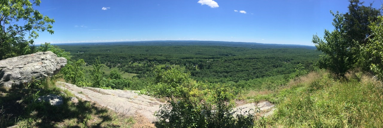 The trail follows the ridge for quite a way with intermittent views, but no spot as good as the amphitheater. 1.2 miles north I passed up an old fire tower. I would have taken some pictures, but there was a gaggle of teenagers climbing it. A bit over a mile north of the fire tower I crossed Millbrook-Blairstown Rd. As part of crossing this road one has to walk for a couple hundred yards on the side of the road-around a blind S turn. Not ideal! Less ideal is the fact that I forgot to get water for camp at the last (acceptable) water source. I made a mental note in the morning to stop at Rattlesnake spring, but when I arrived there and consulted the map I forgot that the next two water sources were, respectively, runoff from a swamp and runoff from a beaver pond. A big nope on both those fronts. So, I backtracked 0.6 miles (each way) to get water from the spring. Once I managed to get my shit together I continued on past Millbrook-Blairstown Rd for the second and final time. Shortly after the road is a HUGE beaver pond. It probably encompasses 10 acres of land and has not one, but two beaver huts in the middle. I was under the impression that a single family of beavers occupied a pond at a time. Perhaps one of the huts is an old, disused one.
After climbing up from the beaver pond the trail crosses some power lines, which provided a nice view.  Power lines always provide a good view Just a short bit after the power lines is a view point that provided an alternate angle of the cut in the forest made for the power lines. 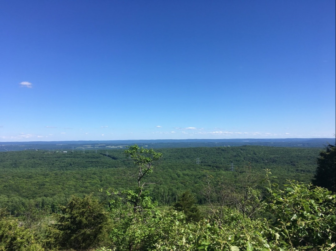 I don’t know about a river. Power lines run through this picture. Between the power lines and the campsite was a thicket of beautiful smelling flowers. I used the SEEK app and discovered that these are roses. It makes sense, given the thorns. However, I've never seen five petalled roses before. 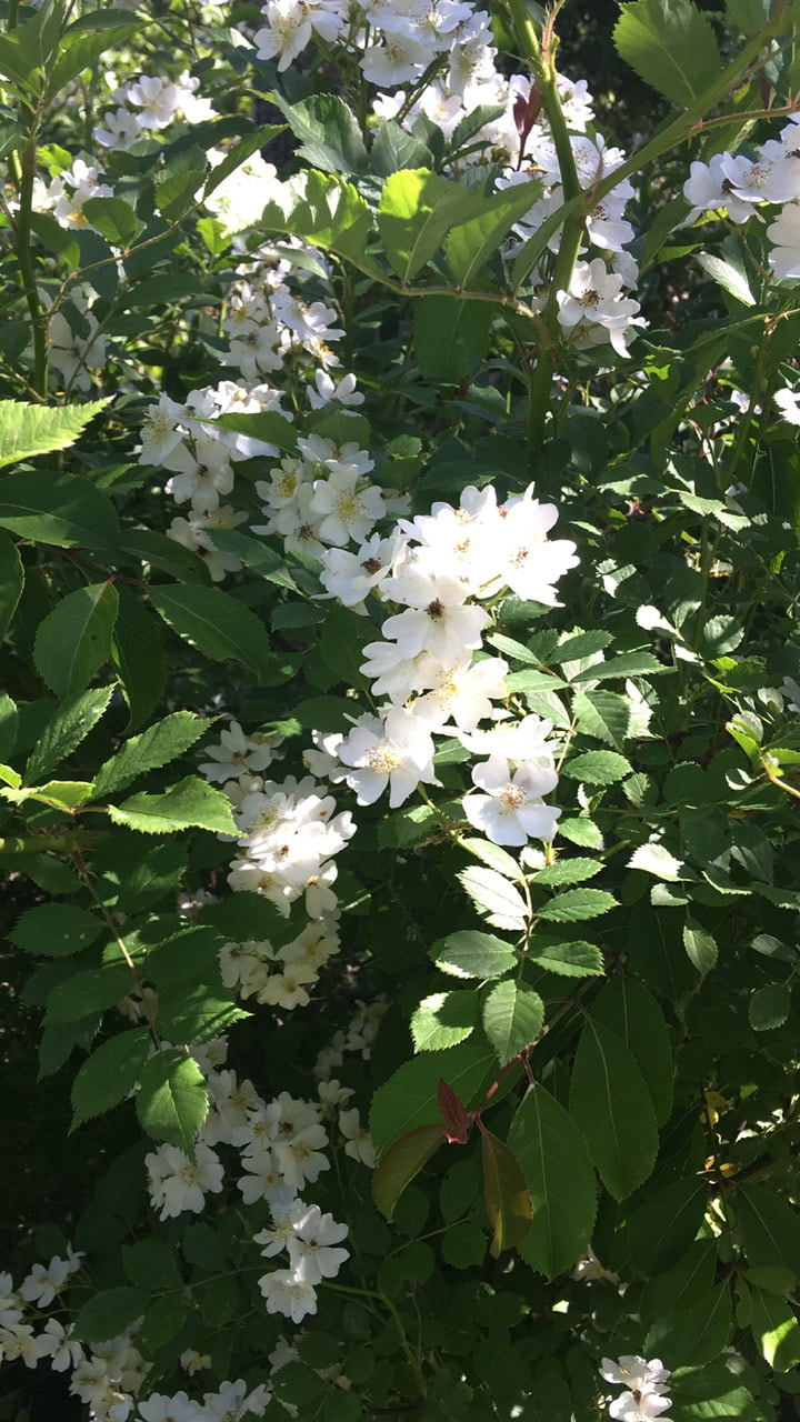 Wild roses From there, I continued down the trail to camp. It's not where I intended to make camp. The late start, combined with my slacking off (not writing up T+15, instead enjoying the fire and sunset) means that the extra 4.2 miles just isn't the cards tonight. On the plus side: the sunset view from my tent didn't suck one bit!  Just before sunset...from the comfort of my tent.
2 Comments
8/12/2020 08:18:55 am
Great article thanks for sharing this informative information Leave a Reply. |
About Me
Archives
July 2020
Categories |


 RSS Feed