|
T+22 (June 20, 2020) Navigation Report: Starting Point: Wawayanda Shelter (mile 1364.5) Destination: Wildcat Shelter (mile 1376.7) Travel Log: 10:00 Break Camp 10:10-10:20 State Park Headquarters (water) 11:10 Longhouse Drive (mile 1366.4) → Trail Magic from JERMS 12:35 Viewpoint (mile 1368.3) 12:50 NY/NS border (mile 1368.6) 1:10 Prospect Rock (mile 1369.0) 1:15 Rocky Outcrop (mile 1369.1) 2:20 Stairs (mile 1370.1) 2:25 Rocky outcry (mile 1370.2) 2:40 Rocky outcrop (mile 1370.5) 3:30 Viewpoint (mile 1372.2) 3:40 Village Vista (mile 1372.5) 4:30 Power lines (mile 1374.1) 5:00-6:30 Bell Vale Farm <ice cream> (mile 1374.6) 6:50 Eastern Pinnacles (mile 1375.9) 7:10 Cat Rocks (mile 1376.4) 7:25 Wildcat Shelter (mile 1376.7) Daily Mileage: 12.2 Total Mileage: 224.1 Commander's Report: I got a fairly early start to the day, although my goal was to leave the State Park Headquarters by 10AM, so I was 20 minutes late (as per usual). Immediately after leaving the State Park Headquarters, the trail crosses the outlet of Parker Lake. The lake made for some really pretty pictures. 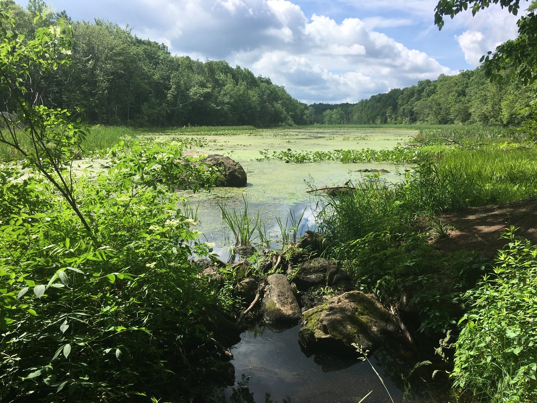 Parker Lake outlet At the crossing with Longhouse Drive I came across some trail magic left by JERMS. He left a bag of oranges for us (and others). Plus he left a NY bagel each for Cyborg and French Press (who he called Feet fingers, for whatever reason).  Tedward’s first Trail Magic If a few days ago the bloom of choice was wild roses, that's now changed. The Mountain Laurel are in bloom here/now. Their flower is shaped like an umbrella. Makes one wonder if the inventor of the umbrella stole the design from Mother Nature. The viewpoint at mile 1368.3 doesn't have the best views, but the hills in the background were quite evocative in person - even if they don’t look particularly impressive in the pictures. 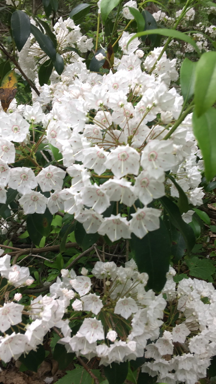 Mountain Laurel in bloom Shortly after that viewpoint the trail crosses the NY/NJ border. I guess I finally finished a whole state. 5 more to go 'til Katahdin.  Just 0.4 miles north of the NY/NS border is Prospect Rock. Only OK views, as the elevation around here is so low. 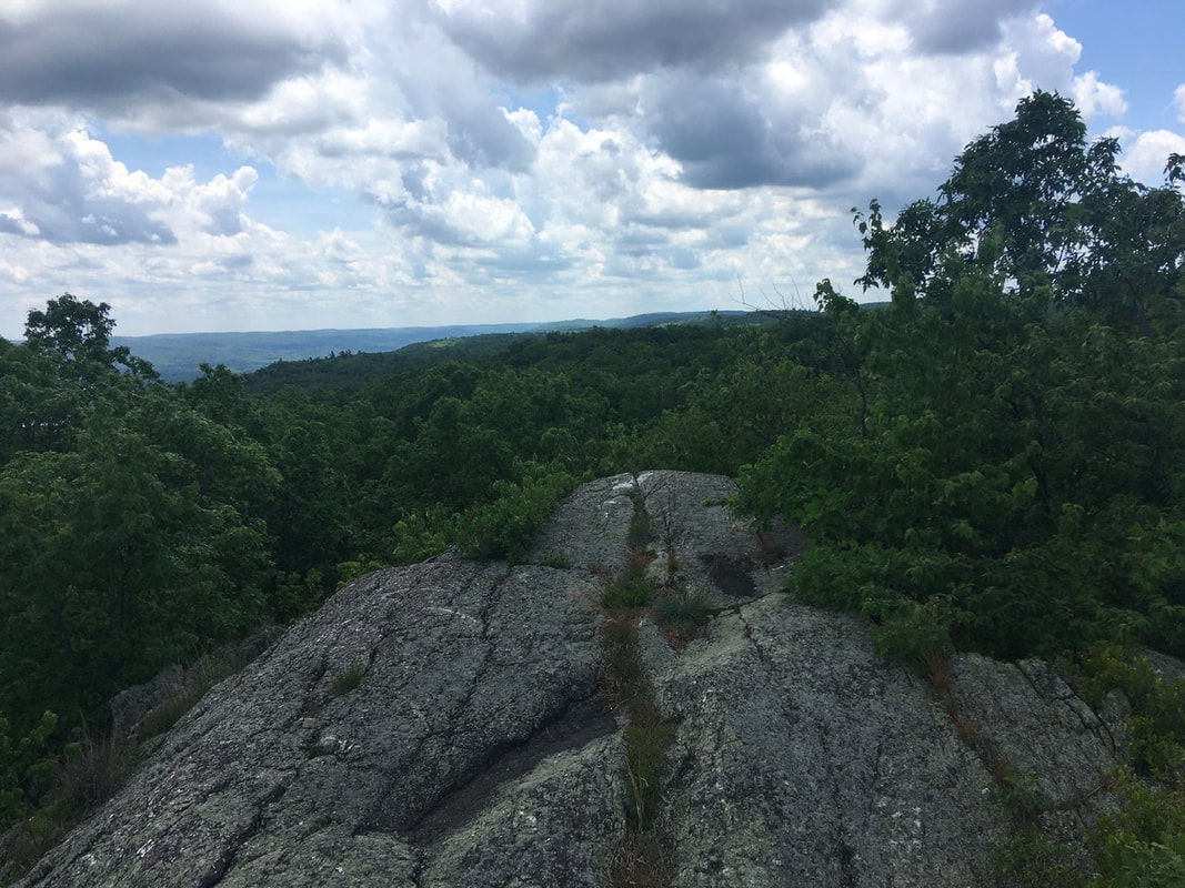 Prospect Rock From this vantage point, one can see Greenwood Lake, which the AT passes a bit further north. 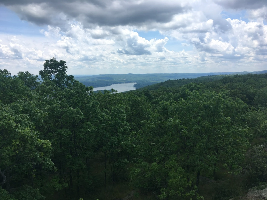 Greenwood Lake as viewed from Prospect Rock A bit further on North brings you to a rocky outcropping. For my money, this is the better view. I'm probably biased as I enjoy the view of lakes for mountain vistas. 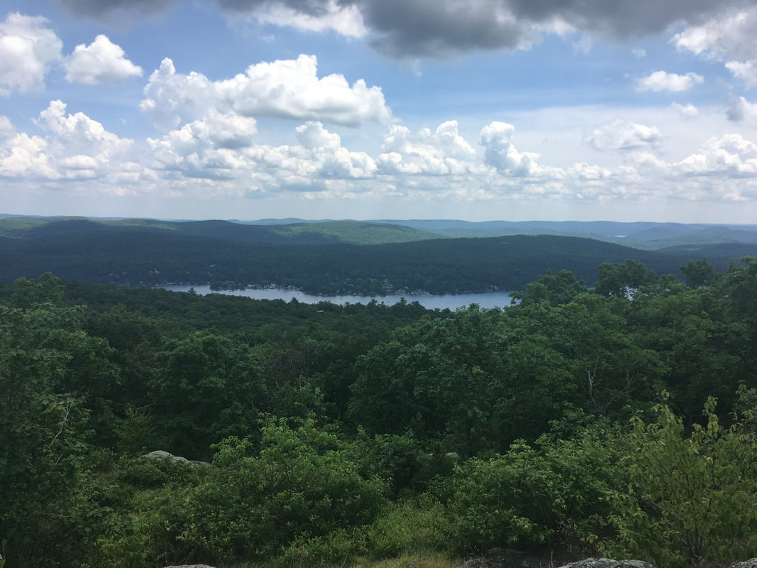 Greenwood Lake and community from on high Less than two miles into NY, and the goofiness of the AT in NYS becomes apparent. Yes, those are rebar "stairs" a fixed to a giant rock. Is there any real need to go over that particular point? Nope, the trail designers thought climbing over a huge rock would be a fun activity. So rock climbing here we come.  “Stairs” Some nice views from the first rocky outcropping after the stairs, again featuring Greenwood Lake.  South end of Greenwood Lake The views from the second outcropping aren't as spectacular, but its hard to complain about fields of trees.  Never ending sea of frees is all I see Five minutes after the second outcropping is a patch of mountain laurel, which (again) happened to be in bloom at the time of my passing.  Not as nice smelling as the roses, but every bit as pretty About a mile and a half after the mountain laurel, are two vantage points overlooking Greenwood Lake and Greenwood village. 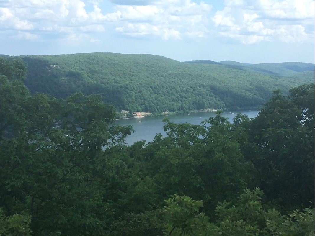 The trees mostly obscure any views of the village below however. 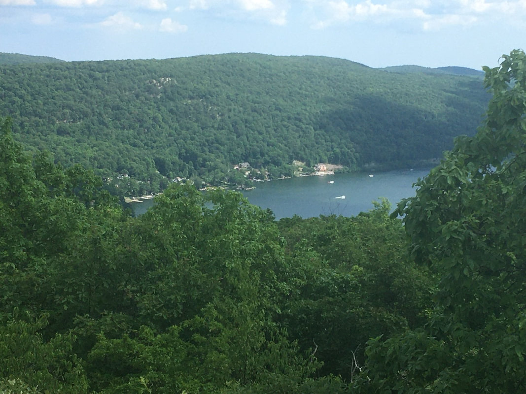 From there it was down the hill to the valley and the prospects of getting some ice cream. I rolled in to Bell Vale Farms ice cream stand just as Cyborg was preparing to leave and French Press was waiting in line. The line took about an hour, but the ice cream was definitely worth the wait! The late afternoon / early evening hiking was certainly challenging. Up over a high point, down again, and up to the shelter. This being NY, the trail is routed straight up, straight down, and straight up again. And if there's a point nearby 20' higher than where you currently are, the trail needs to go over that too. Unfortunately, I don't have any pictures from the jaunt over the Eastern Pinnacles as it was reining pretty good at that point. It was still raining by the time I reached Cat Rocks, but I had to get a picture of the double rainbows (well the Rainbows). That's a first for me! (Also, RIP double rainbow guy.)  It’s a double rainbow! I managed to tweak my left ankle coming down from Cat Rocks. Nothing serious, but makes the walking a bit more difficult. I’ll need to be taking care of it for the foreseeable future. In spite of their insistence that they were pushing on past Wildcat Shelter, I met Cyborg and French Press at the shelter. The rain and terrain forced their hands, so they made the prudent choice to stop short for the day. Later on, another thru-hiker, Aristotle, showed up. I much prefer tent sleeping vs. shelter sleeping so I threw up my tent right away. Aristotle did likewise. It wasn't long after dark that both Cyborg and French Press did the same. The mosquitoes drove them out of the shelter.
0 Comments
Leave a Reply. |
About Me
Archives
July 2020
Categories |
 RSS Feed