|
T+23 (June 21, 2020) Navigation Report: starting location: Wildcat shelter (mile 1376.7) Destination: Fingerboard Shelter (mile 1391.2) Travel Log: 10:30 Break Camp 11:10 Lakes Road / Trout Brook (mile 1378.3) 11:30 Fitzgerald Falls (mile 1378.5) 12:15 Mombasha View (mile 1379.8) 12:45 Mombasha High Point (mile 1380.5) 1:15 West Mombasha Rd. (mile 1381.7) 1:25-3:20 Accidental Detour (off trail) 3:45 View (mile 1382.6) 4:15 Buchanan Mountain (mile 1383.2) 4:40-5:00 Little Dam Lake inlet (mile 1383.7) 6:45 View (mile 1386.3) 7:10 I-87 (mile 1386.8) 8:05 Island Pond (mile 1388.2) Commander’s Report: As usual, I got a late start today. Pretty much every time I want to make minor tweaks it precipitates 30 minutes of futzing about with equipment. Today was no exception. First thing in the morning I traversed a VERY popular area of trail that took me past Fitzgerald Falls. There were a bunch of families and tons of little kids running around. So, I didn't dilly-daily to perfect my pictures. They'll have to suffice.  Fitzgerald Falls Immediately north of Fitzgerald Falls is a stairway leading up up and away.  Stairway to heaven? Owing to the terrain, many of the "views" are too obscured by foliage to be truly considered views in my book. Mombasha View almost made it into that category, but a bit of the surroundings can be seen. 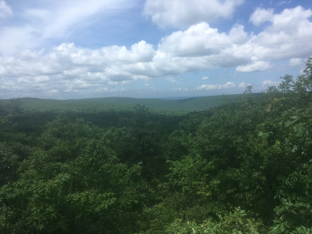 Trees, trees all around me The views for Mombasha High Point were... underwhelming. 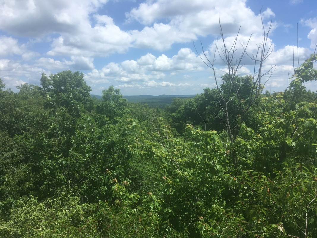 The horizon can barely be seen on the...horizon A bit over a mile north, and down from the mountain, the AT passes by Kloiber's Pond. Quite pretty, especially how the sky reflects off the surface.  Kloiber’s Pond At this point in time, I went for a bit of a detour. Between poor blazing and my inattentiveness, I ended up WAY off trail, like 1.5 miles off trail. You see, I thought I was walking around a lake further down the trail, not Mombasha, Lake. By the time I realized my mistake I decided that it was like 45 minutes back to the trail, so I decided to do the smart thing: jump in the lake, wash up a bit, and cool down. Almost worth the detour for that. (Almost...)  Mombasha Lake On the detour, I came across these amazing mushrooms. The SEEK app says they're Eastern Jack O' Lanterns.  Eastern Jack O’ Lanterns After Buchanan Mountain, the trail runs roughly along a ridge line and has a few points to look out over the landscape. Here's a few pictures.  
Late in the afternoon, the trail crosses I-87 by way of a local roadway's bridge. To me, this my entry into New England. I don't know why, but in my brain the interstate, not state lines, has always been the demarcation line. Perhaps that is because I-87 generally follows the Hudson River and thats a better geographic boundary to me than the nice straight line our founders settled upon. After I-87 I decided to pack it in at the first reasonable stealth camping spot. I picked a place in Harriman State Park. Just off the trail and close to Island Pond. I know it's not kosher, but not only was I not physically able to make the next shelter, it was closed due to problematic bear activity. Sorry for being "that guy"...
0 Comments
Leave a Reply. |
About Me
Archives
July 2020
Categories |


 RSS Feed