|
T+24 (June 22, 2020) Navigation Report: Start Point: Island Pond (mile 1388.2) Destination: West Mountain Shelter (mile 1399.9) Travel Log: 9:40 Break Camp (mile 1388.2) 10:20 Lemon Squeezer (mile 1389.0) 11:15 Fingerboard Shelter (mile 1391.2) 11:50 Water towers (mile 1392.2) 1:00-1:35 Stream <water> (mile 1394.4) 2:25 William Brien Shelter (mile 1396.5) 3:00 View (mile 1397.5) 3:20 Black Mountain (mile 1397.9) 4:00 Palisades Parkway (mile 1398.7) 4:30 View (mile 1399.8) 4:45 Ledges (mile 1399.9) 540 West Mountain Shelter (mile 1399.9) Daily Mileage = 11.7 Total Mileage = 245.7 Commander’s Report: Got up really early this AM in order to ensure that the tent was down before other people started arriving. I was still late to break camp this morning as I decided to take advantage of the pond to "do laundry". Washed my toe socks, bandanas, and shift I had been hiking in. I then strapped these wet items to the outside of my pack during the day to gave them the opportunity to dry. Once on the trail, the first thing of note came less than a mile north. It's listed as the "Lemon Squeezer". The planners directed the trail over a stead of large boulders just for fun. Here's a picture of what we're talking about  Huge ass boulders That giant ass boulder is one of the obstacles the AT traverses, the trail actually goes behind the boulder. (I got off trail to get the picture.) Here's what the trail looks like there. The rocks you see here are the same pictured above. Yes, the trail goes through that space.  Watch your head! Next up, a narrow angled passageway created when a large chunk of mountain broke off. I took the pack off, held it in front of me and walked sideways through with my stomach toward the left. Easy peasy, lemon Squeezy. (I'll be here all week.)  Reminds me of the discombobulated house at the fair Here's a view of the passageway from above. My bag is included for reference. It's a bit less than 3 feet tall.  The giant gash from above The next obstacle is a mini version of the previous passage. No problem Drill Sargent!  Looks like other areas of the AT in NY, NBD! Last up: this. whatever this is. It's about 8 feet tall (my poles are reference and should be 117.5cm tall - you do the conversion) and flatter on the face than it looks in the picture. I attacked it to the extreme right. Made it up first try, though I was worried about my choice so practiced once without my pack.  This rock climbing or hiking? I forgot... Unfortunately, I snagged the mesh front pouch of my pack on the rocks when going through the first passageway, so now there's 3 holes in the mesh. Oh well, guess I’ll have to research how to repair this.  I guess the pack is officially broken in now... A bit over a half mile further north the AT crosses the New York Long Path. I need to do some research about this one. It currently goes from NYC to Albany, but I've read that it is supposed to be linked into the Adirondack trail system somehow at some nebulous point in the future. Never heard of it before seeing the sign.  NY Long Path North  NY Long Path South About a half mile before Fingerboard Shelter the trail passes these two picturesque scenes. The first is a wonderfully grassy cree in the woods. The second is another stand of mountain laurel in bloom. Maybe you're getting sick of the laurel by now? I'm not yet, so you're just gonna have to deal with it.  All your grass are belong to us  FFS, enough of the mountain laurel! I never did go the couple tenths of a mile to check out Fingerboard shelter, but here's the sign. The "problem bear activity" consisted of a bear opening up a tent, with person inside, to get at some food. I'm of the following opinion: if you store food in your tent in bear country, it is you who are the problem, not the bear.  Beware of bears on the Fingerboard The noon time and early afternoon hiking was uneventful and devoid of any pictures. It wasn't until I was headed up Black Mountain that there was any real photo ops. Here's the view of Silver Mine Lake from the viewpoint at mile 1397.5. 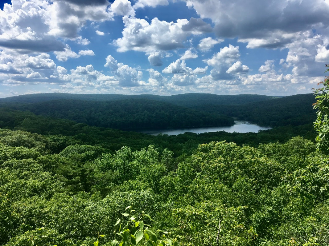 Silver Mine Lake I took a few pictures from the top of Black Mountain. Here's a panorama. 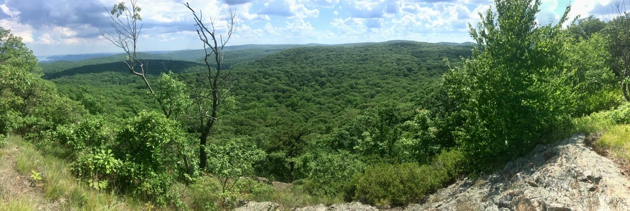 The view from Black Mountain Off to the left of that panorama you may be able to spot a tiny sliver of blue. That's the Hudson River. I got a picture of that alone at the highest magnification my poor phone could do. 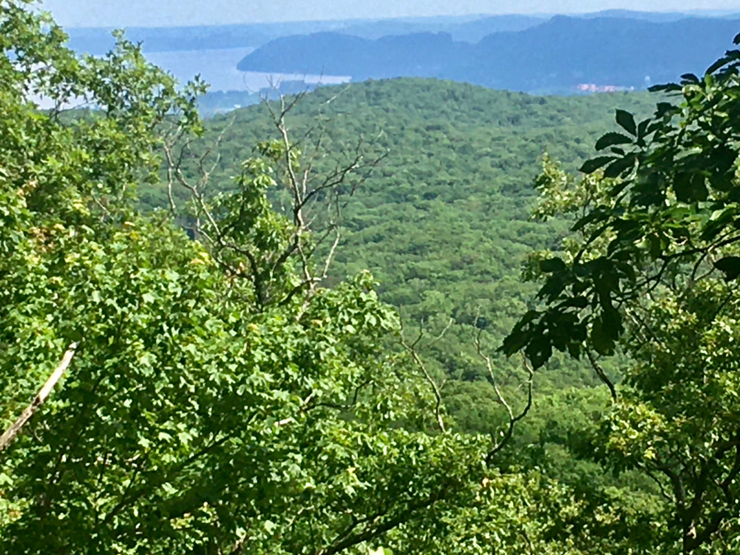 First views of the Hudson Finally, here's the obligatory sea of trees picture. 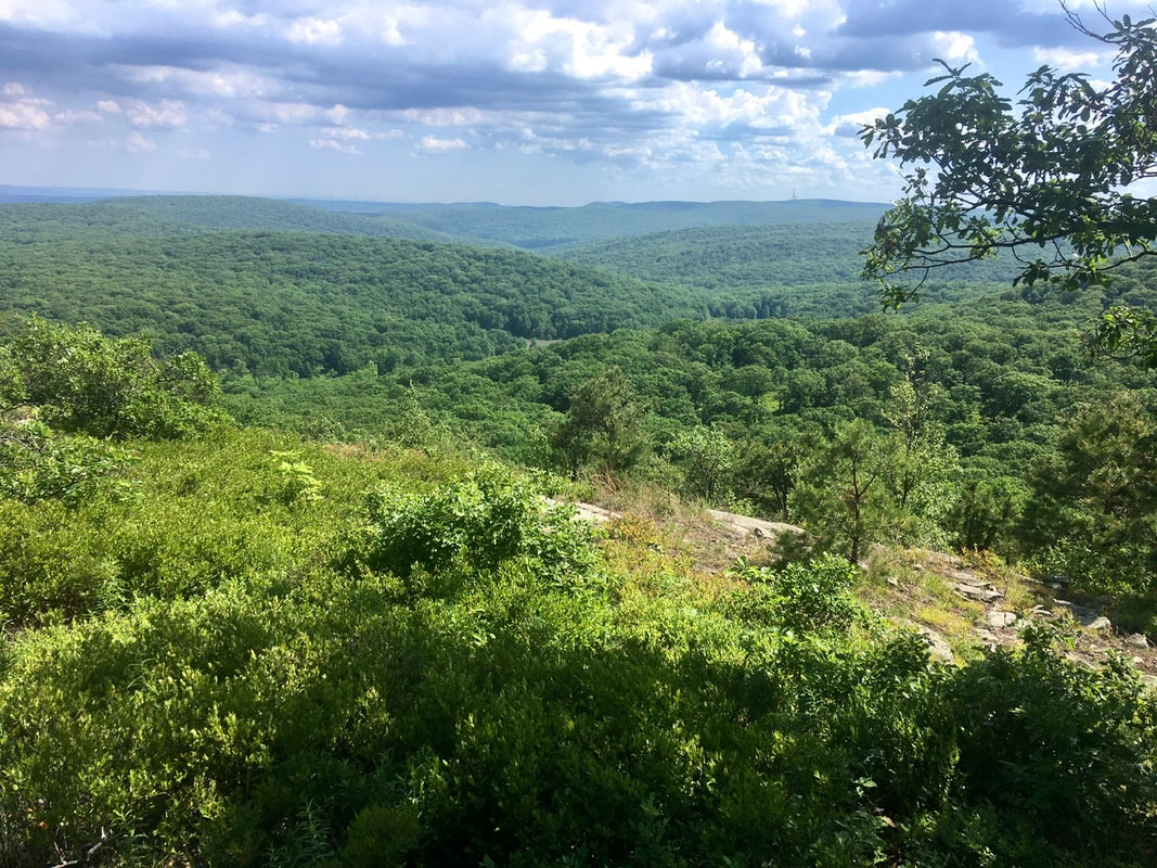 It’s a sea of trees! From the top of Black Mountain, it is a steep descent to the valley below. In the valley is the Palisades Parkway... and the trail straight up crosses it - Frogger style. Seems dangerous to me, but I had no problems getting across. After automobile dodging, the trail makes a steep ascent up to the top of West Mountain. On top of this mountain is a number of vistas and outlooks. I'll just dump a mass of pics here. That last one included a portion of the Hudson River. 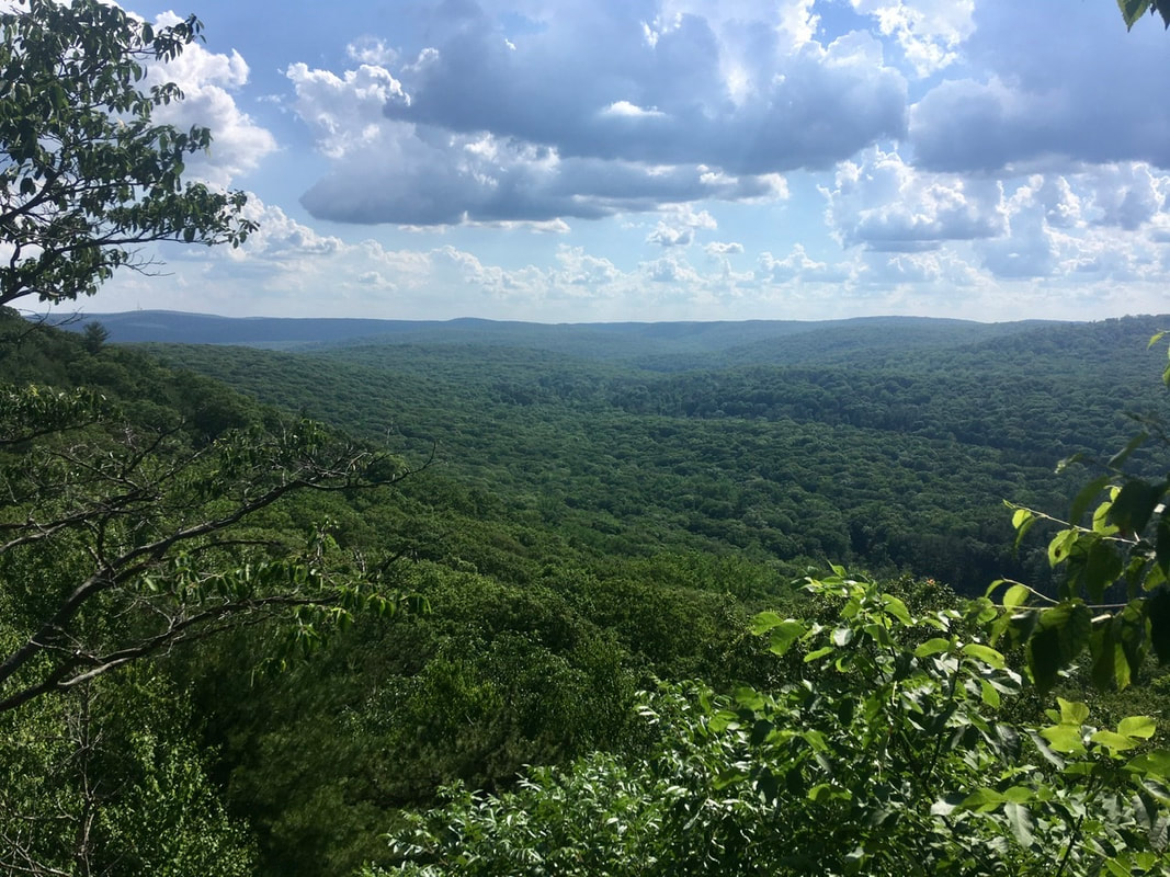 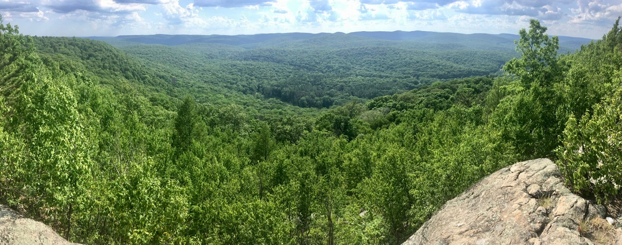 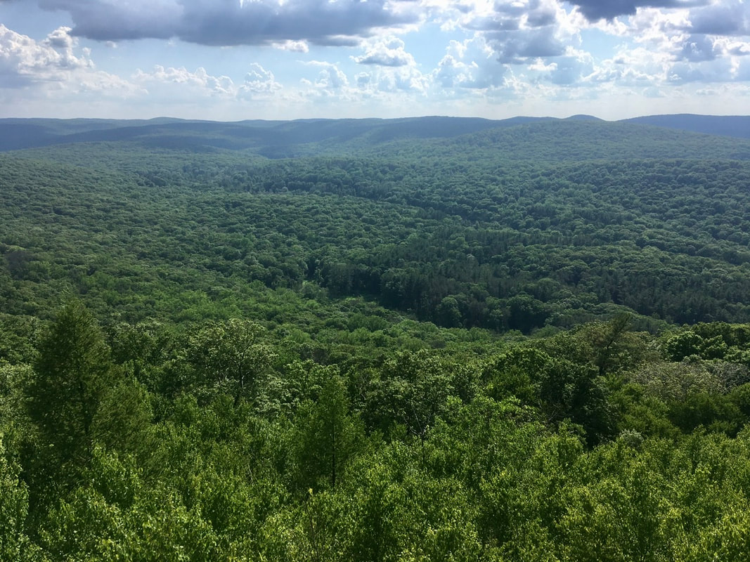 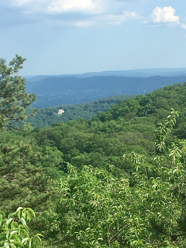 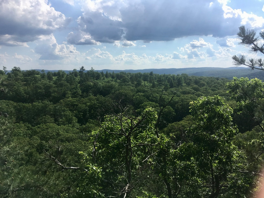 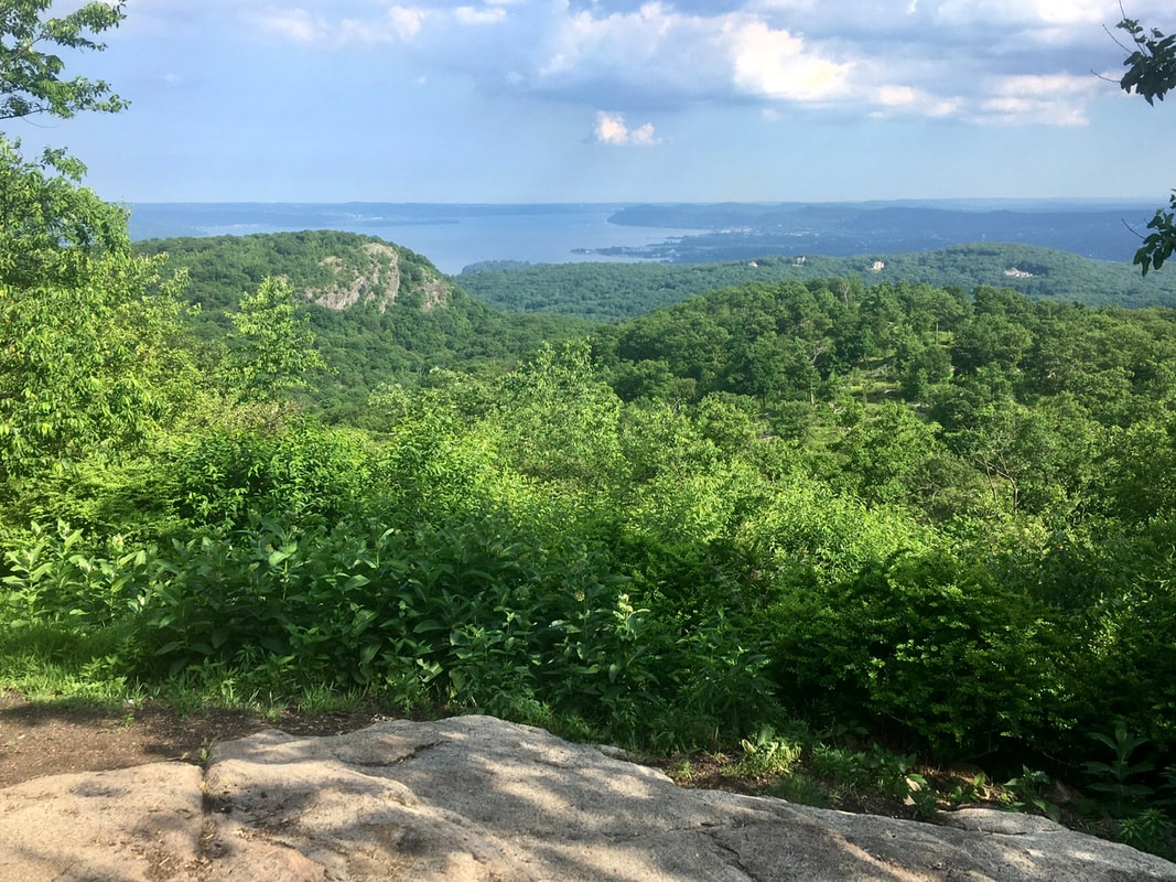 This one is not as nice technically, but if you squint and imagine you can make out the NYC skyline. It was visible by eye, but not well captured by camera. Oh well. 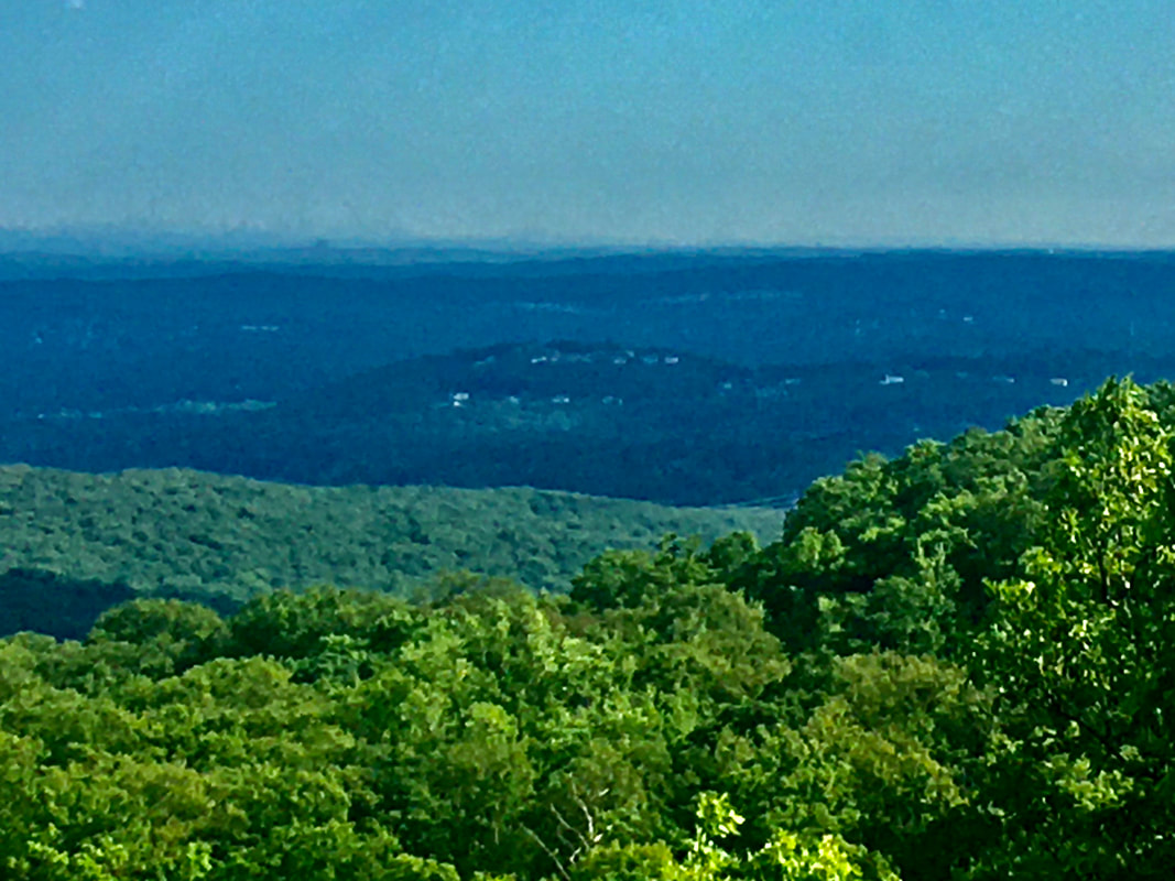 “View” of the NYC skyline from West Mountain [ed. note: I much preferred West Mountain to Bear Mountain. The crowds on Bear Mountain were amazing to behold.] The West Mountain Shelter is a 0.75 mile hike from the AT (and some of the pictures above come from that walk). The mountaintop is oddly arid for this part of the world, so by the time I made shelter I was parched. Here's the kicker about this shelter: the water source is half way down the mountain. Took an hour round trip to gather water. Still worth it in my book. I loved the location.
0 Comments
Leave a Reply. |
About Me
Archives
July 2020
Categories |
 RSS Feed