|
T+28 (June 26, 2020) Navigation Report: Start point: Stealth campsite @ stream (mile 1417.3) Destination: Shenandoah tent site (mile 1430.6) Travel Log: 11:15 Break Camp (mile 1417.3) 11:20 Canopus hill road (mile 1417.4) 11:20 Inoculation station (mile 1417.4) 11:30 First in series of walls (mile 1417.8) 11:55 South Highland road (mile 1418.4) 12:45 Small Stream [dry] (mile 1420.4) 1:05 Denny town Road (mile 1421.1) 1:50 Sunken Mine road (mile 1422.7) 1:55-2:15 Canopus creek (mile 1423.5) → refill water 3:10 Mining road (mile 1424.2) 3:30 NY route 301 (mile 1424.8) 4:30 Canopus Lake beech (mile 1426.8) → refill water 5:10 View point (mile 1427.1) 5:15 View point (mile 1427.2) 6:00 Shenandoah Mountain (mile 1428.8) 6:50 Shenandoah tent site (mile 1430.6) Daily mileage = 13.3 Total mileage = 276.3 Commander's Report: As usual, I got a late start in the morning. I didn't get on the trail until 11:15. Such delays don't bode well for the prospects of making the 13+ miles I plan on accomplishing. In my defense, I made good progress in uploading blog posts. The internet was solid here, so I took advantage of it! Once on the trail, I almost immediately came across the ruins of a barn that George Washington used as a place of smallpox vaccination during the Revolutionary War. It's amazing to me that vaccines have been around since before the founding of our fine nation and yet a large portion of the population are antivax. I just fail to comprehend this.  Plaque commemorating the barn and it’s function The foundations of the barn are quite modest in size and sort of built into the hill.  The ruined foundations of George Washington’s inoculation barn Just a bit north of that, the trail crosses a rather substantial wall. It's about 4 feet both wide and tall. This is much larger than a typical field boundary. I wonder if it was a defensive fortification from either the Revolutionary War or the War of 1812. 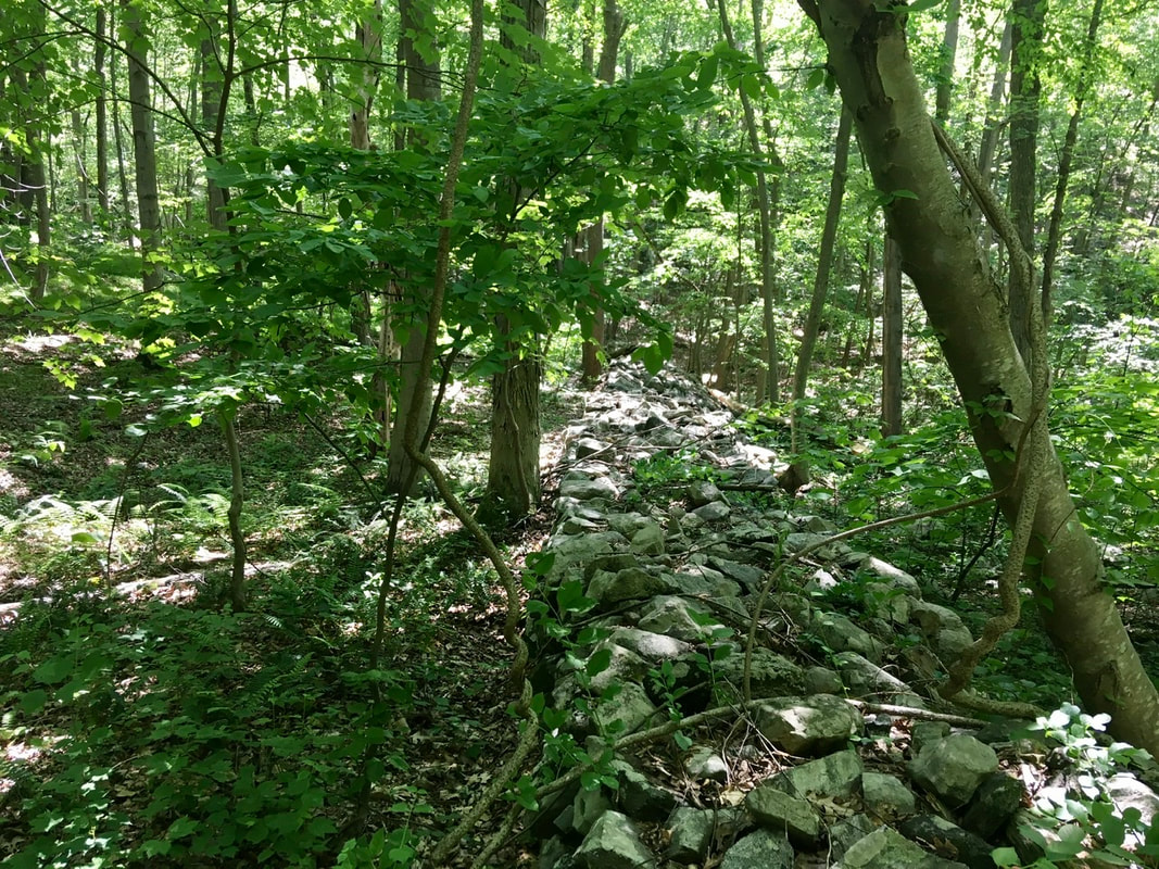 Defensive fortifications(?) If one pays close attention to the profile of the wall, it looks like there was a modest structure there first that was later added to in order to produce the final, impressive, results.  It’s wall-ception. A tenth of a mile, or so, north of this wall is another series of walls. This time, the walls run parallel with one another and there’s a passage between the two, which the trail runs through. If these were defensive fortifications, such a design would funnel attackers to this narrow point where they could be more easily dispatched. They could also be field boundaries too though, as this would also be helpful for herding cows, sheep, goats, etc.  Herding walls. For defense, or animals? About a mile north of the walls, the trail passes a huge boulder with a flat top. In my youth I would have climbed this to have lunch on top of it. Not today!  This must be a military boulder. Why? Because it has a flattop! Where the AT crosses Sunken Mine Road is the ruined foundations of some building. They are pretty difficult to make out due to the shading. Trust me, it exists - even if I can't photograph it well. 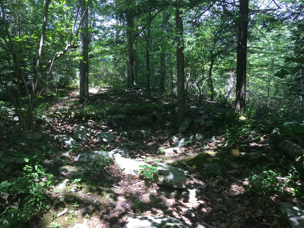 Ruins of some building Around 3 in the afternoon I arrived at the part of the AT that follows an old mine road. It's quite long and consists of a base of stone about 5 foot high in places and around 6 feet wide. It runs for a pretty good distance too (nearly all the way to NY RT 301).  An old mining road re-used for the AT. Made for quick travel! After Route 301, the trail makes more aggressive attacks on the hills. In order to control the resulting erosion, stairs have been built. Here's a couple of examples. There were a lot of stairs in this little area!  Holy rocky stairs, Batman! I don’t see any holes, Robin.  The stairs seem to go on into infinity, but I assure you there’s a finite number of them. (I didn’t count them though.) At 4:30 PM, I stopped by Canopus lake to refill my water bottles. This is the last water source before the campsite and there may or may not be water available there. (No longer has well. May have bottled water, if resupplied recently) After filling up the water bladder from the pond, the branch I was supporting myself on broke. I ended up taking a face-first dive into the pond. Thus, I spent about 20 minutes cleaning myself of the smelly mud. All the time I had an audience of hundreds of beach goers across the pond. Annoying and humiliating? A very Tedward moment. [ed. note: My boots are soaked the next morning. I'm not looking forward to putting them on!] After the impromptu smelly bath, the trail goes up to the top of a ridge. It follows this ridge for about 2 miles - until past Shenandoah Mountain. There are some nice views from the ridge way. The first views are of the pond I fell into. 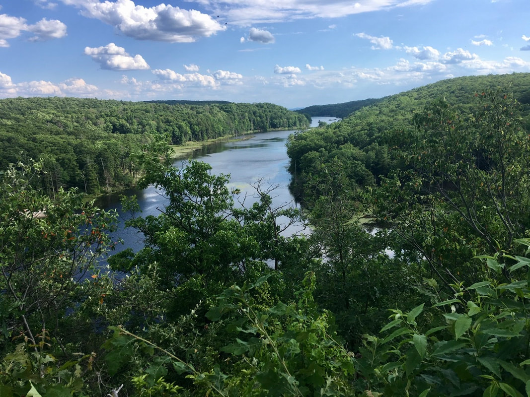 The pond that swallowed me whole Also, the beach is kind of visible, but not the part with all the people.  Canopus Pond beach, with most of the people hidden behind trees. Shortly after that viewpoint is another with a view of the sea of trees. 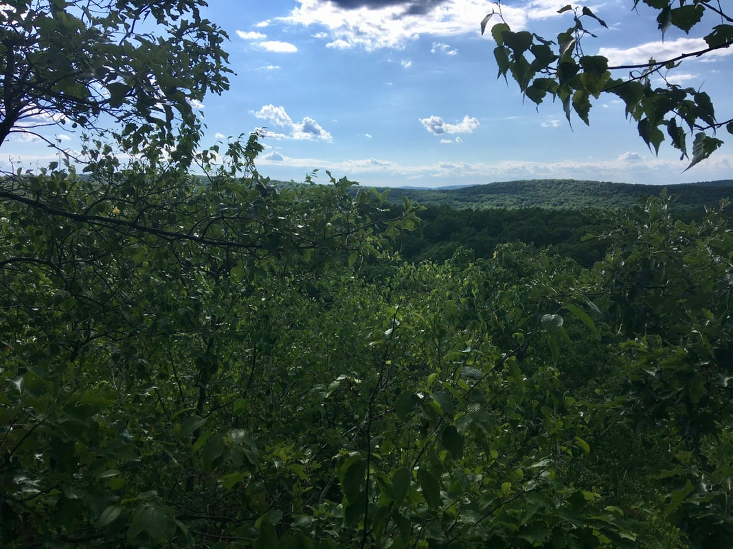 Peeking through the trees to see a sea - of trees The best views come from the top of Shenandoah Mountain. I'll just post a couple of those pics here. 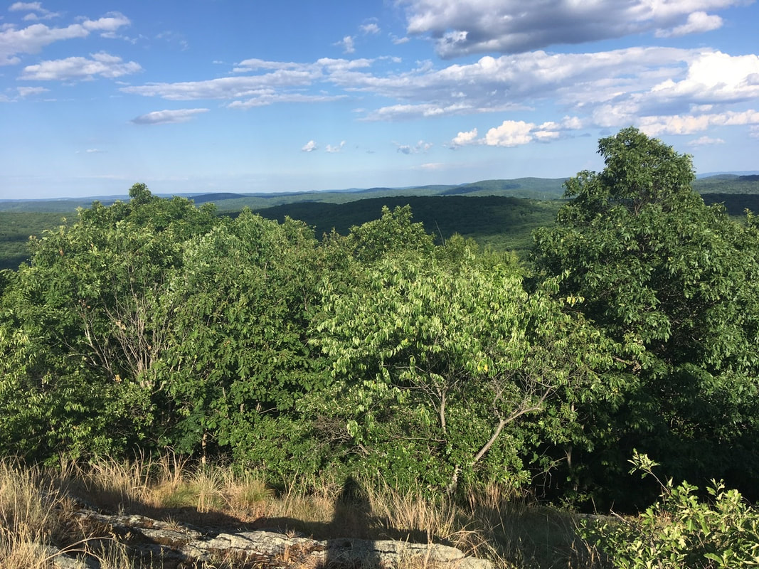  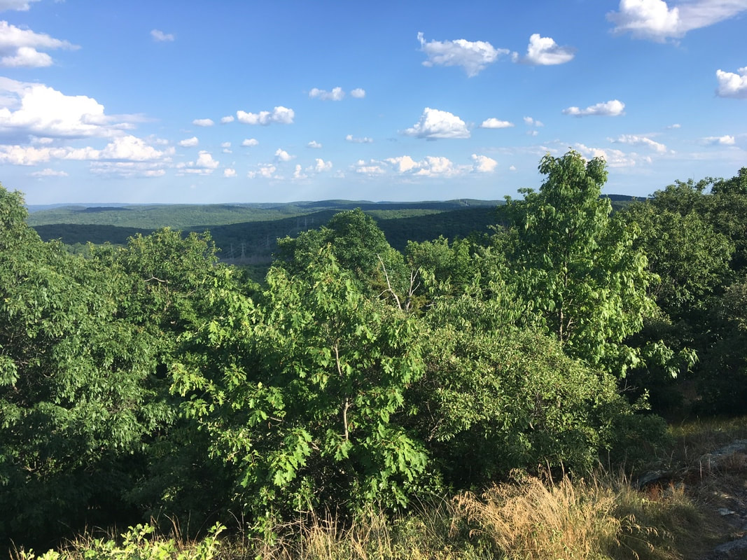 The campsite is quite spacious and includes several chairs, a picnic table, and two fire pits. 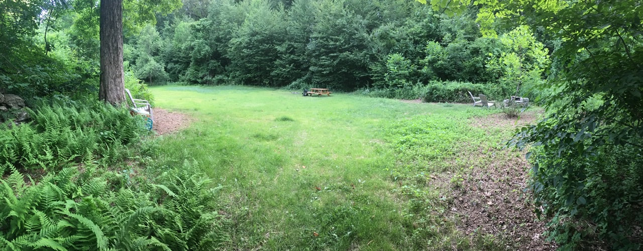 Shenandoah tent site One of the fire pits is very professionally built and has the chairs arranged as if it were a TV.  I’d like one of these in my back yard! The water had almost certainly been restocked yesterday or today. The cooler is half full of (commercial) bottled water and there's two large jugs of tap water to put out fires in the fire pits.  It’s the little things - like water - that make or break a day. This day was made whole by this water cache! As a bonus, the place is empty. Amenities plus solitude? Sign me the hell up!
0 Comments
Leave a Reply. |
About Me
Archives
July 2020
Categories |
 RSS Feed