|
T+31 (June 29, 2020) Navigation Report: Start point: Telephone Pioneers Shelter (mile 1448.6) Destination: 10 Mile Shelter (mile 1461.4) Travel Log: 11:00 Break Camp (mile 1448.6) 11:50 View (mile 1449.7) 12:30 Pastures (mile 1450.1) 12:45 Met owner of field @ mile 1452.0 2:30 NY Route 22 (mile 1454.7) 2:45 Break (mile 1455.2) 3:30 Leather Hill Rd. (mile 1457.0) 3:45 Wiley Shelter (mile 1457.4) 6:30 Ten Mile Shelter (mile 1461.4) Daily Mileage = 12.8 Total Mileage = 307.1 Commander’s Report: Broke camp late again today. This time it was because I stayed to chat with my campsite mates from last night, Melissa and Dmitry. They are college friends reconnecting on the trail after not having seen each other for quite a while. They were also a Hoot! Had a great time chatting with them and hope they both follow through with their threats to get back out on the trail this year! The "morning's" hike brings me down off the mountain and into a valley where the AT cuts around and through farmers' fields. It made for some fantastic pictures, but I'm biased. I've always loved the contrast of a worked field to the woods surrounding it. Here's a sampling from the first pastures that the AT took me through.    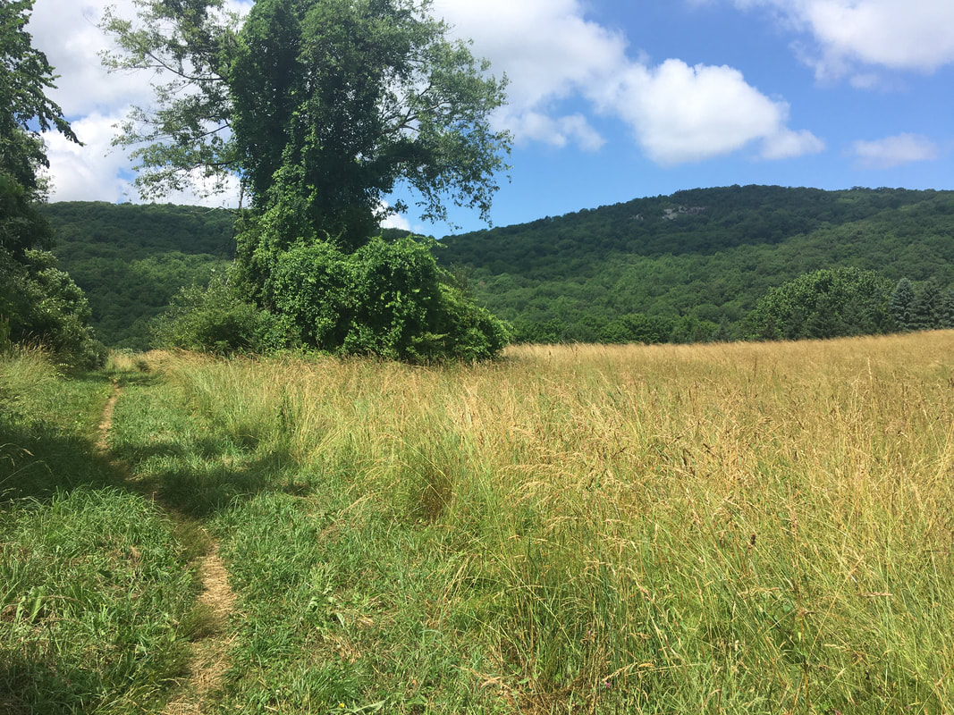 After the pastures, the trail traverses some marshy ground - cutting through a stand of reeds. Be careful, those things can leave paper cut type wounds, yes even in that little crevice where your nose meets your lip / cheek. (This is the voice of experience. I don't recommend trying this "at home”.)  Beware the revenge of the reeds! I really loved the area around mile 1449.7. The trail follows a narrow corridor in between scrub land, with views of the hills / mountains in the background. Fantastic!    Around 12:30 I walked through what the guide calls "pastures" but is really overgrown marginal wetlands. The trail consists of an elevated walkway for large portions of this section. 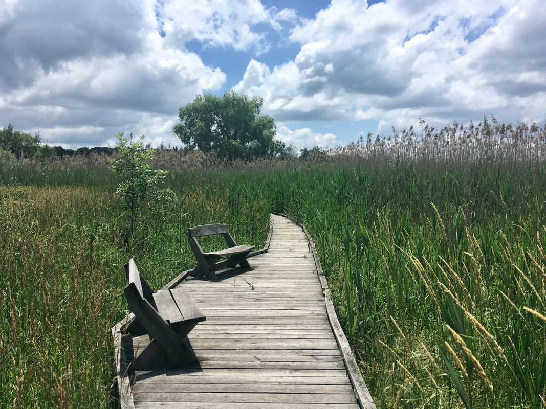 I really liked these Adirondack style chairs, clearly labeled to indicate to hikers which way they are headed. 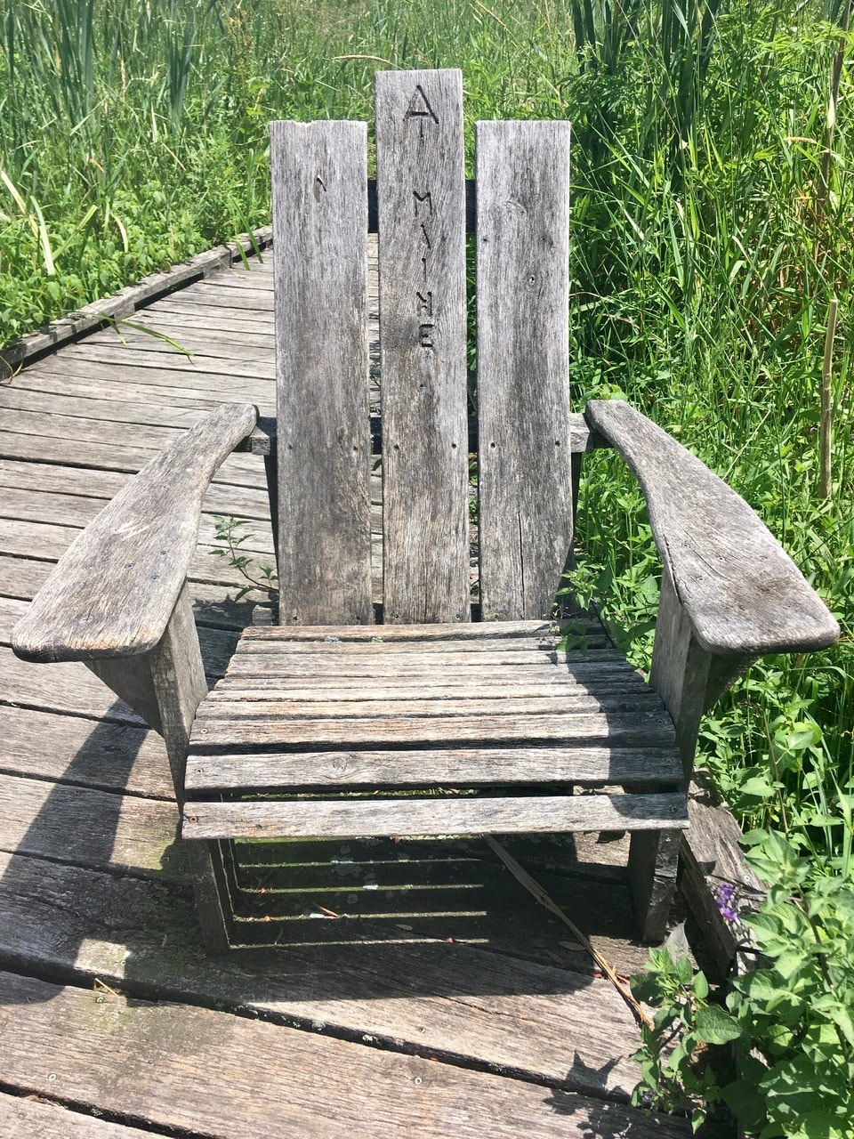 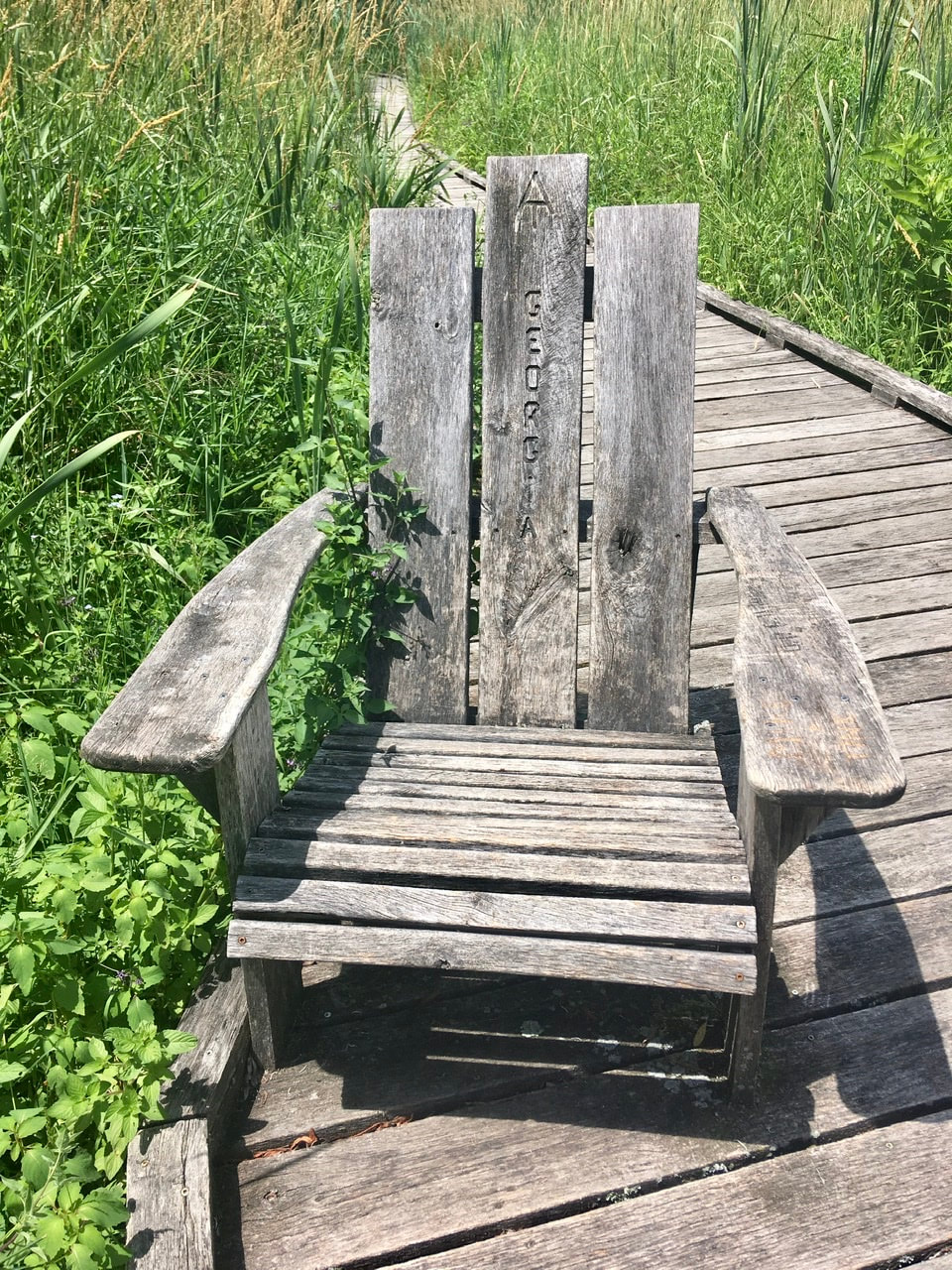 Just after these "pastures" is the Appalachian Trail MTA stop. I fear I will have to walk all the way back from Maine to here in order to get back to Long Island.  About a mile north, the trail crosses Hurds Corner Road and enters into actively farmed land. As I was crossing the road I noticed a farmer driving a tractor in my direction. I waited to enter the field until he passed. On his way by, he indicated that it was his lands I was about to traverse. I hollered "thank you" but don't know if he could make it out over the ruckus of the tractor. There were some really nice views from this farmer's fields. Plus, he has an old school water "tower" on the highest point of the land, which I feel enhances the aesthetic appeal greatly.    Old MacDonald’s barn in the background    In one of his fields I caught two silver-spotted skippers... erm... conjugating. I'd never seen that type of butterfly before. Considering the silver spot on the wings is so eye catching I'd venture the guess that they aren't so numerous where I grew up. 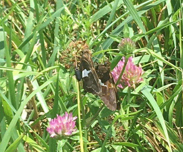 Most of the rest of the day's hike was largely without landmarks. With one small exception: So long NY, hello CT!  I’ve been in New England since I crossed the Hudson, but now it’s official Also, about a mile south of Ten Mile Shelter is Ten Mile Hill. It has a micro view, but I figured I would share.  I arrived at the Ten Mile campsite around 6:30. Before setting up my tent, I checked the two rivers surrounding me and the campsite (Ten Mile River and the Housatonic River). To my surprise I found a family of what I believe to be Common Merganser chilling on a rock. My presence disturbed them, so mommy departed with babies in tow. Wish the pic was higher resolution, but they just didn’t want to come pose for pictures. 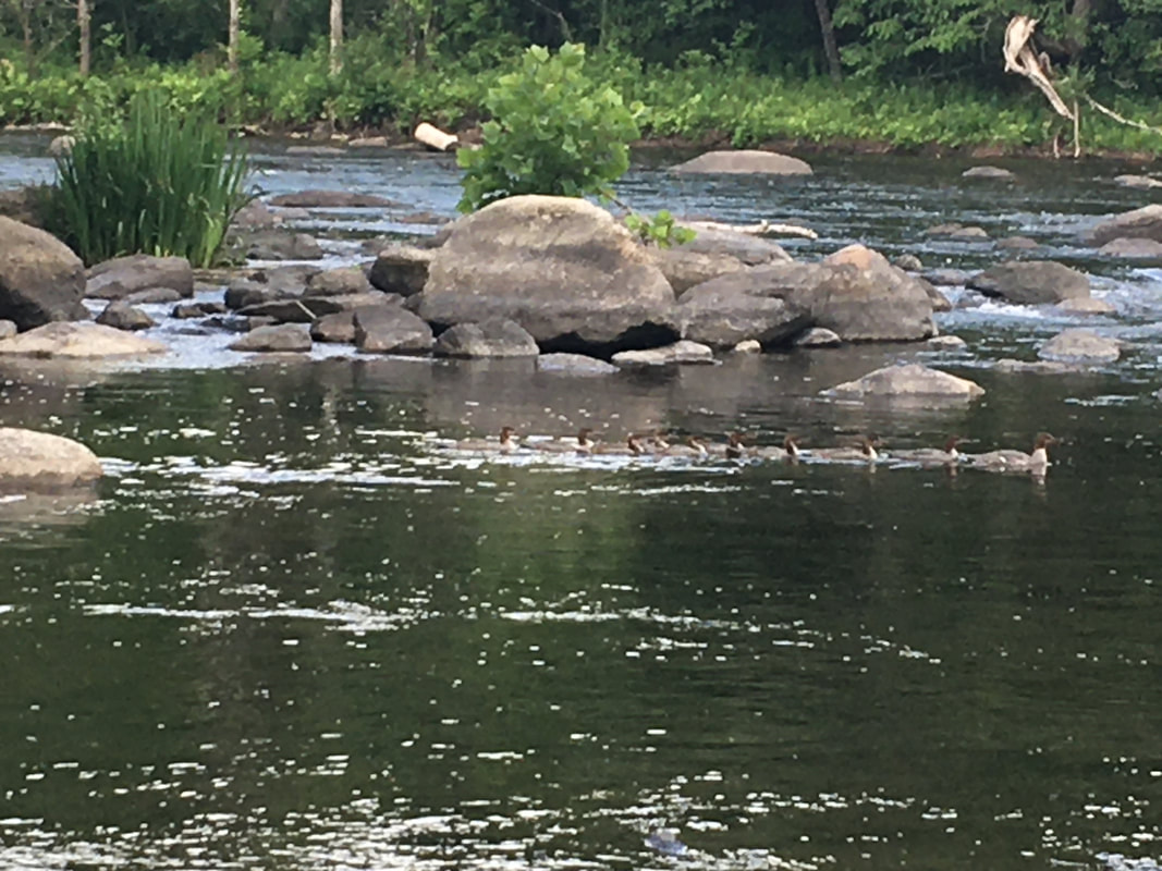 Common Merganser? When I went out put the food in the bear box I was absolutely overwhelmed by the number of fireflies surrounding me! No lie I stood in an opening between the camping area and the privy for about an hour watching them. It was a really amazing experience!
0 Comments
Leave a Reply. |
About Me
Archives
July 2020
Categories |
 RSS Feed