|
T+38 (July 6, 2020) Navigation Report: Start Point: Sage's Ravine Campground (mile 1509.2) Target Destination: Stealth camp after US Rt 7 (mile 1523.8) Travel Log: 7:20 Break Camp 7:45 Posted CT / MA border (mile 1509.9) 8:10 Laurel Ridge Campsite (mile 1510.9) 8:20 Mini view point (mile 1511.2) 8:50 Mt. Race Ledges (mile 1512.2) 9:30 Mt. Race (mile 1512.9) 10:10 Race Brook Falls Campsite (mile 1513.8) 10:20 Yellow Patches 11:10 Mt. Everett (mile 1514.7) 11:40 Mt. Everett Road (mile 1515.3) 12:30 Glenn Brook Shelter (mile 1515.9) 1:10 View (mile 1517.1) 1:20 Mt. Bushnell (mile 1517.5) 2:45 Jog End (mile 1518.6) 3:30 Pastures (1519.9) 4:40 Sheffield-Egremont Rd. (mile 1522.0) 4:45-5:00 Field (mile 1522.1) 5:35 US Route 7 [TRAIL MAGIC] (mile 1523.8) 6:30 Berkshire South Regional Community Center (mile 1523.8) Daily Mileage = 14.6 Total Mileage = 374.6* *My numbers got off in the diaries / blogs as I wasn’t cross referencing with my spreadsheet. The previous days’ numbers deviated by a couple miles. This is corrected here. Commander’s Report: Coming off of the new day, I knew I needed to make up some of the lost distance today. Unfortunately, that leaves me with a "where do I sleep tonight?" dilemma. Massachusetts mandates that hikers camp only at designated camp sites and here are my options for tonight: Laurel Ridge Camp: 1.6 miles Race Brook Falls Camp: 4.5 miles Hemlocks Shelter: 6.5 miles Glenn Brook Shelter: 6.6 miles Great Barrington (town): 14.5 miles Tom Leonard Shelter: 22.9 miles Anyone else notice a flaw in the planners' chosen camping locations? There's 4 camping locations in a few miles and then one in 16 miles. I understand the Sage's Ravine area is popular, but throw a bone to the section / thru-hikers too, please! Anyway, I decided to just pass up Glenn Brook shelter and see what I can find after that. It's not a terribly difficult section of trail, but nearly 23 miles in a day? It's unlikely that I'll be able to make it THAT far, but let's keep an open mind. Before vacating Sage's Ravine I captured this pic of the river. (I may have bathed right behind the large boulder towards the bottom left, but I can neither confirm nor deny those rumors.)  Ted’s bathtub in Sage’s Ravine After heading out of Sage's Ravine I finally passed official notification of the CT / MA border (that I crossed yesterday).   A bit over a mile in, I passed a mini view point, which is unlisted in the guide. I'd much prefer to stumble across such views, rather than anticipating an amazing view only to be greeted with views such as these. It's like a little treat, an amuse bouche (or amuse yeux?) if you will, and a promise of better views to come.   In today's case, I didn't have to wait long for the better views. Just a mile north of the mini view point is the start of the Mt. Race Ledges. These run off and on for over a half mile and provide really great vantage points. So much so that I made over 20 pics. I'm going to limit myself to sharing 5 of these: 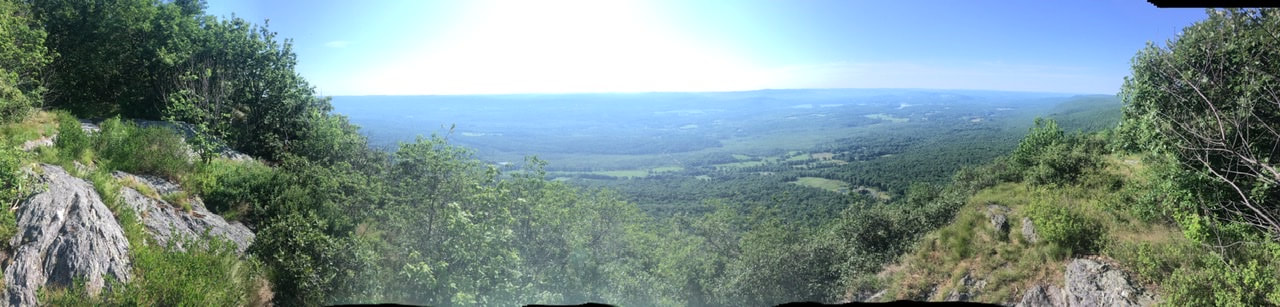     A short distance after the ledges is the summit of Mt. Race. Not as spectacular views from here as compared to the ledges - even from the top of the gigantic slab of stone.   About a mile north of Mt. Race I spotted these cute mushrooms. The SEEK app says that they are Yellow Patches, and are part of the Amanita genus of mushrooms. I believe that this genus includes the red and white poisonous mushrooms.  On the way up Mt. Everett, the trail uses these half-cut timbers as stairs to assist the scaling of slippery, flat rocks. At the time, these seemed to go on forever! 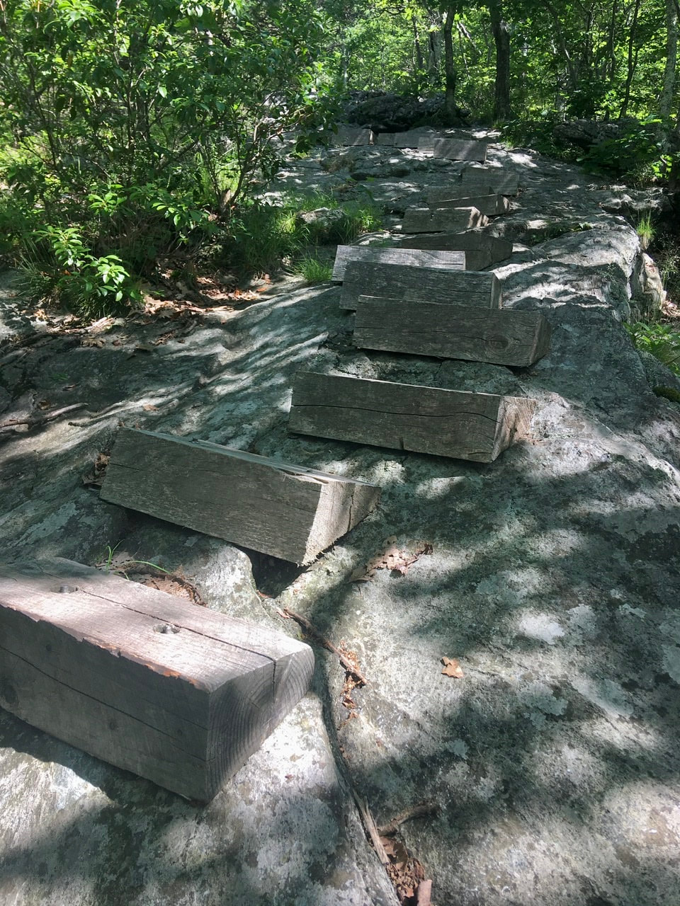 The view from Mt. Everett wasn't all that and a bag of chips. Instead, the attraction was the foundation of the old fire tower - long since taken down.    Oh, Ok. Here's the pictures of the views from the mountain. Could certainly be worse!    It was onward and downward from there. Down and back up actually. And after a 2.5 mile walk, I got to the next viewpoint. This one also had some partial obstructions, but the views weren't half bad. 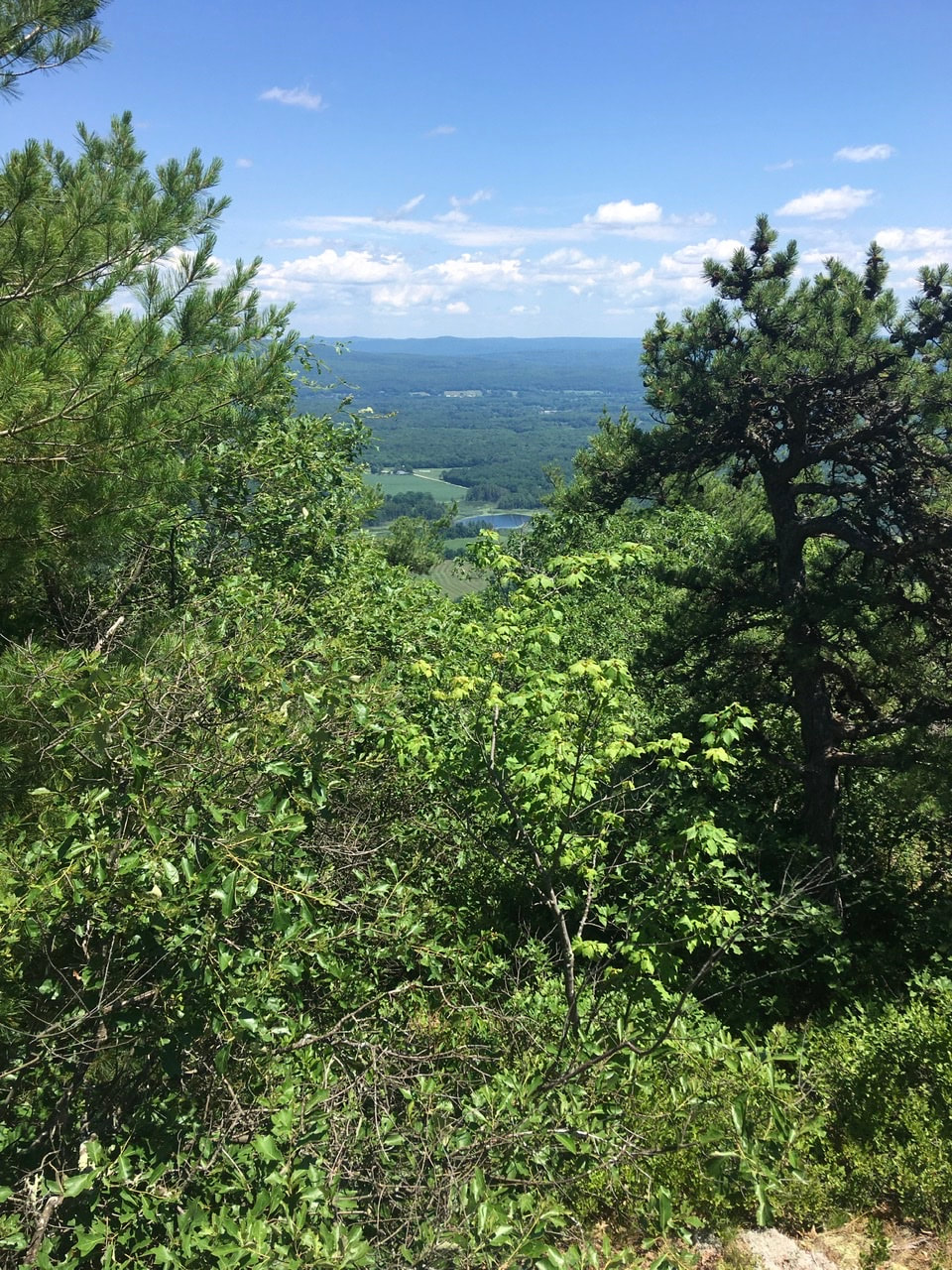  Just a short distance north from that is the summit of Mt. Bushnell, the third and final summit of the day. Again, there were partially obstructed views. Finally, for Mt, Bushnell, there was a mini viewpoint just north of the summit. No surprises that this one also has an obscured view.   After about a mile of sheep downhill, the trail comes to "Jug End", the terminus of a long ridge that traverses the three mountain peaks that I summited today. This vantage point provides some pretty nice views of the surrounding area.     After coming down off the mountain, the trail passes through some fields. Here's a picture or ten from that stretch.     At the beginning of the second field is a marker signifying the spot of the last battle of Shay's Rebellion. I'd definitely heard of this event, but couldn't remember what the motivations were. I'm glad they included a synopsis to refresh my memory.   Around this time, another hiker, Grimm, had caught up to me and we were hiking together. Both of us were in the position of having no fixed sleeping location (due to the locations of shelters). We were fortunate enough to encounter some Trail Magic at Route 7. The Casper Van was there! I had two cans of soda, a mini pie, and a bag of Chex mix. It was a real wonderful surprise!  The owner of the van has houses in both TN and MA. He sees hikers in the spring in TN and gets to see them again in the summer as they pass his second home. A real interesting character. He informed us that tenting is allowed at the community center, offered us a ride there tonight, and connected us with a shuttle for the morning. The community center is right by a McDonald's and a grocery stone. That means I get an unexpected resupply, and two meals that I don't have to prepare. We also stole a bit of electricity from a local business to charge up our batteries. This evening was a real unexpected treat. Better than anything I envisioned when embarking this morning!
1 Comment
Kate Brown
7/16/2020 09:45:18 am
Can't wait to hear the stories that go with the intriguing headlines! Leave a Reply. |
About Me
Archives
July 2020
Categories |
 RSS Feed