Tedward's Trek
  • Home
  • About
  • Equipment
  • Contact
  • Home
  • About
  • Equipment
  • Contact

Documenting My AT Thru-Hike Attempt


T+48 Deciding to dig myself out

7/25/2020

0 Comments

 
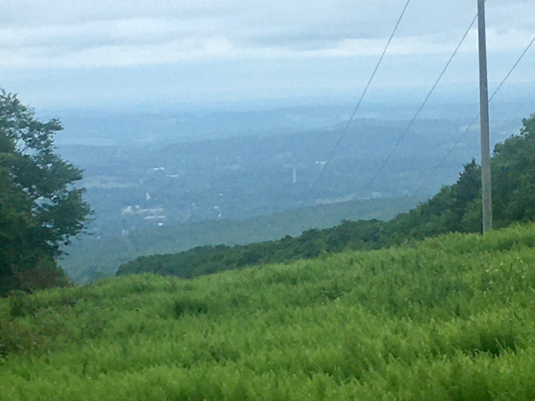
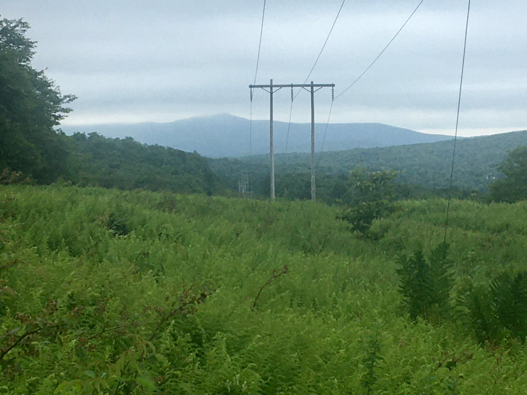
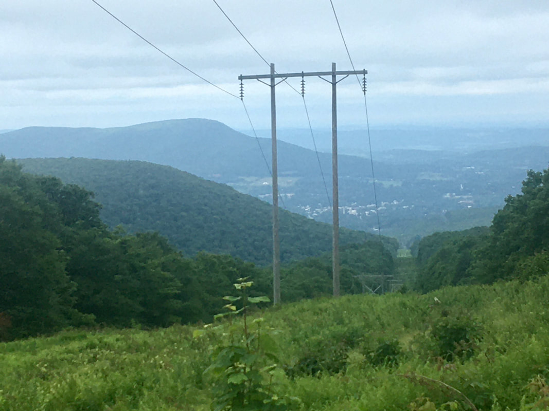
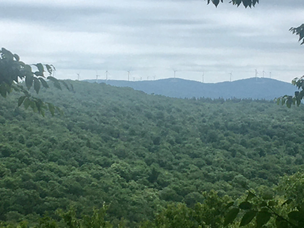
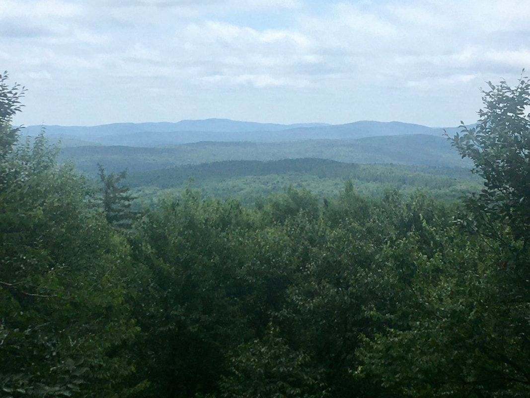
T+48 (July 16, 2020)

Navigation Report:
Start Point: Melville Nauheim Shelter (mile 1615.4)
Target Destination: Kid Gore Shelter (mile 1628.2)

Travel Log:
10:00 Break Camp (mile 1615.4)
10:05 Rejoin AT (mile 1615.4)
10:15 Power Lines (mile 1615.9)
MISSED Beginning of Glastonbury Wilderness (mile 1616.0)
10:45-11:05 Hell Hollow Brook (mile 1617.0)
11:40 Porcupine Lookout (mile 1618.2)
12:20 Little Pond Lookout (mile 1619.6)
MISSED Glastonbury Lookout (mile 1621.4)
1:45 North End of Glastonbury Wilderness (mile 1622.4)
2:56 Goddard Shelter (mile 1623.9)

Daily Mileage = 8.5
Total Mileage = 474.7
Commander’s Report:
Today I spent in a mental fog worrying about how I'm falling behind again on my blog posts. I think my experience in Williamstown on T+36 may have brought this on. A big assist goes to my notes folder, which currently looks like this:
Picture

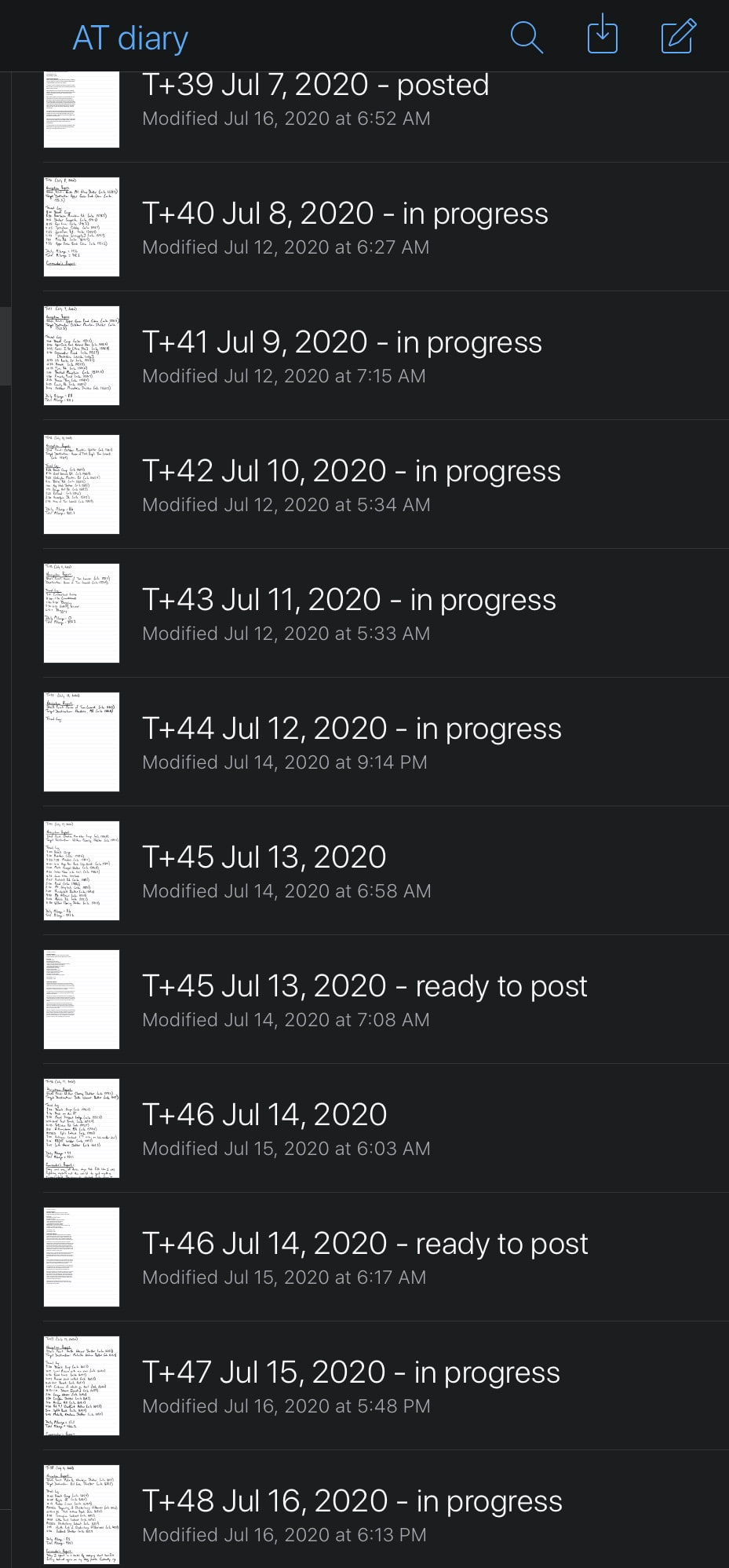
​Yes, that would be the upcoming 10 days worth of posts. Yes, that's 7 in preparation, one posted, and two drafted and waiting to be posted. At some point during the hike today I decided that I was going to catch up on those. My ideal would be to draft each of these the day in which I hiked them, but once I get behind it seems I'm always playing catch up. 

No longer! I'm resolving to get caught up in drafting the diaries and that starts today.

I was joined in camp last night by two guys just starting a section hike of the VT section of the AT, Adam and Matt were their names and they were VERY green (think first day, 2 mile hike in: green). I spent a bit of extra time in the morning giving them some tips and pointers. Thus, I was late getting out of camp again this morning. Plus, I found it impossible to finish the drafting of the diary entry I had hoped to complete in the morning. (Perhaps that also played into my decision to focus on getting caught up on the diaries?)

Once on the trail it was a quick jaunt north to a crossing with some power lines. I almost universally hate these intersections, but at least they can provide a peek at the surroundings. In fact, I quite liked the views offered at this power line cut.
Picture
Picture
Picture
​Supposedly there's a sign right after the power lines announcing the southern end of the Glastonbury Wilderness. I beg to differ. (Or at least, I missed it when I passed.)

A mile north of the power lines the trail crosses Hell Hollow Brook. It's a really nice, large, mountain stream with spots large enough to enjoy a swim in. Unfortunately, today's temperature is supposed to top out at 70°F and it's supposed to rain overnight and into tomorrow. So, no swim for me today. I'll have to take consolation in the pictures.
Picture

​About a mile north of Hell Hollow Brook is Porcupine Lookout. I didn't see any of our be-quilled brethren, but I did find a pretty reasonable viewpoint. Here's the evidence. (I really appreciate the views with the wind turbines, as opposed to some.)
Picture

​About a mile and a half north of that prickly view point is another viewpoint - Little Pond Lookout. This one was quite obstructed, and it was clear that effort was put into maintaining a viewpoint here. I might suggest they let the trees reclaim the location. (Though I did like the way the colors transition between hills in the pictures.)
Picture

​Speaking of letting the trees to reclaim a viewpoint, I totally missed the third viewpoint of the day - Glastonbury Lookout. The guide says of this location, "A very obscured view through trees to the north." It was so obscured that I missed the view (if there remains one at all). I think the trees reclaimed that particular one.

A mile after the missing view is the northern boundary of the Glastonbury Wilderness, I actually managed to spot this sign.
Picture

​A mile and a half further on is the Goddard Shelter. When I arrived I spotted two juvenile red squirrels playing on the front of the shelter's porch. They settled down and pretended to be statues as soon as I got the camera out.

That was it for the hiking. A really easy day today, which meant that there was little sweating and a better chance of having dry-ish clothes to put on for hiking in the morning. (All part of the "slow your roll" decision earlier today.)

[Ed note: I managed to get 3 posts drafted this evening.]


0 Comments


Leave a Reply.

    About Me


    ​Hi, I'm Tedward and I'm hoping my old legs can take me the 2193 miles from Springer Mt to Katahdin!

    Archives

    July 2020
    June 2020
    May 2020
    April 2020
    March 2020
    February 2020
    January 2020

    Categories

    All

    RSS Feed

Site powered by Weebly. Managed by Hostgator